
List of places of worship in the Borough of Guildford facts for kids
.JPG)
The area of Guildford has over 100 places where people used to worship or still do. Most of these, 83 to be exact, are still used by different Christian denominations and even by Jewish people at the Guildford Synagogue. About 20 of these buildings have been changed into other things, like shops or homes. Guildford is one of 11 local areas in Surrey, a county just south of London. Surrey is known for its beautiful hills, old towns, and modern suburbs. Guildford is also the main town of Surrey.
The latest count in 2011 showed that most people living in Guildford are Christian. The Church of England, which is the official church of the country, has the most churches. Other Christian groups like the Catholic Church, Methodists, Baptists, and the United Reformed Church also have many followers. Some of these groups even share buildings. Quakers have met in Guildford since the 1600s, and the Plymouth Brethren Christian Church also has meeting places.
English Heritage, a group that protects important buildings, has given "listed status" to 38 current and four former places of worship in Guildford. This means these buildings are special because of their history or design. There are three levels of listed status:
- Grade I: For buildings that are super important and special.
- Grade II*: For buildings that are very important and more than just special.
- Grade II: For buildings that are special.
In 2001, Guildford had many listed buildings, showing how much history is in the area.
Contents
Guildford's Worship Places: A Quick Look

Guildford is the second largest area in Surrey and has the most people, with about 137,000 residents in 2011. It covers about 104 square miles. The town of Guildford itself is home to about half the population. Another big area is Ash and Tongham, with about 18,000 people. The rest of Guildford is mostly countryside with old, wealthy villages and beautiful natural areas.
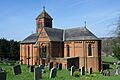
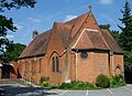
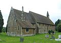
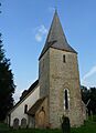
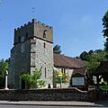
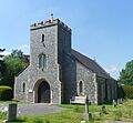
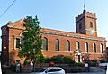
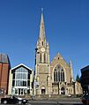
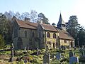
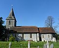
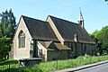
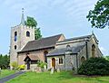
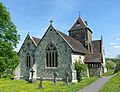
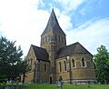
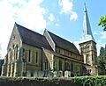
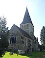
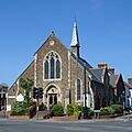
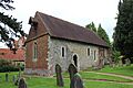
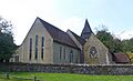
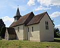
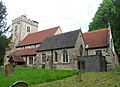
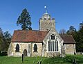
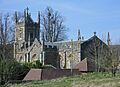
The town of Guildford is very old and important. It sits where the River Wey cuts through the North Downs hills. Many old travel routes and railway lines also meet here. Guildford has been important for hundreds of years. It had a castle and a market way back in the 1200s. There were also three very old churches: St Mary's, Holy Trinity, and St Nicholas'. St Mary's still has its tower from the 1000s! Holy Trinity and St Nicholas' have been rebuilt but still have parts from the 1200s.
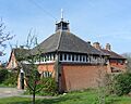
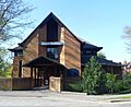
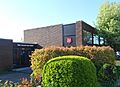
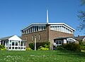
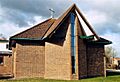
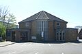
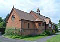
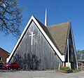
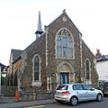
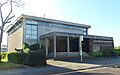
As Guildford grew, especially when railways arrived in the 1800s, more churches were built. Many new Anglican churches appeared, like Christ Church (1868) and St Saviour (1899). Even villages nearby, like Burpham and Merrow, got new churches or had their old ones rebuilt. In the 1900s, as Guildford kept growing, churches were built in new housing areas like Onslow Village and Bellfields. Some of these newer churches, designed by David Evelyn Nye in the 1960s, were known for being "bright, cheerful and well suited to modern needs."
.JPG)
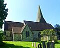
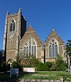
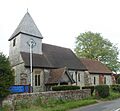
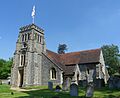
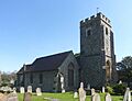
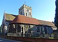
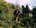
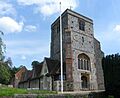
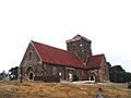
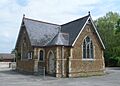
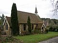
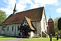
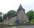
Around Guildford town, there are many ancient villages. Even though some have become like suburbs, many still have their very old parish churches. For example, East and West Clandon have churches from the Norman times (around 1066) and the 1200s. The churches in East and West Horsley have parts from Saxon times and the 1000s and 1100s.
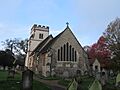
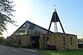
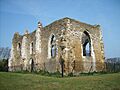
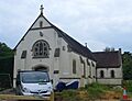
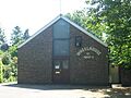
Southeast of Guildford, you'll find popular old churches like St Martha's Church, which was rebuilt in 1848 after being a ruin. St James's Church at Shere is also very old, from the 1000s and 1100s. Some churches, like those in Holmbury St Mary and Peaslake, were built in the 1800s. Even an old barn in Farley Green was turned into a church! Many medieval churches, meaning from the Middle Ages, can still be found in villages like Compton, Effingham, and Ripley.
_(3).jpg)
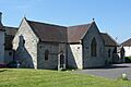
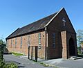
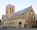
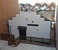
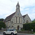
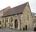
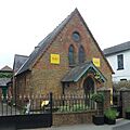
For many years, being Catholic was against the law in England, but some rich families secretly kept their faith. The Catholic community in Guildford started in 1857. Their first church, St Joseph's, was built in 1860, but a bigger one replaced it in 1984. Other Catholic churches were built in the 1960s and 70s in areas like Burpham and Merrow. The Church of Our Lady of Sorrows in Effingham, built in 1913, looks much older than it is! A small church in Gomshall, once Catholic, is now used by the Coptic Orthodox Church. People even called it the "Bingo Chapel" because so much money for it was raised through bingo games!
_(2).JPG)
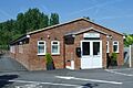
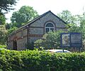
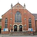
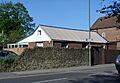
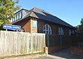
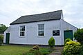
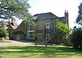
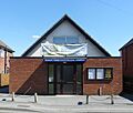
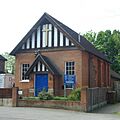
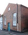
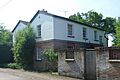
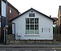
Other Protestant groups, called Nonconformists, were very popular in the 1800s. Many of their chapels still exist, though not all are used for worship anymore. An Independent chapel in Guildford, built in 1802, later became a Congregational church. When a new Congregational church opened in 1863, the old one became a Sunday school and is now a restaurant. The current Guildford United Reformed Church was built in 1965. Other United Reformed churches can be found in Gomshall and Worplesdon.
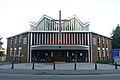
Baptists have fewer churches but have been in the area for a long time. The "Charcoal Barn Chapel" from the 1680s was the starting point for four Baptist churches in Guildford. Grace Church Guildford is a direct descendant of that old chapel. Guildford Baptist Church, founded in 1837, now has its third building, the Millmead Centre. There's also Bethel Strict Baptist Chapel, started in 1879, and New Life Baptist Church in Stoughton.
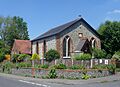
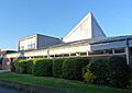
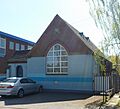
Methodist chapels were built in many villages in the 1800s. In 1947, there were nine Wesleyan Methodist chapels and one Primitive Methodist church in Guildford. Today, only a few are still open, like those in Effingham and West Horsley. Many others have closed and are now used for different purposes. The old Methodist church in Guildford town centre was demolished in the 1960s, and the new one built then closed in 2013. Its congregation now shares St Mary's Church with the Anglicans.
_(Flintwork).JPG)
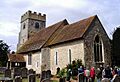
The churches in Guildford are built from different materials. Good quality stone isn't common in Surrey, but local stones like sarsen and puddingstone were sometimes used. Bargate stone, quarried nearby, was used for churches in Burpham, Compton, and St Nicolas Church in Guildford. Another interesting technique called "galleting" involved placing small pieces of stone into the mortar, which you can see at Pirbright church.
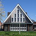
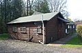
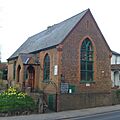
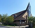
However, the most common material for medieval churches in Surrey was flint. This hard stone was easy to find around the North Downs. Most flint churches in Surrey are not as fancy as those in other areas because the flints were often laid roughly. Nonconformist chapels are usually made of brick with tiled roofs. More modern churches, like those designed by David Evelyn Nye in the 1960s, used a lot of laminated wood.
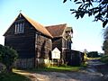
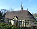
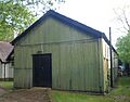
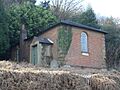
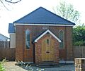
Some religious buildings in Guildford are quite unique. There's a timber church in Chilworth from the 1950s. A "tin tabernacle" (a church made of corrugated iron) is still used in Peasmarsh. Two old barns have even been turned into churches, one in Farley Green and another in East Horsley. In Normandy, a former telephone exchange was converted into a church in 1985!
Who Belongs to Which Religion?
In 2011, out of 137,183 people in Guildford:
- 60.23% said they were Christian.
- 1.98% were Muslim.
- 0.95% were Hindu.
- 0.61% were Buddhist.
- 0.23% were Jewish.
- 0.15% were Sikh.
- 0.34% followed another religion.
- 27.78% said they had no religion.
- 7.73% did not say their religion.
Compared to England as a whole, Guildford had more Christians, Buddhists, and people with no religion. It had fewer Hindus, Jews, Muslims, and Sikhs.
How Churches Are Organized
Anglican Churches: The Diocese of Guildford
_(Noticeboard).JPG)
All the Anglican churches in Guildford are part of the Diocese of Guildford. The main church for the diocese is Guildford Cathedral. The 46 Anglican churches are grouped into smaller areas called deaneries. These deaneries are part of even larger areas called Archdeaconries. For example, churches in Ash and Tongham are in Aldershot Deanery, while those in Albury and Shere are in Cranleigh Deanery. The churches in Guildford town and its suburbs are part of Guildford Deanery.
Roman Catholic Churches: Arundel and Brighton Diocese
Guildford has five Roman Catholic churches. These are in Merrow, Rydes Hill, Guildford town centre, Ash, and Effingham. There's also a Catholic monastery called St Augustine's Abbey in Chilworth. Most of these churches are part of Guildford Deanery, which is one of 13 deaneries in the Roman Catholic Diocese of Arundel and Brighton. The main church for this diocese is Arundel Cathedral.
Other Christian Groups
- Baptists: Guildford Baptist Church and New Life Baptist Church are part of a larger group called the South Eastern Baptist Association. Other Baptist churches, like Ebenezer Chapel in Ripley and Bethel Chapel in Guildford, are "Strict Baptist" and follow the Gospel Standard movement. Grace Church Guildford is linked to GraceNet UK, a group of Reformed Evangelical Christian churches.
- Methodists: Most Methodist churches in Guildford are part of the Wey Valley Methodist Circuit. This includes churches in Merrow, Stoughton, and West Horsley, as well as the shared Anglican/Methodist church of St Mary's in Guildford town centre. Effingham Methodist Church is part of a different circuit.
- United Reformed Church: The United Reformed churches in Guildford are divided between two larger groups called synods. Gomshall United Reformed Church is in the Southern Synod, while Guildford, Normandy, and Worplesdon churches are in the Wessex Synod. St Peter's Shared Church in Bellfields, which is used by both Anglicans and the United Reformed Church, is also part of the Wessex Synod.
- Evangelical Churches: Chilworth Free Church, Horsley Evangelical Church, and Send Evangelical Church are part of two Evangelical networks: the Fellowship of Independent Evangelical Churches (FIEC) and Affinity.
Current Places of Worship
-
St Peter and St Paul's Church, Albury
-
Brethren's Meeting Hall, Artington
-
St Peter's Church, Ash
-
Church of the Holy Angels, Ash
-
St Mary's Church, Ash Vale
-
Ash Vale Christian Assembly
-
St Peter's Shared Church, Bellfields
-
New Hope Centre, Bellfields
-
St Luke's Church, Burpham
-
Church of the Holy Spirit, Burpham
-
Christ Church, Charlotteville
-
Addison Hall, Charlotteville
-
St Thomas's Church, Chilworth
-
Chilworth Free Church
-
St Nicholas' Church, Compton
-
St Thomas of Canterbury's Church, East Clandon
-
St Martin's Church, East Horsley
-
Horsley Evangelical Church
-
St Lawrence's Church, Effingham
-
Effingham Methodist Church
-
Church of Our Lady of Sorrows, Effingham
-
St Michael's Church, Farley Green
-
St Augustine's Coptic Orthodox Church, Gomshall
-
Gomshall Chapel
-
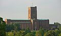
Guildford Cathedral
-
Holy Trinity Church, Guildford
-
St John the Evangelist's Church, Guildford
-
St Nicolas' Church, Guildford
-
St Saviour's Church, Guildford
-
St Mary's Church, Guildford
-
Grace Church Guildford (Chertsey Street)
-
Guildford Baptist Church
-
Kingdom Hall, Guildford
-
Guildford Synagogue
-
Friends Meeting House, Guildford
-
St Joseph's Church, Guildford
-
Salvation Army Citadel, Guildford
-
Bethel Strict Baptist Chapel, Guildford
-
Guildford United Reformed Church
-
Grace Church Guildford (Guildford Park)
-
St Mary the Virgin's Church, Holmbury St Mary
-
St Francis' Church, Littleton
-
St John the Evangelist's Church, Merrow
-
Merrow Methodist Church
-
Church of St Pius X, Merrow
-
St Mark's Church, Normandy
-
Emmanuel Church, Normandy
-
All Saints Church, Ockham
-
All Saints Church, Onslow Village
-
St Clare's Church, Park Barn
-
St Mark's Church, Peaslake
-
St Michael's Church, Peasmarsh
-
St Michael and All Angels Church, Pirbright
-
St John the Baptist's Church, Puttenham
-
St Mary Magdalen's Church, Ripley
-
Ebenezer Chapel, Ripley
-
St Mary's Church, Rydes Hill
-
St Martha-on-the-Hill Church
-
St Lawrence's Church, Seale
-
St Mary the Virgin's Church, Send
-
St Mary's Church Room, Send
-
Send Evangelical Church
-
St Mary the Virgin's Church, Shackleford
-
St Mary the Virgin's Church, Shalford
-
St James's Church, Shere
-
Harry Edwards Spiritual Healing Sanctuary
-
Emmanuel Church, Stoughton
-
New Life Baptist Church, Stoughton
-
Stoughton Methodist Church
-
Manor Road Evangelical Church
-
Church of the Good Shepherd, The Sands
-
St Paul's Church, Tongham
-
Tongham Christian Fellowship
-
St Bartholomew's Church, Wanborough
-
St Peter and St Paul's Church, West Clandon
-
St Mary's Church, West Horsley
-
West Horsley Methodist Church
-
St Francis' Church, Westborough
-
Westborough Church
-
Wisley Church
-
St Alban's Church, Wood Street Village
-
St Mary the Virgin's Church, Worplesdon
-
Worplesdon United Reformed Church
_(3).JPG)
_(5).JPG)
_(2).jpg)
_(1).JPG)
_(3).JPG)
_(3).JPG)
_(2).JPG)
,_Larch_Avenue,_Bellfields,_Guildford_(April_2014,_from_Southeast).JPG)
_(4).JPG)
_(1).JPG)
.jpg)
,_Addison_Road,_Guildford_(April_2014,_from_Southwest).JPG)
.JPG)
.JPG)
_(1).JPG)
_(1).JPG)
_(3).JPG)
_(3).JPG)
_(2).JPG)
_(3).JPG)
_(6).JPG)

_(2).JPG)
,_Station_Road,_Gomshall_(March_2014,_from_West)_(1).JPG)
_(May_2014)_(1).JPG)
_(4).jpg)
_(2).jpg)
_(1).JPG)
_(1).JPG)
_(1).JPG)
_(1).JPG)
.JPG)
.JPG)
.JPG)
.JPG)
_(Front).JPG)
_(3).JPG)
_(1).JPG)
.JPG)
,_Guildford_Park_Road,_Guildford_(April_2014,_from_Southeast).JPG)
_(2).jpg)

_(2).JPG)
_(4).JPG)
_(2).JPG)
_(6).JPG)
_(2).JPG)
.jpg)
_(5).JPG)

.JPG)
_(1).JPG)
_(9).JPG)
_(4).jpg)
_(5).JPG)
_(3).JPG)
,_Aldershot_Road,_Guildford_(April_2014,_from_North).JPG)

_(4).JPG)

_(3).JPG)
_(1).JPG)
_(6).JPG)
_(3).jpg)
.JPG)
_(2).JPG)
.JPG)
,_Queen_Elizabeth_Park,_Guildford_(April_2014,_from_North).JPG)
_(1).JPG)
.JPG)


_(3).JPG)

_(1).JPG)
_(7).JPG)
_(3).JPG)
.JPG)
_(2).JPG)
_(5).JPG)
_(2).JPG)
_(1).JPG)
_(2).JPG)
Former Places of Worship
-
Old St Peter and St Paul's Church, Albury
-
Catholic Apostolic Church, Albury
-
St Catherine's Chapel, Artington
-
Ash Vale Methodist Church
-
Mission Hall, Bellfields
-
Burpham Primitive Methodist Chapel
-
Chilworth Mission Church
-
Compton Congregational Church
-
Independent (Congregational) Chapel, Guildford
-
Providence Chapel, Guildford
-
Ward Street Chapel, Guildford
-
Felday Chapel, Holmbury St Mary
-
Normandy United Reformed Church
-
Providence Mission Chapel, Pirbright
-
Ripley Methodist Chapel
-
Congregational Mission Hall, Rydes Hill
-
St William of York's Church, Send
-
Shalford Methodist Church
-
Shalford Wesleyan Chapel
-
St Mary's Church Centre, West Horsley
-
Guildford Methodist Church
.JPG)
_(9).JPG)

_(3).JPG)
.JPG)
_(1).JPG)
,_New_Road,_Chilworth_(March_2014).JPG)
_(1).JPG)
_Chapel,_Chapel_Street,_Guildford_(April_2014).JPG)
_(2).JPG)
_(1).JPG)
_(1).JPG)
_(2).JPG)
_(2).JPG)
_(1).JPG)
.JPG)
_(3).JPG)
,_Kings_Road,_Shalford_(May_2014)_(2).JPG)
,_Kings_Road,_Shalford_(May_2014)_(1).JPG)
,_East_Lane,_West_Horsley_(May_2014)_(3).JPG)
_(1).JPG)
