
List of tallest buildings and structures in Nottingham facts for kids
Nottingham is a city in England with many interesting buildings and structures. This page lists the tallest ones in the city. The very tallest structure in Nottingham is the Eastcroft Incinerator, which is like a giant chimney, standing 91 meters (299 feet) tall. But the tallest actual building is Victoria Centre Flats A, which is 75 meters (246 feet) high.
For a long time, St. Peter's Church was the tallest building in Nottingham. It was built way back in 1480 and stayed the tallest for 361 years! Many tall buildings, especially homes, were built in Nottingham during the 1960s. Some of these have been updated or taken down since then. Not many tall buildings have been built since the year 2000.

Contents
Tallest Buildings and Structures Now
Here are the tallest buildings and structures in Nottingham that are still standing today, as of March 2022. They are all taller than 40 meters (131 feet).
| Rank | Name (other names) | Image | Height | Floors | Year | Use | Coordinates | Notes | |
|---|---|---|---|---|---|---|---|---|---|
| 1 | Eastcroft Energy from Waste Facility (Eastcroft Incinerator) |
 |
91 m | 299 ft | 1970 | Chimney | 52°56′47″N 1°08′07″W / 52.946379°N 1.135228°W |
|
|
| 2 | Victoria Centre Flats A |  |
75 m | 246 ft | 26 | 1972 | Homes | 52°57′26″N 1°08′50″W / 52.957261°N 1.147263°W |
|
| 3 | Mapperley radio mast |  |
71 m | 233 ft | Transmitter (sends radio signals) | 52°58′24″N 1°07′45″W / 52.9734550°N 1.129210058°W | |||
| 4= | Pine View (Buckland Court) |
.jpg) |
62 m | 203 ft | 21 | 1967 | Homes | 52°57′36″N 1°10′19″W / 52.960003°N 1.171941°W |
|
| 4= | Lenton radio mast |  |
62 m | 203 ft | Transmitter | 52°56′30″N 1°10′35″W / 52.941756°N 1.176364°W | |||
| 6= | Bowman Telephone Exchange (BT) |  |
61 m | 200 ft | 13 | 1978 | Telephone Exchange Office |
52°57′22″N 1°08′27″W / 52.956094°N 1.140956°W | |
| 6= | UoN Chimney |  |
61 m | 200 ft | 1968 | Chimney | 52°56′24″N 1°11′32″W / 52.939972°N 1.192139°W | ||
| 6= | Burrows Court | _(cropped).jpg) |
61 m | 200 ft | 21 | 1967 | Homes | 52°57′24″N 1°07′34″W / 52.956642°N 1.126121°W |
|
| 6= | Nottingham Council House |  |
61 m | 200 ft | 1929 | City Hall Shops and Businesses |
52°57′12″N 1°08′55″W / 52.953452°N 1.148558°W |
|
|
| 10 | Aspire |  |
60 m | 197 ft | 2008 | Sculpture | 52°57′06″N 1°11′05″W / 52.951549°N 1.184603°W |
|
|
| 11 | Southchurch Court |  |
59 m | 194 ft | 20 | 1969 | Homes | 52°54′42″N 1°10′16″W / 52.911688°N 1.170988°W | |
| 12 | Tower Building, UoN |  |
57.9 m | 190 ft | 17 | 1966 | University | 52°56′32″N 1°11′19″W / 52.942221°N 1.188617°W | |
| 13 | All Hallows Church, Gedling |  |
54.8 m | 180 ft | 1230 | Church | 52°58′37″N 1°04′50″W / 52.97699°N 1.08050°W |
|
|
| 14 | Ash View (Bampton Court) |
.jpg) |
54.5 m | 179 ft | 18 | 1968 | Homes | 52°57′38″N 1°10′23″W / 52.960438°N 1.173084°W | |
| 15= | Victoria Centre Flats B |  |
53.3 m | 175 ft | 18 | 1972 | Homes | 52°57′23″N 1°08′49″W / 52.956324°N 1.146999°W | |
| 15= | All Saints' Church |  |
53.3 m | 175 ft | 1864 | Church | 52°57′37″N 1°09′41″W / 52.960185°N 1.161265°W | ||
| 17 | High Point (Braidwood Court / The Pinnacle) |
.jpg) |
52.7 m | 173 ft | 19 | 1970 | Homes | 52°57′59″N 1°10′06″W / 52.966283°N 1.168435°W | |
| 18= | Unity Square Phase 1 |  |
50 m | 160 ft | 11 | 2022 | Government Office | 52°56′47″N 1°08′53″W / 52.946366°N 1.148105°W | |
| 18= | Cranbrook House |  |
50 m | 164 ft | 14 | 1963 | Homes | 52°57′15″N 1°08′29″W / 52.954244°N 1.141358°W | |
| 18= | City Hospital Chimney | .jpg) |
50 m | 164 ft | 1969 | Chimney | 52°59′29″N 1°09′08″W / 52.991363°N 1.152244°W |
|
|
| 20 | Marco Island (Royal Mail Building) |
 |
47.9 m | 157 ft | 15 | 2005 | Homes Shops and Businesses Parking |
52°57′20″N 1°08′31″W / 52.955655°N 1.142021°W |
|
| 21= | Oak View (Mellors Court) |
.jpg) |
46 m | 151 ft | 16 | 1968 | Homes | 52°57′36″N 1°10′22″W / 52.959899°N 1.172862°W | |
| 21= | Mapperley Ridge DAB mast | .jpg) |
46 m | 151 ft | Transmitter | 52°58′35″N 1°07′57″W / 52.9763682°N 1.132584931°W | |||
| 23= | IQ Newtown House | .jpg) |
45.7 m | 150 ft | 14 | 1962 | Homes Shops and Businesses |
52°57′06″N 1°09′12″W / 52.951766°N 1.153302°W |
|
| 23= | Newton Building, NTU |  |
45.7 m | 150 ft | 10 | 1956 | University | 52°57′24″N 1°09′07″W / 52.956537°N 1.152034°W | |
| 23= | St Paul's Church, Daybrook | .jpg) |
45.7 m | 150 ft | 1897 | Church | 53°00′02″N 1°08′17″W / 53.000613°N 1.137917°W |
|
|
| 23= | St Andrews Church |  |
45.7 m | 150 ft | 1871 | Church | 52°57′55″N 1°09′08″W / 52.965182°N 1.152196°W | ||
| 23= | Nottingham Cathedral (The Cathedral Church of St. Barnabas) |
 |
45.7 m | 150 ft | 1844 | Church | 52°57′17″N 1°09′26″W / 52.954677°N 1.157120°W | ||
| 23= | St. Peter's Church |  |
45.7 m | 150 ft | 1480 | Church | 52°57′08″N 1°08′55″W / 52.952260°N 1.148517°W |
|
|
| 29 | Nottingham One Tower |  |
45.6 m | 150 ft | 14 | 2014 | Homes Office |
52°56′57″N 1°08′32″W / 52.949182°N 1.142128°W | |
| 30= | Kingston Court |  |
45.1 m | 148 ft | 16 | 1966 | Homes | 52°57′07″N 1°08′02″W / 52.952016°N 1.133915°W | |
| 30= | Colwick Woods Court |  |
45.1 m | 148 ft | 16 | 1966 | Homes | 52°57′03″N 1°07′07″W / 52.950875°N 1.118489°W | |
| 30= | Woodthorpe Court |  |
45.1 m | 148 ft | 16 | 1965 | Homes | 52°59′01″N 1°08′13″W / 52.983679°N 1.137077°W | |
| 30= | Winchester Court |  |
45.1 m | 148 ft | 16 | 1965 | Homes | 52°58′58″N 1°08′12″W / 52.982709°N 1.136757°W | |
| 30= | Bentinck Court |  |
45.1 m | 148 ft | 16 | 1965 | Homes | 52°57′09″N 1°08′09″W / 52.952629°N 1.135947°W | |
| 30= | Manvers Court |  |
45.1 m | 148 ft | 16 | 1964 | Homes | 52°57′07″N 1°08′07″W / 52.951944°N 1.135365°W | |
| 36 | Colwick Wood radio mast |  |
45 m | 148 ft | 1995 | Transmitter | 52°57′11″N 1°06′43″W / 52.9530147°N 1.11198794°W | ||
| 37= | Market Square House |  |
44.5 m | 146 ft | 12 | 1966 | Office Shops and Businesses |
52°57′12″N 1°09′06″W / 52.953226°N 1.151686°W |
|
| 37= | Pitcher & Piano (The Unitarian Church) |  |
44.5 m | 146 ft | 2 | 1876 | Restaurant/Pub | 52°57′03″N 1°08′43″W / 52.950911°N 1.145220°W |
|
| 39 | The Litmus Building |  |
44 m | 144 ft | 14 | 2007 | Homes | 52°57′24″N 1°08′37″W / 52.956746°N 1.143654°W | |
| 40= | Global Point (Academy Heights / Kaplan Residences) |
 |
43 m | 141 ft | 14 | 2014 | Homes Shops Restaurant |
52°57′11″N 1°09′12″W / 52.953116°N 1.153461°W | |
| 40= | E.ON Trinity House |  |
43 m | 141 ft | 9 | 2012 | Office | 52°57′23″N 1°09′00″W / 52.956485°N 1.150024°W | |
| 40= | Leonardo Hotel |  |
43 m | 141 ft | 13 | 2005 | Hotel | 52°56′54″N 1°08′26″W / 52.948444°N 1.140655°W | |
| 43 | Britannia Hotel |  |
42.6 m | 140 ft | 14 | 1969 | Hotel | 52°57′08″N 1°09′14″W / 52.952352°N 1.153812°W | |
| 44 | Queens Medical Centre Chimney |  |
42 m | 138 ft | 1971 | Chimney | 52°56′45″N 1°11′05″W / 52.945736°N 1.184647°W | ||
| 45 | The Vantage |  |
40 m | 130 ft | 14 | 2021 | Rental Apartments Public Parking Fitness Centre |
52°56′44″N 1°09′08″W / 52.945610°N 1.152340°W | |
Future Tall Buildings in Nottingham
Here are some tall buildings that are either being built, have been approved, or are planned for Nottingham.
Buildings Being Built Now
This section lists buildings over 40 meters (131 feet) that are currently under construction in Nottingham.
| Rank | Name (other names) | Image | Height | Floors | Year | Use | Coordinates | Notes | |
|---|---|---|---|---|---|---|---|---|---|
| 1 | Island Quarter Hotel | 73.15 m | 240.0 ft | 20 | 2023 | Hotel Rental Apartments |
|
||
| 2 | Hotel Indigo / Staybridge Suite | 70 m | 230 ft | 18 | 2023 | Hotel |
|
||
Buildings Approved for Construction
This lists buildings over 40 meters (131 feet) that have been given permission to be built in Nottingham, but construction hasn't started yet.
| Rank | Name (other names) | Height | Floors | Year | Use | Coordinates | Notes | |
|---|---|---|---|---|---|---|---|---|
| 1 | Three Wilford Road | 105 m | 344 ft | 23 | 2024 | Homes Rental Apartments |
52°56′45″N 1°09′08″W / 52.9459°N 1.1521°W |
|
| 2 | Unity Square Phase 2 | 60 m | 200 ft | 15 | 2023 | Office Government Office |
52°56′47″N 1°08′57″W / 52.9463°N 1.1491°W |
|
| 3 | London Road Centre | 48 m | 157 ft | 13 | 2023 | Office Restaurant |
52°56′36″N 1°08′21″W / 52.9432°N 1.1391°W | |
| 4= | Arkwright Street | 45 m | 148 ft | 13 | 2023 | Homes Office |
52°56′42″N 1°08′50″W / 52.9450°N 1.1473°W |
|
| 4= | Island Quarter Apartments | 45 m | 148 ft | 18 | Rental Apartments Shops |
|
||
Proposed Buildings
This lists buildings over 40 meters (131 feet) that have been suggested but haven't been approved for building yet.
| Rank | Name (other names) | Height | Floors | Year | Use | Coordinates | Notes | |
|---|---|---|---|---|---|---|---|---|
| 1 | Glasshouse Street | 121.92 m | 400.0 ft | 43 | 2025 | Rental Apartments Homes |
52°57′30″N 1°08′48″W / 52.9583°N 1.1467°W | If built, this will be the tallest building in Nottingham, even taller than the Eastcroft Incinerator chimney! |
| 2 | 1–4 Queen's Road | 68 m | 223 ft | 26 | 2023 | Rental Apartments Hotel |
52°56′49″N 1°08′27″W / 52.9470°N 1.1407°W | |
| 3 | Guildhall Hotel | 45 m | 148 ft | 15 | Hotel | 52°57′25″N 1°09′02″W / 52.9569°N 1.1505°W | ||
Tallest Buildings That Were Never Built or Were Taken Down
This section looks at tall buildings in Nottingham that were planned but never built, or those that used to be tall but have since been demolished.
Tallest Buildings Never Built
This lists plans for buildings in Nottingham over 40 meters (131 feet) that were either rejected or cancelled.
| Rank | Name (other names) | Image | Height | Floors | Use | Notes | |
|---|---|---|---|---|---|---|---|
| 1 | Whyte Tower 1 (Lower Parliament Street Tower 1) |
151 m | 495 ft | 54 | Homes Hotel Office |
||
| 2 | Christian Centre | 93 m | 305 ft | Church | |||
| 3 | No. 1 Brook Street Tower 1 | 80 m | 260 ft | 25 | Homes Shops and Businesses |
||
| 4 | Whyte Tower 2 | 78 m | 256 ft | 25 | Office Hotel |
||
| 5 | No. 1 Brook Street Tower 2 | 46.8 m | 154 ft | 12 | Homes Shops and Businesses |
||
Tallest Buildings That Were Taken Down
This list shows the tallest buildings in Nottingham (at least 40 meters or 131 feet high) that have been demolished.
| Rank | Name (other names) | Image | Height | Floors | Completed | Demolished | Use | Coordinates | Notes | |
|---|---|---|---|---|---|---|---|---|---|---|
| 1= | Evans Court | 61 m | 200 ft | 20 | 1971 | 1985 | Homes | 52°59′01″N 1°10′57″W / 52.983611°N 1.1825°W | ||
| 1= | Auburn Court | 61 m | 200 ft | 20 | 1971 | 1985 | Homes | 52°58′58″N 1°10′55″W / 52.982778°N 1.181944°W | ||
| 1= | Wicklow Court | 61 m | 200 ft | 20 | 1971 | 1985 | Homes | 52°59′01″N 1°11′03″W / 52.983611°N 1.184167°W | ||
| 1= | Mill Court | 61 m | 200 ft | 20 | 1971 | 1985 | Homes | 52°59′02″N 1°11′07″W / 52.983889°N 1.185278°W | ||
| 5 | Holy Trinity Church |  |
54 m | 177 ft | 1841 | 1958 | Church | 52°57′22″N 1°08′56″W / 52.956111°N 1.148889°W |
|
|
| 6= | Willoughby Court |  |
48.1 m | 158 ft | 17 | 1967 | 2015 | Homes | 52°56′58″N 1°10′22″W / 52.949562°N 1.172836°W | |
| 6= | Newgate Court |  |
48.1 m | 158 ft | 17 | 1967 | 2016 | Homes | 52°57′04″N 1°10′22″W / 52.951145°N 1.172764°W | |
| 6= | Lenton Court | |
48.1 m | 158 ft | 17 | 1967 | 2013 | Homes | 52°57′01″N 1°10′23″W / 52.950361°N 1.173155°W | |
| 6= | Digby Court | |
48.1 m | 158 ft | 17 | 1967 | 2014 | Homes | 52°56′59″N 1°10′19″W / 52.949776°N 1.172003°W | |
| 6= | Abbey Court | |
48.1 m | 158 ft | 17 | 1967 | 2014 | Homes | 52°57′02″N 1°10′20″W / 52.950619°N 1.172340°W | |
| 11 | Highcross Court | 43.3 m | 142 ft | 15 | 1966 | 2012 | Homes | 52°57′34″N 1°10′10″W / 52.959339°N 1.169399°W | ||
Timeline of Nottingham's Tallest Structures
This table shows which building or structure was the tallest in Nottingham over different periods in history.
| Year tallest | Name | Image | Height | Floors | Coordinates | Notes | |
|---|---|---|---|---|---|---|---|
| 1480–1841 | St. Peter's Church | |
45.7 m | 150 ft | 52°57′08″N 1°08′55″W / 52.952260°N 1.148517°W | ||
| 1841–1929 | Holy Trinity Church | |
54 m | 177 ft | 52°57′22″N 1°08′56″W / 52.956111°N 1.148889°W | ||
| 1929–1967 | Nottingham Council House | |
61 m | 200 ft | 52°57′12″N 1°08′55″W / 52.953452°N 1.148558°W | ||
| 1967–1970 | Pine View (Buckland Court) |
|
62 m | 203 ft | 21 | 52°57′36″N 1°10′19″W / 52.960003°N 1.171941°W | |
| 1970–present | Eastcroft Energy from Waste Facility (Eastcroft Incinerator) |
|
91 m | 299 ft | 52°56′47″N 1°08′07″W / 52.946379°N 1.135228°W | ||
Images for kids
-
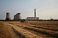
Cottam Power Station chimney
-
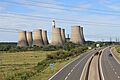
Ratcliffe-on-Soar Power Station chimney
-
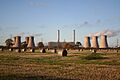
West Burton Power Station chimney


