Little Schoharie Creek facts for kids
Quick facts for kids Little Schoharie Creek |
|
|---|---|
|
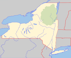
Location of mouth within New York
|
|
| Country | United States |
| State | New York |
| Counties | Schoharie, Albany |
| Physical characteristics | |
| Main source | East of Huntersland 42°33′42″N 74°11′40″W / 42.5617435°N 74.1945799°W |
| River mouth | Schoharie Creek Middleburgh 617 ft (188 m) 42°35′31″N 74°20′32″W / 42.5920204°N 74.3423607°W |
| Basin features | |
| Basin size | 24.5 sq mi (63 km2) |
The Little Schoharie Creek is a small waterway, or creek, located in New York. It flows into a larger stream called the Schoharie Creek near the town of Middleburgh. Think of it like a smaller road joining a bigger highway!
About the Little Schoharie Creek
The Little Schoharie Creek starts its journey east of Huntersland. It then travels through parts of Schoharie and Albany counties. Finally, it meets the Schoharie Creek in Middleburgh. The area of land that drains water into the creek, called its basin, is about 24.5 sq mi (63 km2).
How We Study the Creek
Scientists often study creeks and rivers to understand how much water flows through them. This is part of a science called hydrology, which is the study of water. Knowing about water flow helps us manage water resources. It also helps us predict things like floods or droughts.
Measuring Water Flow
The United States Geological Survey (USGS) is a government agency that studies the Earth, including its water. They use special tools called stream gauges to measure how much water is flowing in creeks like the Little Schoharie Creek. These gauges are like rulers that constantly check the water level and speed.
One of these gauges is located near Middleburgh. It has been collecting data since December 2017. This station is about 1.6 miles (2.6 km) upstream from where the creek joins the Schoharie Creek.
The measurements from this gauge show how the water flow, or "discharge," changes over time:
- The most water ever recorded flowing through the creek was 442 cubic feet (12.5 m3) per second. This happened on April 16, 2018.
- The least amount of water recorded was 0.75 cubic feet (0.021 m3) per second. This low flow occurred on July 21, 2018.
These measurements help scientists understand the creek's health. They also help local communities prepare for different water conditions.
 | DeHart Hubbard |
 | Wilma Rudolph |
 | Jesse Owens |
 | Jackie Joyner-Kersee |
 | Major Taylor |


