Little Scioto River (Ohio River tributary) facts for kids
Quick facts for kids Little Scioto River |
|
|---|---|

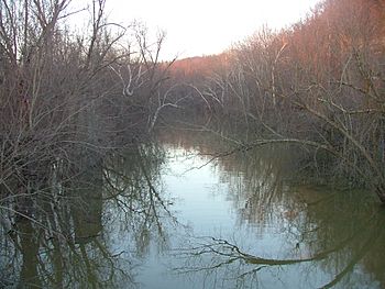
Near its confluence with the Ohio River at Sciotoville
|
|
| Physical characteristics | |
| Length | 43 miles (69 km) |
| Basin features | |
| Basin size | 233 sq mi (600 km2) |
The Little Scioto River is a smaller river in southern Ohio, United States. It flows into the larger Ohio River. Think of it like a smaller stream joining a bigger river. The Little Scioto River is about 42.8 miles (68.9 km) (68.9 km) long.
This river is part of a huge water system called a watershed. A watershed is an area of land where all the water drains into a single river or lake. The Little Scioto River's water eventually flows into the Mississippi River. It drains an area of about 233 square miles (600 km2) (603 km²).
Journey of the Little Scioto River
The Little Scioto River starts in the western part of Jackson County. From there, it flows mostly south. It travels through the land until it reaches Scioto County, near a place called Minford.
The river's journey ends when it meets the Ohio River. This meeting point is in the eastern part of the city of Portsmouth. It's about 6 miles (9.7 km) east of the center of Portsmouth.
How the River Got Its Name
The official name, Little Scioto River, was decided in 1913. This decision was made by a group that names places in the United States.
Before that, the river had a few other names. People sometimes called it "Brushy Fork." It was also known as "Little Siota River" or "Little Sciota River." These older names show how the river's identity changed over time.
 | Delilah Pierce |
 | Gordon Parks |
 | Augusta Savage |
 | Charles Ethan Porter |

