Little White Salmon River facts for kids
Quick facts for kids Little White Salmon River |
|
|---|---|

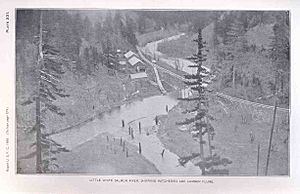
Fish hatchery and log flume, 1898
|
|
|
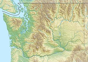
Location of the mouth of the Little White Salmon River in Washington
|
|
| Country | United States |
| State | Washington |
| County | Skamania, Klickitat |
| Physical characteristics | |
| Main source | Monte Cristo Range of the Cascade Range Gifford Pinchot National Forest, Klickitat County 3,384 ft (1,031 m) 45°55′07″N 121°35′52″W / 45.91861°N 121.59778°W |
| River mouth | Columbia River Drano Lake of the Bonneville Pool, Skamania County 98 ft (30 m) 45°43′14″N 121°38′25″W / 45.72056°N 121.64028°W |
| Length | 19 mi (31 km) |
| Basin features | |
| Basin size | 136 sq mi (350 km2) |
The Little White Salmon River is a cool river in Washington state. It's about 19 miles (31 km) long. It flows into the big Columbia River.
The river starts high up in the Monte Cristo Mountains. This area is part of the Gifford Pinchot National Forest. It flows down from the Cascade Range mountains. The river ends in Drano Lake, which is a part of the Bonneville Pool of the Columbia River.
The Little White Salmon River drains an area of about 136 square miles (352 km²). This area is called its "basin." In 2000, about 513 people lived in this river basin.
Contents
River Adventures: Whitewater Kayaking
The Little White Salmon River is famous for its exciting whitewater rapids. Expert kayakers love to paddle a 4-mile (6 km) section of the river. This part is in a deep canyon. It stretches between the Cook–Underwood Road bridge and Drano Lake.
This section is very challenging. It is rated Class V on the International Scale of River Difficulty. This means it is "extremely difficult" and only for experienced paddlers. Some of the rapids have fun names like Gettin' Busy, Spirit Falls, and Master Blaster.
The River's Journey
The Little White Salmon River begins in the Monte Cristo Mountains. This is in western Klickitat County, near Skamania County. At first, it flows south through the Gifford Pinchot National Forest. Then, it turns southwest.
As it flows, smaller streams join the river. Beetle Creek flows in from the right side. The river then enters Skamania County. It passes by Oklahoma Campground and under Oklahoma Road. Homes Creek joins from the left, and Lusk Creek joins from the right.
The river turns more sharply south. Berry Creek and Cabbage Creek flow in from the right. Oklahoma Road follows along the river's left side. The river winds along the base of Shingle Mountain. Wilson Creek joins from the left.
Next, the river reaches Big Cedars County Park. After the park, it goes under Oklahoma Road again. It flows past Moss Creek Campground, where Moss Creek joins from the right.
Fish Hatcheries and the Gorge
Further downstream, the river reaches the small community of Willard. Here, it leaves the national forest. Just below Willard, it flows under Willard Road. Pine Creek joins from the right.
A little further, you'll find the Willard National Fish Hatchery. This is a special place that helps raise fish. The river then goes under Cook–Underwood Road. It enters the beautiful Columbia River Gorge National Scenic Area. Lapham Creek joins the river from the left.
The river flows through a narrow canyon. Cook–Underwood Road runs along both sides of the river here. Rock, Squaw, and Bunker creeks all join from the right. At the end of the canyon, the river passes through the Little White Salmon National Fish Hatchery. Finally, it flows into Drano Lake. This lake is about 163 miles (262 km) from where the Columbia River meets the Pacific Ocean.
Places to Camp
There are a few nice places to camp along the Little White Salmon River.
- The United States Forest Service runs the Oklahoma Campground. It's along the upper part of the river. It has 22 campsites, toilets, and drinking water. The Lower Monte Carlo Trailhead is right across Oklahoma Road from the campground.
- Further down the river, Skamania County manages the Big Cedars Campground. It has two spots for tents and one for a small camper.
- Near Big Cedars Park, the Forest Service also runs Moss Creek Campground. It has drinking water, toilets, and 17 campsites.
 | Madam C. J. Walker |
 | Janet Emerson Bashen |
 | Annie Turnbo Malone |
 | Maggie L. Walker |


