Littleville, Alabama facts for kids
Quick facts for kids
Littleville, Alabama
|
|
|---|---|

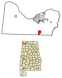
Location of Littleville in Colbert County, Alabama.
|
|
| Country | United States |
| State | Alabama |
| County | Colbert |
| Area | |
| • Total | 5.02 sq mi (12.99 km2) |
| • Land | 4.97 sq mi (12.88 km2) |
| • Water | 0.04 sq mi (0.12 km2) |
| Elevation | 686 ft (209 m) |
| Population
(2020)
|
|
| • Total | 1,038 |
| • Density | 208.77/sq mi (80.60/km2) |
| Time zone | UTC-6 (Central (CST)) |
| • Summer (DST) | UTC-5 (CDT) |
| FIPS code | 01-43648 |
| GNIS feature ID | 2406027 |
Littleville is a small town located in the state of Alabama, United States. Most of the town is in Colbert County, but a small part of it reaches into Franklin County. Littleville is also part of a larger area known as "The Shoals", which includes the cities of Florence and Muscle Shoals. In 2020, about 1,038 people lived in Littleville.
Contents
History of Littleville
The town of Littleville was named after a person known as Captain Little. He used to own a store in the area, and that's how the town got its name.
Where is Littleville?
Littleville is located in the southern part of Colbert County, Alabama. A small section of the town also extends south into Franklin County.
Land and Water Area
According to the U.S. Census Bureau, Littleville covers a total area of about 13.0 square kilometers (which is about 5.02 square miles). Most of this area, about 12.9 square kilometers (4.97 square miles), is land. The remaining small part, about 0.1 square kilometers (0.04 square miles), is water.
Population of Littleville
The number of people living in Littleville has changed over the years. Here's how the population has grown and shrunk:
| Historical population | |||
|---|---|---|---|
| Census | Pop. | %± | |
| 1960 | 460 | — | |
| 1970 | 858 | 86.5% | |
| 1980 | 1,262 | 47.1% | |
| 1990 | 925 | −26.7% | |
| 2000 | 978 | 5.7% | |
| 2010 | 1,011 | 3.4% | |
| 2020 | 1,038 | 2.7% | |
| U.S. Decennial Census 2013 Estimate |
|||
People in Littleville (2020)
In 2020, the 2020 United States census counted 1,038 people living in Littleville. These people lived in 364 households, and 287 of these were families.
The population of Littleville is made up of people from different backgrounds. Here's a quick look at the racial makeup in 2020:
| Race | Num. | Perc. |
|---|---|---|
| White (non-Hispanic) | 921 | 88.73% |
| Black or African American (non-Hispanic) | 10 | 0.96% |
| Native American | 3 | 0.29% |
| Asian | 14 | 1.35% |
| Other/Mixed | 42 | 4.05% |
| Hispanic or Latino | 48 | 4.62% |
See also
 In Spanish: Littleville (Alabama) para niños
 | Selma Burke |
 | Pauline Powell Burns |
 | Frederick J. Brown |
 | Robert Blackburn |

