
Llano, New Mexico facts for kids
Quick facts for kids
Llano
|
|
|---|---|

Llano
Location in New Mexico

Llano
Location in the United States
|
|
| Country | United States |
| State | New Mexico |
| County | Taos |
| Elevation | 8,075 ft (2,461 m) |
| Time zone | UTC-7 (Mountain (MST)) |
| • Summer (DST) | UTC-6 (MDT) |
| ZIP codes |
87543
|
| Area code(s) | 575 |
| GNIS feature ID | 908081 |
Llano, also known as Llano de San Juan, is a small community in New Mexico, United States. It is located in Taos County. Llano is an "unincorporated community." This means it's a place where people live, but it doesn't have its own local government like a city or town.
History of Llano
Llano was founded a long time ago, in 1796. The community started after Governor Fernando Chacon gave permission for people to settle in the valley. Llano is part of the Las Trampas Land Grant. A land grant is like a special gift of land from the government. This grant dates all the way back to 1751.
For many years, Llano had its own post office. It first operated from 1898 to 1914. Then, it was opened again in 1925.
Location and Scenery
Llano is found in a very scenic part of New Mexico. It sits in the valley of the Rio Santa Barbara. This area is on the western side of the Sangre de Cristo Mountains. The community is about two miles from the famous High Road to Taos. This road is known for its beautiful views and historic villages. Llano is located on New Mexico State Road 73. It is about 2.1 miles south of a town called Peñasco.
Gallery
-
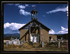
The Catholic Church in Llano.
-
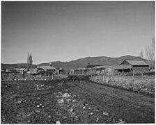
Llano around the 1930s.
-
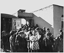
School children in Llano, 1940s.
-
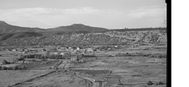
The small community of Rodarte, New Mexico, one mile from Llano, in August 1940.


