High Road to Taos facts for kids
Quick facts for kids High Road to Taos |
|
|---|---|

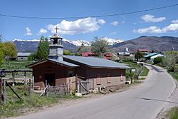
Truchas, with Truchas Peaks in background
|
|
| Location | New Mexico |
| Designated | February 28, 1975 |
| Reference no. | 363 |
| Lua error in Module:Location_map at line 420: attempt to index field 'wikibase' (a nil value). | |
The High Road to Taos is a beautiful, winding road in New Mexico. It stretches about 56 miles (90 km) through the Sangre de Cristo Mountains. This road connects the cities of Santa Fe and Taos. (There's also a "Low Road" that follows the Rio Grande river valleys.)
Along the way, you'll see high deserts, tall mountains, green forests, and small farms. You'll also pass through tiny villages. Some were settled by Spanish families long ago. Others are Pueblo Indian villages. Many artists and craftspeople live here. They have galleries and studios because they love the natural beauty of the area. New Mexico has named it an official scenic byway. This means it's a special road known for its amazing views.
Contents
- Exploring the High Road to Taos
- Starting Point: Nambé Pueblo
- Chimayó: A Place of Healing and Art
- Córdova: Home of Woodcarvers
- Truchas: A Mountain Village with History
- Ojo Sarco and Las Trampas: Blue Spring and Traps
- El Valle, Ojito, and Chamisal
- Picurís Pueblo: People Who Paint
- Peñasco and Nearby Valleys
- Vadito and Sipapu
- Talpa: An Ancient Site
- Ranchos de Taos: The Famous Church
- Where the Road Begins and Ends
- See Also
Exploring the High Road to Taos
The High Road to Taos is a journey through history and stunning landscapes. Let's explore some of the interesting places you'll find along this famous route.
Starting Point: Nambé Pueblo
The High Road adventure begins north of Santa Fe. You'll start in Pojoaque, New Mexico, where U.S. 285/84 meets State Road 503. The road then leads to Nambé Pueblo. This pueblo was founded way back in the 1300s. Its name, "Nambé," means "People of the Round Earth" in their native Tewa language.
The main plaza of Nambé Pueblo is a special place. It is recognized as a National Historic Landmark. The pueblo covers about 19,000 acres (77 km²) of land. This includes beautiful waterfalls, lakes, and mountains. For a long time, Nambé was known for its unique pottery. Today, artists are bringing back old pottery styles. They also create beautiful woven items.
Chimayó: A Place of Healing and Art
The road continues through rolling hills. You'll see interesting rock formations shaped by the wind. After about 7.5 miles (12 km), the High Road turns onto State Road 98. This road takes you across the open desert. Then it dips down into the green, farming valley of Chimayó.
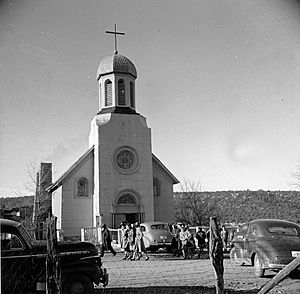
Many visitors stop at the historic Santuario de Chimayó. This small church was built between 1811 and 1816. People from all over the United States and Mexico visit it. They especially come during Good Friday of Easter week. Thousands of people gather there, hoping for healing. Chimayó is also famous for its traditional weaving studios. These studios are run by families whose ancestors were among the first Spanish settlers.
Córdova: Home of Woodcarvers
After Chimayó, the road turns onto State Road 76. This is where the climb into the Sangre de Cristo Mountains begins. The first small village you'll reach is Córdova. It has narrow streets above a river valley. Córdova is known for its amazing woodcarvers. They create beautiful statues of saints, called santos. These carvings are unique because they are unpainted. They show off the natural grain and shape of the wood.
Truchas: A Mountain Village with History
The road keeps climbing to a high mesa. Here you'll find the village of Truchas. Its name means 'trout'. It's a collection of adobe houses with the snow-capped Truchas Peaks in the background. Truchas was founded in 1754. It was a land grant from the Spanish king. The village was built to protect against raids from Apache and Comanche groups.
The settlers built Truchas like a walled fort around a plaza. They also dug miles of acequias (irrigation ditches). These brought water from the trout-filled river to their farms. Today, many residents still farm. Others work in nearby cities like Santa Fe. Many artists and craftspeople live here, drawn by the stunning mountain views.
Ojo Sarco and Las Trampas: Blue Spring and Traps
The High Road continues on State Road 76. It passes through the Carson National Forest. You'll see a series of very small villages. The first is Ojo Sarco. This name likely comes from a nearby spring. Ojo can mean "spring" and zarco means "light blue" in Spanish. So, it means "blue spring."
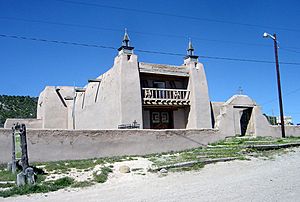
Next is Las Trampas. It was founded in 1751. The full name was "Santo Tomás Apostol del Río de las Trampas." This means "Saint Thomas, Apostle of the River of Traps." Despite challenges like illness and raids, the village survived. The settlers built the grand San José de Gracia Church. It was finished in 1776. This church is a National Historic Landmark. The entire village is also a National Historic District.
El Valle, Ojito, and Chamisal
State Road 76 continues through the Carson National Forest. Smaller roads lead to El Valle, meaning 'the valley', and Ojito, meaning 'little spring'. Both were settled by people from Las Trampas. These side trips offer beautiful drives through the forest.
The next village on SR 76 is Chamisal. It was also settled by Spanish villagers from Las Trampas. Chamisal is probably named after the "chamisa" shrub. This plant turns a golden color in late summer. There is a small, old church in the village.
Picurís Pueblo: People Who Paint
When SR 76 ends, the High Road turns right onto State Road 75. But if you turn left, you can visit Picurís Pueblo. A Spanish explorer named Juan de Oñate called these people "pikuria," meaning "those who paint."
Long ago, Picurís was one of the largest and strongest pueblos. It was located where two rivers met. This spot was also on a major pass through the mountains to the Great Plains. This made it a key place for trading with the Apaches. The Picurís people were known for their strength. They even fought the Spanish after the Reconquest. Today, Picurís Pueblo is small but active. It is known for its gold-colored pottery. This pottery has shiny flecks of mica. The San Lorenzo de Picurís church was rebuilt by hand by pueblo members after it collapsed in 1989.
Peñasco and Nearby Valleys
The High Road continues on State Road 75 into Peñasco. Spanish colonists first settled the villages in this area in 1796. This was the same year Taos was settled. Today, Peñasco serves as a center for many surrounding villages and for Picurís Pueblo.
Leaving Peñasco, the High Road makes a wide curve. You can take a side trip onto State Road 73. This road leads to Llano San Juan and Llano de la Yegua. A es|llano is a "broad, treeless plain." es|yegua means "mare" (a female horse). These are green valleys surrounded by steep mesas.
Vadito and Sipapu
The High Road continues along State Road 75 through the tiny village of Vadito. This name means "little ford." After Vadito, the road goes through the valley of Placita.
At a "stone wall" intersection, the High Road turns left onto State Road 518. This road leads to Ranchos de Taos. However, just a few miles east on SR 518 is Sipapu Ski Resort. The drive to Sipapu through the Carson National Forest is very scenic. There are also many trails and fishing spots along the Rio Pueblo.
Talpa: An Ancient Site
The High Road turns northwest along SR 518. It passes through more valleys and views of the Carson National Forest. Eventually, it reaches Talpa, the last village on the High Road. Talpa is a very old site. People built pit houses and pueblos here between 1100 and 1300. Spanish colonists settled it in the early 1700s. Talpa means "knob," which might refer to a rock formation in one of its canyons.
Ranchos de Taos: The Famous Church
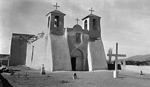
The High Road officially ends where SR 518 meets SR 68 in Ranchos de Taos. But many people feel it truly ends at the famous San Francisco de Asis Mission Church. This church is a few blocks south. It is one of the most painted and photographed churches in the country. Artists like Georgia O'Keeffe and photographers like Ansel Adams have captured its beauty. The church took a long time to build, from 1772 to 1815.
Where the Road Begins and Ends
- Beginning: Near Santa Fe (35°53′49″N 106°01′12″W / 35.897°N 106.020°W)
- End: Near Taos (36°21′29″N 105°36′29″W / 36.358°N 105.608°W)
See Also
- Scenic byways in the United States
 | Stephanie Wilson |
 | Charles Bolden |
 | Ronald McNair |
 | Frederick D. Gregory |


