
Llanos Costa, Cabo Rojo, Puerto Rico facts for kids
Quick facts for kids
Llanos Costa
|
|||
|---|---|---|---|
|
Barrio
|
|||

A view of Llanos Costa
|
|||
|
|||

Location of Llanos Costa within the municipality of Cabo Rojo shown in red
|
|||

Llanos Costa, Cabo Rojo, Puerto Rico
Location in Caribbean
|
|||
| Commonwealth | |||
| Municipality | |||
| Area | |||
| • Total | 23.49 sq mi (60.8 km2) | ||
| • Land | 19.52 sq mi (50.6 km2) | ||
| • Water | 3.97 sq mi (10.3 km2) | ||
| Elevation | 223 ft (68 m) | ||
| Population
(2010)
|
|||
| • Total | 3,571 | ||
| • Density | 182.9/sq mi (70.6/km2) | ||
| Source: 2010 Census | |||
| Time zone | UTC−4 (AST) | ||
| ZIP code |
00623
|
||


Llanos Costa is a special area, called a barrio, located in the municipality of Cabo Rojo, Puerto Rico. In 2010, about 3,571 people lived there. It is known for its beautiful coastal views and natural areas.
A Look Back: The History of Llanos Costa
Puerto Rico became a territory of the United States after the Spanish–American War in 1898. This happened because of a peace agreement called the Treaty of Paris of 1898. After this, Puerto Rico became an unincorporated territory of the United States. This means it is part of the U.S. but does not have all the same rights as a state.
In 1899, the United States Department of War counted the people living in Puerto Rico. They found that 867 people lived in the Llanos Costa barrio at that time. Over the years, the population of Llanos Costa has changed. You can see how it grew and changed in the table below.
| Historical population | |||
|---|---|---|---|
| Census | Pop. | %± | |
| 1900 | 867 | — | |
| 1910 | 1,246 | 43.7% | |
| 1920 | 1,281 | 2.8% | |
| 1930 | 1,402 | 9.4% | |
| 1940 | 2,059 | 46.9% | |
| 1950 | 2,471 | 20.0% | |
| 1980 | 1,849 | — | |
| 1990 | 2,511 | 35.8% | |
| 2000 | 3,495 | 39.2% | |
| 2010 | 3,571 | 2.2% | |
| U.S. Decennial Census 1899 (shown as 1900) 1910-1930 1930-1950 1980-2000 2010 |
|||
Exploring Llanos Costa: Photo Gallery
-
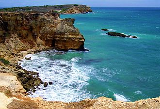
Rocky seashore in Llanos Costa near the Faro Los Morrillos de Cabo Rojo
-
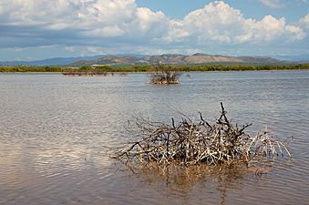
A beautiful view of the landscape in Llanos Costa
-
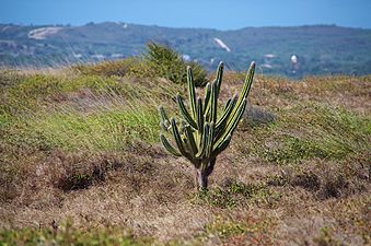
Another scenic view of Llanos Costa
.jpg)
.jpg)
.jpg)
See also
 In Spanish: Llanos Costa (Cabo Rojo) para niños
- List of communities in Puerto Rico
