Loch Callater facts for kids
Quick facts for kids Callater loch |
|
|---|---|
| Loch Callater | |

Callater loch
|
|
| Location | Braemar, Scotland |
| Coordinates | 56°56′23″N 3°20′37″W / 56.93972°N 3.34361°W |
| Type | freshwater loch |
| Primary inflows | Allt an loch |
| Primary outflows | Callater Burn |
| Basin countries | Scotland |
| Max. length | 1.6 km (1 mi) |
| Max. width | 320 m (1,050 ft) |
| Surface area | 30.9 ha (76 acres) |
| Average depth | 3.7 m (12 ft) |
| Max. depth | 9.1 m (30 ft) |
| Water volume | 1,100,000 m3 (38,000,000 cu ft) |
| Shore length1 | 3.2 km (2.0 mi) |
| Surface elevation | 501 m (1,644 ft) |
| Islands | 0 |
| 1 Shore length is not a well-defined measure. | |
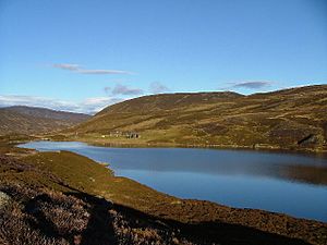
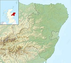
Loch Callater is a beautiful freshwater loch (a Scottish word for lake) located in the mountains of Scotland. It's about 5 miles (8 km) south of a town called Braemar. This long, narrow loch stretches for about 1.6 km (1 mi) and is surrounded by steep hills. It's a great place to explore the Scottish Highlands!
Contents
Exploring Loch Callater
Loch Callater is a special place for many reasons. It's known for its clear, cool water and the amazing nature around it.
What Lives in the Loch?
Loch Callater is home to several kinds of fish. If you enjoy fishing, you might find:
Remember, if you want to fish here, you'll need to get a special permit first. This helps protect the fish and their home.
Fun Things to Do at Loch Callater
The area around Loch Callater is very popular with people who love to walk and hike. The scenery is stunning, with mountains and peaceful waters.
At the north end of the loch, there's a place called the Callater Stable. This isn't a stable for horses anymore. It's a special kind of mountain shelter called a bothy. Bothies are simple huts that hikers can use for free to rest or stay overnight. They offer a basic place to shelter from the weather and are a welcome sight for tired walkers.
How We Know About the Loch
People have been studying Loch Callater for a long time. In 1905, two researchers named T.N. Johnston and L.W. Collett carefully measured the loch. They created detailed maps of its depths. This work was part of a much bigger project led by Sir John Murray. He created a huge survey of all the freshwater lochs in Scotland between 1897 and 1909. This helped us learn a lot about these amazing natural places.
 | Sharif Bey |
 | Hale Woodruff |
 | Richmond Barthé |
 | Purvis Young |


