Loch o' th' Lowes (New Cumnock) facts for kids
Quick facts for kids Loch o' th' Lowes |
|
|---|---|

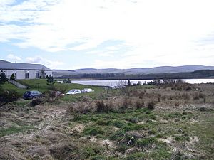
Loch o' th' Lowes and Lochside House Hotel buildings
|
|
| Lua error in Module:Location_map at line 420: attempt to index field 'wikibase' (a nil value). | |
| Location | East Ayrshire, Scotland |
| Type | Freshwater loch |
| Primary inflows | Creoch Loch, Lochill Burn, rainfall and runoff |
| Primary outflows | Lochside Burn |
| Basin countries | Scotland |
| Max. length | 600 m (2,000 ft) |
| Max. width | 550 m (1,800 ft) |
| Islands | Two (19th century) |
| Settlements | New Cumnock |
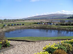
Loch o' th' Lowes is a freshwater loch (a Scottish word for lake) located in East Ayrshire, Scotland. It's also known as Lochside or Meikle Creoch Loch. This loch is one of three lakes connected together. It sits in a natural dip in the land called a glacial kettle hole, which was formed by melting glaciers long ago. The A76 road passes right by it.
Contents
Exploring Loch o' th' Lowes
Loch o' th' Lowes is found in the New Cumnock area, at the base of a place called Lowesmuir. The name 'Lowes' might come from an old English word meaning 'low'. Some people have even suggested it means 'Loch of Flames'!
There are other lochs with similar names in Scotland, like one near Perth and another near Selkirk. There's also Lowes Loch in North Ayrshire, which is thought to get its name from a Celtic word for 'Hill'.
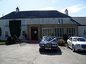
The name 'Lochside' comes from a building next to the loch. This building used to be a hunting lodge and is now a hotel.
How the Lochs Connect
A long time ago, a deep ditch called the 'Runner' was dug. This ditch connects Loch o' th' Lowes with two other nearby lochs: Black Loch and Creoch Loch. This connection means that in very wet weather, all three lochs can sometimes join up and look like one big lake!
Islands in the Loch
Old maps from the 1800s show that Loch o' th' Lowes used to have two small islands. One was close to the southern shore, and the other, larger one, was near the western shore.
What the Maps Show
Old maps help us understand how Loch o' th' Lowes has changed over time.
- A map from 1636–52 by Robert Gordon shows just one loch with water flowing out into the River Nith.
- Blaeu's map from 1654 also shows a single loch, but it marks a 'Black Loch' part at the northern end.
- Later maps, like John Adair's in 1685 and Roy's in 1747, also show a single loch, sometimes called 'Loch Side'.
- Armstrong's map from 1775 shows the 'Lows' loch without any islands.
- By 1832, Thomson's map shows 'Lochside Loch' with one stream flowing in and a single island.
- The 1857 OS map is more detailed, showing 'Lochside Loch' with two islands and even a piece of land that almost forms a third island! This map also shows a large wetland area next to the loch.
Uses of the Loch
In the past, the people who owned Lochside House had the right to fish and hunt around the loch. There was even a boathouse by the water. The loch was home to fish like perch, pike, and eels. It was also known to be quite shallow in many places, about four feet deep, which made it a relatively safe spot for swimming.
Animals and Plants
Loch o' th' Lowes is a great place for wildlife! In the 20th century, a pair of great crested grebes, which are beautiful water birds, nested here. Other birds you might find include:
- Reed warblers
- Snipe
- Meadow pipits
- Lapwings
Fun Facts and Old Stories
A River Changing Direction?
Once, a powerful person called the Earl of Dumfries had an idea. He wanted to dig a channel from the River Nith through Loch o' th' Lowes and Creoch Loch, all the way to the Black Loch. His plan was to use this water to power a factory he wanted to build. If this had happened, some of the River Nith's water would have flowed towards the River Clyde instead of the Solway, changing its natural path! But this big project was never finished.
The Traveling Trout
Imagine a very adventurous trout! People used to tell a fun story about a trout that could swim a really long way. It would start in the River Ayr, then go into the Lugar Water, then the Glaisnock Water to reach the Black Loch. From there, it would travel through Creoch Loch, then into Loch o' th' Lowes, and finally into the River Nith, ending its journey in the Solway Firth. That's a trip of about 70 miles (110 kilometers)!
The Witch and the Hare
An old local story tells of a witch who could turn herself into a hare. One day, a young man at Lowes Farm shot the hare. To stop any bad luck or a curse from the witch, he quickly fired a piece of silver at the exact spot where the hare had been wounded.
 | Victor J. Glover |
 | Yvonne Cagle |
 | Jeanette Epps |
 | Bernard A. Harris Jr. |


