Loch of Kirbister facts for kids
Quick facts for kids Loch of Kirbister |
|
|---|---|
| Kirbister loch, Loch of Orphir | |

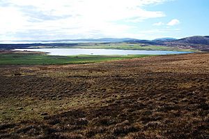
Looking roughly SW over moorland down to the loch.
|
|
| Location | Mainland Orkney, Scotland |
| Coordinates | 58°57′08″N 3°5′36″W / 58.95222°N 3.09333°W |
| Type | freshwater loch |
| Primary inflows | several burns |
| Primary outflows | Mill burn at south end in to Waulkmill Bay |
| Catchment area | 8 sq mi (21 km2) |
| Basin countries | Scotland |
| Max. length | 1.25 mi (2.01 km) |
| Max. width | 0.5 mi (0.80 km) |
| Surface area | 227 acres (0.92 km2) |
| Average depth | 4 ft (1.2 m) |
| Max. depth | 6 ft (1.8 m) |
| Water volume | 41,000,000 cu ft (1,200,000 m3) |
| Surface elevation | 52 ft (16 m) |
| Islands | Holm of Groundwater |
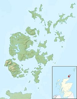
The Loch of Kirbister is a small, shallow lake on Mainland Orkney, Scotland. It's shaped a bit like a triangle. This loch is found in the area called Orphir, about 5 miles (8 km) southwest of Kirkwall. It sits on farmland between two hills.
Contents
Exploring Loch of Kirbister
The Loch of Kirbister is a freshwater loch, which is the Scottish word for a lake. It's not very deep, only about 4 to 6 feet (1.2 to 1.8 meters). The loch gets its water from several small streams, called burns. Its water then flows out through the Mill Burn at its southern end. This burn eventually reaches Waulkmill Bay.
The Holm of Groundwater
Near the eastern shore of the loch, there's a small island. It's called the Groundwater of Holm. This island is covered in grass and measures about 121 feet (37 meters) long and 62 feet (19 meters) wide. You can still see traces of an old oval stone structure and a small pier on the island.
Fishing and Wildlife
The Loch of Kirbister is a popular spot for fishing, especially for trout. The Orkney Trout Fishing Association even has a special place called a hatchery right by the loch. A hatchery is where young fish are raised before they are released into the loch. This helps to keep the fish population healthy.
Kirbister Mill's History
The Mill Burn, which flows out of the loch, was once very important. In the 18th century, it provided power for the Kirbister Mill. Mills like this used the force of flowing water to turn large wheels. These wheels then helped to grind grain into flour.
Mapping the Loch
Scientists have studied the Loch of Kirbister to learn more about it. In 1903, two people named T.N. Johnston and R.C. Marshall surveyed the loch. Later, their findings were used to create detailed maps. These maps were part of a big project led by Sir John Murray. His team mapped many freshwater lochs across Scotland between 1897 and 1909. This project helped us understand the depths and shapes of Scotland's lakes.
 | Mary Eliza Mahoney |
 | Susie King Taylor |
 | Ida Gray |
 | Eliza Ann Grier |


