
Mainland, Orkney facts for kids
| Gaelic name | Mòr-thìr |
|---|---|
| Norse name | Megenland/Hrossey |
| Meaning of name | Norse for 'mainland' or 'island of horses' |
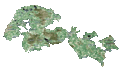
 Map of Orkney Islands, mainland highlighted |
|
| OS grid reference | HY350158 |
| Physical geography | |
| Island group | Orkney |
| Area | 52,325 hectares (202 sq mi) |
| Area rank | 6 |
| Highest elevation | Mid Hill 271 metres (889 ft) |
| Administration | |
| Sovereign state | United Kingdom |
| Country | Scotland |
| Council area | Orkney Islands Council |
| Demographics | |
| Population | 17,162 |
| Population density | 32.80 people/km2 |
| Largest settlement | Kirkwall |
The Mainland is the biggest island in Orkney, Scotland. It's also known as Hrossey or Pomona. The two main towns in Orkney, Kirkwall and Stromness, are both on this island. Mainland is also the main hub for ferries and flights in Orkney.
Most of Orkney's people, about 75%, live on Mainland. The island has a long history, with many important old sites to explore. Its sandstone ground makes the farmland very good for growing crops. There's also lots of wildlife, especially many different kinds of seabirds.
Contents
What's in a Name? The Island's Names
The name Mainland comes from the Old Norse word Meginland. This word simply means "main land."
Long ago, the island was also called Hrossey. This name means "Horse Island."
Sometimes, you might hear the island called "Pomona". This name came from a mistake in translation in the 1500s. Even though it's not used much today, you can still see it in names like the Pomona Inn in Finstown.
Island Geography: Exploring Mainland
Mainland has many people living on it and lots of good farmland. The western part of the island, near Kirkwall, is mostly flat. It has tall cliffs along the coast in the north and west. There are also two big freshwater lochs, Stenness and Harray.
The eastern part of Mainland looks a bit like the letter "W". The furthest eastern part is called Deerness. To the south, there are special causeways called Churchill Barriers. These causeways connect Mainland to other islands like Burray and South Ronaldsay. They pass through smaller islands called Lamb Holm and Glimps Holm.
Mainland is like the center of the Orkney Islands. It connects the islands to the north with those to the south. The western side of the island is part of a beautiful area called the Hoy and West Mainland National Scenic Area. This is one of Scotland's 40 special scenic areas.
In 2011, about 17,162 people lived on Mainland. This was a bit more than in 2001.
Island Parishes: Local Areas
Mainland is divided into 13 local areas called parishes. Some parishes like Sandwick, Birsay, and Stromness are on the west coast. Rendall and Evie are in the northwest.
On the eastern side, you'll find Holm, Deerness, and St Andrews. These are around the central parish of St Ola, where Kirkwall is located. West of Kirkwall are Firth, Orphir, Stenness, and Harray. Harray is special because it's the only parish in Orkney that doesn't touch the sea. However, it does have a long shore along the freshwater Loch of Harray.
Island Economy: How People Make a Living
The people on Mainland work in different areas. Many work in farming, fishing, and fish farming. The island also has jobs related to oil and gas.
In recent years, there's been more work in making things, tourism, and processing food and drinks. Renewable energy, like wind power, is also growing. Tourism is very important, with over 190,000 people visiting the islands in 2019. Many visitors arrive on cruise ships.
The COVID-19 pandemic in 2020 and 2021 affected tourism a lot. The Scottish government created special programs to help businesses on the islands. These programs gave money to hotels, shops, and restaurants that were struggling.
Main Settlements: Towns and Villages

The three main places where people live on Mainland are Kirkwall, Stromness, and Finstown. Kirkwall and Stromness are both official towns, called burghs.
- Kirkwall
Kirkwall is the capital city of the Orkney Islands. It's located on a narrow strip of land between the west and east parts of Mainland. This location was great for its harbors, which faced both north and south. The southern harbor, Scapa Flow, is a large, calm natural harbor. Kirkwall is home to the Bishop of Orkney and the famous St Magnus Cathedral. It's also one of the main places where ferries leave from.
- Stromness
Stromness is an old seaport that became important when whaling grew. About 2,200 people live there. The old part of town has narrow streets with houses and shops made from local stone. Small lanes and alleys branch off the main street. You can take a ferry from Stromness to Scrabster on the Scottish mainland. There's also a ferry to the Isle of Hoy.
- Finstown
Finstown is the third largest settlement on Mainland. It used to be called the "Toon o' Firth." Its name might come from an Irishman named David Phin who arrived in 1811. Finstown is on the main road between Stromness and Kirkwall.
Island Geology: The Rocks Beneath Our Feet

Like most of the Orkney islands, Mainland is mostly made of Old Red Sandstone. This rock is about 400 million years old. It formed from sand and mud that settled in river deltas. A large freshwater lake, called Lake Orcadie, once covered this area.
Underneath the sandstone, there are older metamorphic rocks. You can see a small strip of these grey rocks, called gneiss and granite, between Stromness and Inganess.
The island also shows many signs of glaciers from long ago. You can find marks on rocks in Kirkwall Bay and clay with sea shells. There are also large rocks that came from other places, like chalk and flint.
The soil on Mainland is usually sandy or a strong clay. It's very good for farming. People also use seaweed and lime to make the soil even better.
Surrounding Islands: Mainland's Neighbors

Many smaller islands surround Mainland. Some are tiny islets that are only separate at high tide. Others are skerries, which are rocks that only appear at low tide. These include places like Damsay, Holm of Houton, and Thieves Holm.
The other Orkney Islands are usually grouped as either north or south of Mainland. Two far-off islets, Sule Skerry and Sule Stack, are about 37 miles (60 km) west of Orkney. They are part of Orkney for local government reasons.
Island History and Notable Sites


The western part of Mainland has many ancient buildings from the Neolithic period (New Stone Age) and the time of the Picts.
Some of the most famous Neolithic sites are in west Mainland. These are part of the "Heart of Neolithic Orkney", which is a UNESCO World Heritage Site. This special area includes:
- Maeshowe: A large ancient tomb with a chamber.
- Standing Stones of Stenness: A circle of tall ceremonial stones.
- Ring of Brodgar: Another large stone circle.
- Skara Brae: An ancient village from the Stone Age.
These sites show us what life was like in northern Scotland about 5,000 years ago. Nearby, there's also the Barnhouse Settlement, which has more old buildings.
Other interesting places to visit include St Magnus Cathedral and the ruins of the Bishop's Palace in Kirkwall. You can also see the Earl's Palace, a ruined castle from the 1500s in Birsay, and Skaill House, a manor house and museum near Skara Brae.
Vikings came and lived in Orkney a long time ago. Mainland was part of Norway until the 1400s. Then, it became part of Scotland. You can still see signs of the Vikings everywhere. For example, many place names are from Norse words. There are also runic writings at Maeshowe and other old sites.
Stromness is a newer town, first mentioned in the 1500s. It became important in the late 1600s. At that time, England was at war with France, so ships had to avoid the English Channel. Ships from the Hudson's Bay Company and whaling ships often stopped in Stromness.
The Churchill Barriers are a series of four causeways. They are about 1.5 miles (2.4 km) long in total. They connect the south of Mainland to the island of South Ronaldsay. They pass through Burray, Lamb Holm, and Glimps Holm. These barriers were built during World War II. On October 14, 1939, a German submarine sank the British battleship HMS Royal Oak in Scapa Flow. To stop more attacks, Winston Churchill ordered the barriers to be built. Work started in 1940 and finished in 1944. They were officially opened in 1945, just after the war ended in Europe. Now, they are used as roads.
Island Climate: Weather and Light

The climate on Mainland is quite mild and steady, even though it's far north. The average temperature for the whole year is 8 °C (46 °F). In winter, it's about 4 °C (39 °F), and in summer, it's around 12 °C (54 °F).
The island gets about 850 to 940 mm (33 to 37 in) of rain each year. Sometimes there are fogs in summer and early autumn. Strong gales, or very windy storms, happen about four or five times a year.
One exciting thing for visitors is the long summer days. On the longest day, the sun rises at 3:00 AM and sets at 9:29 PM. It stays light almost all night! You can even read at midnight because it's not truly dark. However, winter is long. On the shortest day, the sun rises at 9:05 AM and sets at 3:16 PM.
Transportation and Infrastructure
Roads: Getting Around Mainland
Mainland has most of the roads in Orkney. These roads also connect to the main southeastern islands, like South Ronaldsay and Burray, thanks to the Churchill Barriers.
There are ideas to build an undersea tunnel to connect Orkney to the Scottish Mainland. This tunnel would be about 9–10 miles (14–16 km) long. Another idea is a shorter tunnel connecting Orkney Mainland to Shapinsay. If the tunnel to the Scottish Mainland is built, it would connect to South Ronaldsay, which is already linked to Mainland by road.
Air Travel: Flying to and From Mainland
The main airport in Orkney is Kirkwall Airport. It's managed by Highlands and Islands Airports Limited. The airline Loganair offers flights from Kirkwall to other Scottish cities like Aberdeen, Edinburgh, Glasgow, and Inverness. You can also fly to Sumburgh Airport in Shetland. Most flights between the Orkney islands also use Kirkwall Airport.
Ferries: Island Connections

Ferries connect Orkney to the rest of Scotland and to other islands within the Orkney group. You can take a ferry from Kirkwall to Lerwick in Shetland or to Aberdeen in Scotland. NorthLink Ferries operates these routes. There are also ferries from Stromness to Scrabster in Scotland, also run by NorthLink Ferries. Another ferry service, Pentland Ferries, connects Gills Bay to St Margaret's Hope on South Ronaldsay.
Ferries also link all the inhabited Orkney islands to Mainland. These services are run by Orkney Ferries, which is owned by the Orkney Islands Council.
Flora and Fauna: Plants and Animals

Mainland is surrounded by lots of sea life, especially many kinds of seabirds. You might also find Corncrakes in some areas. The Loch of Harray is important for birds, with up to 10,000 pochard ducks spending the winter there.
There are not many wild land mammals on Mainland. However, there is a special type of common vole called the Orkney vole (Microtus arvalis orcadensis). This small animal is found only in the Orkney Islands. It might have been brought here by early settlers about 4,000 years ago. You can also find brown hares and rabbits. There are frogs, but no toads.
Mainland has about six hundred different kinds of plants. Two rare plants found here are the oyster plant (Mertensia maritima) and the Scottish primrose (Primula scotica). The Scottish primrose only grows on the north coast of Scotland, including Orkney and nearby Caithness. It is related to Arctic plants.
Images for kids
-
Mainland
-
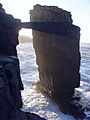
Sea Arch at Yesnaby
-
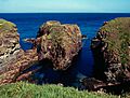
Brough of Deerness


See also
 In Spanish: Mainland (Orcadas) para niños
