South Ronaldsay facts for kids
| Norse name | Rognvaldsey |
|---|---|
| Meaning of name | Old Norse for "Rognvald/Ronald's island" |
 St Margaret's Hope on South Ronaldsay |
|
| OS grid reference | ND449899 |
| Coordinates | 58°47′N 2°57′W / 58.78°N 2.95°W |
| Physical geography | |
| Island group | Orkney |
| Area | 4,980 hectares (19.2 sq mi) |
| Area rank | 22 |
| Highest elevation | Ward Hill 118 metres (387 ft) |
| Administration | |
| Sovereign state | United Kingdom |
| Country | Scotland |
| Council area | Orkney Islands |
| Demographics | |
| Population | 909 |
| Population density | 18.3 people/km2 |
| Largest settlement | St Margaret's Hope |
South Ronaldsay (called Sooth Ronalshee in Scots) is one of the Orkney Islands. These islands are located off the north coast of Scotland. South Ronaldsay is connected to the Orkney Mainland by the Churchill Barriers. These barriers are a series of causeways that link several islands, including Burray, Glimps Holm, and Lamb Holm.
Contents
What's in a Name?
South Ronaldsay, along with North Ronaldsay, gets its name from St Ronald.
Island Geography and Features
South Ronaldsay covers an area of about 4,980 hectares (19.2 square miles). This makes it the fourth largest of the Orkney islands. Only The Mainland, Hoy, and Sanday are bigger.
Getting There: Ferries
You can catch ferries from two places on the island. One ferry leaves from Burwick and goes to John o' Groats on the Scottish mainland. Another ferry sails from St Margaret's Hope to Gills Bay.
St Margaret's Hope Village
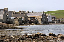
The main village on South Ronaldsay is St Margaret's Hope. It is the third largest settlement in Orkney. The village might be named after Margaret, Maid of Norway. She was an heir to the Scottish throne who sadly died in Orkney at age seven. It could also be named after St. Margaret.
The village has a small museum about blacksmithing. It is also famous for its yearly Boys' Ploughing Match. In this special event, young girls and boys dress up as horses. Other young boys use small ploughs to compete. They try to plough a 4-foot square area of sand.
Island Landmarks
The main points of the island are:
- Ayre of Cara, near Churchill Barrier no. 4 (north)
- Grimness (east)
- Brough Ness (south)
- Hoxa Head (west)
The highest point on the island is Ward Hill. It reaches 118 metres (387 ft) high. Many highest points on Orkney islands are called "Ward Hill." This name comes from a time when these spots were used to light warning beacons.
Ancient History of South Ronaldsay

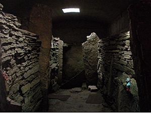
South Ronaldsay is well-known for an ancient site called the Neolithic Isbister Chambered Cairn. People often call it the "Tomb of the Eagles." Ronald Simison discovered this site in 1958 in the southeast part of the island. Inside, archaeologists found 16,000 human bones and 725 bird bones. Most of the bird bones belonged to the White-tailed Sea Eagle (Haliaeetus albicilla). This tomb was used for over a thousand years.
Bronze Age Cooking Place
Near the tomb, there is a burnt mound at Liddle. Ronald Simison found this in 1972. It is a great example of a Bronze Age cooking place in Orkney. This structure was made of flat stone slabs, originally sealed with clay. A central stone trough would have been filled with water. Stones heated by peat fuel were then placed in the water to cook food. The building probably did not have a roof.
Hoxa Broch Site
There is also a broch site at Howe of Hoxa in the northwest. A broch is an ancient stone tower. This site might have been the burial place of Thorfinn "Skullsplitter".
Island History
In 1627, records show there were nine chapels on South Ronaldsay. Some of their names suggest that Christian worship happened here even before the Norse people took over Orkney. These chapels included Sant Androis, Our Ladie, Sant Colmis, and Sant Margrat. Their locations are known, but not much physical evidence remains today.

Early Descriptions and Mining
In the late 1600s, South Ronaldsay was described as having "fertile Corns and abounding with People." This means it grew a lot of grain and had many residents. A map from 1750 by Murdoch MacKenzie shows where lead mining took place near Grimness. A visitor in 1774 saw "several deep holes" where people looked for lead ore. However, only small amounts of lead were ever found.
Parishes and Churches
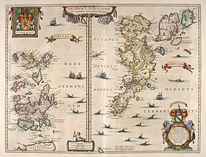
By the late 1700s, South Ronaldsay was split into two parishes. St. Peter’s covered the northern two-thirds of the island. St. Mary’s made up the southern third. St. Peter’s church has a stone with the date 1642. It also appears on Blaeu's 1654 map. By 1793, the church building had no roof, but it was likely repaired by 1801. A Pictish symbol stone was found in a window of the church. This stone has ancient carvings, including a mirror-case and crescent shapes.
Fishing and Trade in the 1800s
During the 1800s, the island's economy grew thanks to the herring fishing industry. St Margaret's Hope became the main trading center for the South Isles. By 1890, there were 20 shops and 18 tradesmen working there.
Tomison's Academy
Tomison's Academy was a school started by William Tomison. He was born on the island and later became the Governor of the Hudson's Bay Company. When it first opened, the school had 170 students. However, it closed in the 1960s. Tomison is buried near his old home, Dundas House.
Many old houses and other buildings on the island are well-preserved. They show the traditional local style.
Local Government
South Ronaldsay is part of the "East Mainland, South Ronaldsay and Burray" ward. This area is represented by three independent councillors on the Orkney Islands Council. The local community council looks after both South Ronaldsay and Burray.
Wildlife: The Orkney Vole
Microtus arvalis ronaldshaiensis is a special type of Orkney vole. It is a sub-species of the common vole and is found only in the Orkney islands. This vole is larger than the common vole. It looks like a field vole but has shorter, paler fur.
The Orkney voles were brought to the archipelago during the Neolithic period. The oldest known radiocarbon-dated fossil of an Orkney vole is 4600 years old. This date tells us the latest possible time they could have arrived.
|
See also
 In Spanish: South Ronaldsay para niños
 | Emma Amos |
 | Edward Mitchell Bannister |
 | Larry D. Alexander |
 | Ernie Barnes |


