
Sanday, Orkney facts for kids
| Norse name | Sandey |
|---|---|
| Meaning of name | Old Norse: sand island |
 An aerial view of the southern coast of Sanday, looking west. Tres Ness and Conninghole are in the foreground. |
|
| OS grid reference | HY677411 |
| Coordinates | 59°15′N 2°33′W / 59.25°N 2.55°W |
| Physical geography | |
| Island group | Orkney |
| Area | 5,043 ha (19.5 sq mi) |
| Area rank | 21 |
| Highest elevation | The Wart 65 m (213 ft) |
| Administration | |
| Sovereign state | United Kingdom |
| Country | Scotland |
| Council area | Orkney Islands |
| Demographics | |
| Population | 494 |
| Population density | 9.8 people/km2 |
| Largest settlement | Lady |
Sanday is one of the islands in Orkney, a group of islands off the north coast of Scotland. It's the third largest island in Orkney, covering about 50.43 square kilometers (19.5 square miles). The main towns on Sanday are Lady Village and Kettletoft. You can get to Sanday by Orkney Ferries or by plane from Kirkwall on the Orkney Mainland.
Contents
What's in a Name?
Long ago, people called Picts lived on Sanday. But most of the place names we use today come from the Norse people. They called the island Sandey or Sand-øy. This means "sand island" because Sanday has so many sandy beaches. Later, this name became "Sanday."
Many places on the island have names from the old Norse language. For example, Kettletoft might mean "Kettil's farm." The end of some names, like Sellibister, comes from a Norse word meaning "dwelling" or "farm." Other common endings like -wick and -ness mean "bay" and "headland."
Island Shape and Land
Sanday is located south of North Ronaldsay and east of Eday and Westray. A bay called Otterswick comes in from the north, and Kettletoft Bay comes in from the south. These two bays almost cut the island in half. A writer once said that Sanday looks like a giant fossilized bat from above!
The island's shape has changed a lot over time. After the last ice age, sea levels changed. In 1838, a big storm washed away a lot of sand in Otterswick Bay. This showed a layer of old plants and fallen trees under the sand. The trees looked like they had been knocked down by a storm.
Sanday has fertile land, which is great for farming. People also catch lobsters in the sea around the island. There are a few small freshwater lakes on Sanday, like North Loch and Bea Loch.
Ancient History of Sanday
Sanday has many signs of people who lived there long, long ago. The Neolithic Quoyness chambered cairn is a very old stone tomb, built around 2900 BC. Nearby, you can find Bronze Age mounds.
At a place called Pool, scientists dug up an old mound in the 1980s. They found remains of buildings from different times. There was a Neolithic building, a later building from before the Vikings, and a Viking stone building from the late 700s or early 800s. They also found tools and pottery. Many fish and animal bones suggest people processed meat there.
There are also ruined Iron Age towers called brochs on the island. One example is the Broch of Wasso. These show that people lived here for thousands of years.
Viking Times and Beyond
Around the 800s, Orkney became part of the Scandinavian lands. In 1985, a special discovery was made on Sanday: the Scar boat burial. This was a Viking boat that had rotted away, but over 300 iron rivets remained. Inside, they found the remains of a man, a woman, and a child. They also found many items buried with them, like a sword, arrows, a comb, and a special dragon plaque made from whale bone. This burial dates back to around 875-950 AD.
In the Middle Ages, Sanday was divided into areas for taxes. The island was known for being low-lying, which meant ships sometimes crashed there at night. People on the island sometimes hoped for shipwrecks because they could use the wood for fires. There wasn't much peat (a type of fuel) on Sanday, so dried seaweed was very important for cooking fires.
In the 1700s, a writer described life on the island. He said that people dressed well. Some wore shoes made from animal skins. Their houses were neat and well-furnished. Most people spoke English.
Later, in the 1800s, two brothers, Malcolm and Samuel Laing, started a "New Model Farm" on Sanday. They brought in special sheep. You can still see the ruins of their steam engine house today. These new farming ideas helped the island produce more food.
During World War II, the Royal Air Force built a radar station on Sanday. This needed a large camp for the soldiers, which even had a cinema! Sanday also once had a very small, private railway called the Sanday Light Railway. It was the most northern passenger railway in the United Kingdom.
Start Point Lighthouse
 |
|
| Start Point Lighthouse in 2007 | |

Start Point Lighthouse
Location in Orkney Islands
|
|
| Location | Start Point Sanday Orkney Scotland United Kingdom |
|---|---|
| Coordinates | 59°16′39″N 2°22′33″W / 59.277431°N 2.375906°W |
| Year first constructed | 1806 (first) |
| Year first lit | 1870 (current) |
| Automated | 1962 |
| Construction | stone tower |
| Tower shape | cylindrical tower with balcony and lantern |
| Markings / pattern | white and black vertical stripes tower, black lantern, ochre trim |
| Height | 25 metres (82 ft) |
| Focal height | 24 metres (79 ft) |
| Range | 24 nautical miles (44 km; 28 mi) |
| Characteristic | Fl (2) W 20s. |
| Admiralty number | A3718 |
| NGA number | 3276 |
| ARLHS number | SCO-225 |
The Start Point lighthouse on Sanday was finished in 1806 by an engineer named Robert Stevenson. It was the first lighthouse in Scotland to have a light that spun around. Since 1915, it has had special black and white vertical stripes. No other lighthouse in Scotland looks quite like it! The light became automatic in 1962 and now uses solar power.
Even with the lighthouse, a ship called HMS Goldfinch crashed in the fog near Start Point in 1915.
Life on Sanday Today
Sanday has two golf courses. One is a 9-hole course run by the Sanday Golf Club. The other is a very small, one-hole course called the "Peedie Golf Course." It's believed to be the shortest golf course in Scotland!
In 2004, three large wind turbines were built on the island. These turbines make electricity. The Sanday community worked with the energy company to create a fund. This fund uses money from the wind farm to help the people of Sanday.
The Sanday Development Trust was formed to help the island grow and improve. Their goal is to make Sanday a great place to live and work. They want it to be a safe, clean place where children can grow up and people can achieve their dreams. Projects include building a sports hall and youth center. They also have a service to help people explore the countryside.

A special design for a Sanday tartan has been created by someone living on the island. It shows the sea, the sandy beaches, the green fields, and the black and white stripes of the Start Point lighthouse.
In 2008, a concert was held on the island. This was part of a project to train music teachers. The goal was to offer more music lessons in the school and for everyone in the community.
Island Legends
There's a local legend about a Sanday girl who got a book called The Book of Black Art from a witch. The story says the Devil would claim the soul of anyone who still owned the book when they died. The only way to get rid of it was to sell it. A local clergyman, Matthew Armour, took the book from her. He managed to get rid of it before he died in 1903, though the legend doesn't say how.
At the ruined Kirk of Lady, you can see what people call the "Devil's Clawmarks." These are parallel grooves carved into the stone wall of the old church.
Images for kids
-
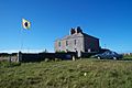
Sanday's West Manse

