Lorette River facts for kids
Quick facts for kids Lorette river |
|
|---|---|

La rivière and the Cap-Rouge trestle
|
|
|
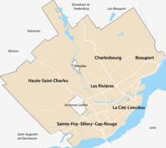
Location of the mouth of the river in Quebec City
|
|
| Native name | Rivière Lorette |
| Country | Canada |
| Province | Quebec |
| Region | Capitale-Nationale |
| Cities | Quebec City |
| Physical characteristics | |
| Main source | Agricultural stream L'Ancienne-Lorette 66 units? 46°46′42″N 71°26′02″E / 46.77832°N 71.43379°E |
| River mouth | Saint-Charles River Quebec (city) (sector Les Saules) 10 m 46°48′30″N 71°19′04″W / 46.80833°N 71.31778°W |
| Length | 23.4 km (14.5 mi) |
| Basin features | |
| River system | Saint Lawrence River |
| Basin size | 71 km2 (27 sq mi) |
| Tributaries |
|
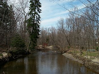
The Lorette River is a river in Quebec, Canada. It flows into the Saint-Charles River. This river runs through parts of Quebec City, including the areas of Sainte-Foy–Sillery–Cap-Rouge and L'Ancienne-Lorette.
The Lorette River valley is surrounded by many city roads. These roads help people travel around the area. Some of the main roads include route 358 and route 138.
During winter, the Lorette River usually freezes over. This happens from early December to late March. It's generally safe to walk on the ice from late December to early March. The amount of water in the river changes with the seasons. It also changes depending on how much rain or snow falls. The river's water level is highest in March or April, during the spring thaw.
Contents
Where the Lorette River Flows
The Lorette River is part of the larger Saint-Charles River system. It covers the southwest part of this area. The Lorette River has several smaller streams that flow into it. These are called tributaries.
Some of the main tributaries are the Friches stream, the Mont-Châtel stream, and the Souvenance stream. The Souvenance stream starts near Mont Bélair. Other smaller streams are mostly ditches used for farm drainage. The land around the river is used for farming, forests, and city areas.
The Lorette River is about 18 kilometers (11 miles) long. Its entire water collection area is about 71 square kilometers (27 square miles). The river drops about 56 meters (184 feet) from its start to its end.
The River's Journey
The Lorette River flows for about 23.4 kilometers (14.5 miles). Here's how it travels:
- It starts by flowing northeast through farms for about 2.7 km (1.7 mi). It crosses a road called route Jean-Gauvin.
- Then, it continues northeast for about 3.0 km (1.9 mi). It flows next to the Jean-Lesage international airport. Along this part, two more streams join the river.
- Next, it goes northeast for 2.4 km (1.5 mi). It crosses Étienne-Lessard street. The Friches stream also joins it here.
- It then turns east for 3.0 km (1.9 mi) as it enters Quebec City. The Mont Châtel stream joins it. The river makes a big curve through a city forest.
- For the next 7.7 km (4.8 mi), it flows south. It makes a large loop to the west through a city park. It winds past Saint-Jean-Baptiste street. Another stream joins it from the southwest. It continues until it reaches route 138.
- It flows east for 3.0 km (1.9 mi). It makes a big hook to the north. It passes through an industrial area called Carrefour-Du-Commerce. It then reaches Autoroute 73.
- Finally, it flows north for 1.6 km (1.0 mi). It makes a loop to the west and another to the east. It crosses Boulevard du Parc Technologique, route 138, and Boulevard Masson. This is where it meets the Saint-Charles River.
The Lorette River joins the Saint-Charles River in the Les Saules area of Quebec City. From this meeting point, the water flows about 12.5 km (7.8 mi) northeast along the Saint-Charles River.
River Health and Challenges
The quality of the water in the Lorette River changes along its path. Upstream, the water quality is generally good. It's often safe for most uses, like boating. However, downstream, the water quality becomes very poor. This means it's not safe for many uses. The river has a very high amount of bacteria from farm and city waste.
The Lorette River also faces problems with erosion. This happens when the river banks wear away. When trees are cut down along farms, the soil is left bare. In city areas, more land is covered with concrete. This makes it harder for rain to soak into the ground. Instead, the water runs off quickly into the river. This fast-moving water washes away the soil, especially during heavy rains.
You can see places where the soil is bare or the banks are damaged. This runoff water carries away the best part of the soil. This includes silt, clay, and other natural materials. These materials flow into the river. They make the water cloudy, which is called turbidity. This cloudy water can make it hard for fish and other water animals to live.
Historically, the Lorette River has always had times when it overflowed. But as more cities grew around the river, these floods became much worse. Now, the river's water level changes a lot during heavy rains. These overflows can cause damage to nearby buildings and roads.
The River's Name
The Lorette River got its name a long time ago. In 1673, a Jesuit priest named Pierre-Joseph-Marie Chaumonot named a mission for the Wendat (Huron) people "Lorette." This mission was near Quebec. The river then took on this name.
As early as 1686, a map by Robert de Villeneuve showed the river as "Rivière de Lorette." It was also sometimes called Ruisseau Lorette. People sometimes spelled it Laurette or L'aurette. It was also known as Petite rivière Saint-Charles. You can find more about this in the article about L'Ancienne-Lorette.
The official name "Lorette river" was made formal on December 5, 1968. This was done by the Commission de toponymie du Québec, which names places in Quebec.
 | Anna J. Cooper |
 | Mary McLeod Bethune |
 | Lillie Mae Bradford |


