Los Villareales, Texas facts for kids
Quick facts for kids
Los Villarreales, Texas
|
|
|---|---|
|
former CDP
|
|
 |
|
| Country | United States |
| State | Texas |
| County | Starr |
| Area | |
| • Total | 20.5 sq mi (53.1 km2) |
| • Land | 20.5 sq mi (53.0 km2) |
| • Water | 0.0 sq mi (0.1 km2) |
| Elevation | 217 ft (66 m) |
| Population
(2000)
|
|
| • Total | 930 |
| • Density | 45.4/sq mi (17.5/km2) |
| Time zone | UTC-6 (Central (CST)) |
| • Summer (DST) | UTC-5 (CDT) |
| FIPS code | 48-44168 |
| GNIS feature ID | 1852734 |
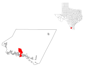
Los Villarreales was a special kind of community in Starr County, Texas, United States. It was known as a census-designated place (CDP). A CDP is an area that looks like a town but isn't officially a city with its own local government.
In the year 2000, about 930 people lived in Los Villarreales. However, this CDP no longer exists. It was removed from the census list before the 2010 count. Parts of Los Villarreales became part of Rio Grande City, Texas, and other parts helped form new CDPs like La Escondida, Texas, La Esperanza, Texas, and Santel, Texas. Some areas also became part of Mi Ranchito Estate, Texas and Ranchitos del Norte, Texas.
Where Was Los Villarreales Located?
Los Villarreales was located in Texas, at these coordinates: 26°24′6″N 98°52′41″W / 26.40167°N 98.87806°W.
According to the United States Census Bureau, the total area of Los Villarreales was about 20.5 square miles (53.1 square kilometers). Most of this area was land, about 20.5 square miles (53.0 square kilometers). A very small part, about 0.04 square miles (0.1 square kilometers), was water.
Who Lived in Los Villarreales?
| Historical population | |||
|---|---|---|---|
| Census | Pop. | %± | |
| 2000 | 930 | — | |
| U.S. Decennial Census 1850–1900 1910 1920 1930 1940 1950 1960 1970 1980 1990 2000 2010 |
|||
Los Villarreales was first counted as a census-designated place in the 2000 U.S. Census. A census is like a big count of all the people living in a country. It helps us understand how many people live in different areas and what their lives are like.
In 2000, there were 930 people living in Los Villarreales. Most of the people, about 96.45%, were of Hispanic or Latino background.
There were 238 households, which means 238 different homes where people lived. Many of these households, about 58.4%, had children under 18 living with them. The average household had about 3.91 people.
The population was quite young. About 40.3% of the people were under 18 years old. The average age of people living there was 24 years.
Schools in the Area
Most of the area where Los Villarreales used to be is now part of the Rio Grande City Consolidated Independent School District.
A smaller part of the community is served by the Roma Independent School District. Students in this area would attend schools like Anna S. Canavan Elementary School (for pre-kindergarten), R.T. Barrera Elementary School (for grades K-5), Ramiro Barrera Middle School (for grades 6-8), and Roma High School (for grades 9-12).
 | Laphonza Butler |
 | Daisy Bates |
 | Elizabeth Piper Ensley |

