
Lougheed Island facts for kids

Lougheed Island, Nunavut
|
|

Lougheed Island
Location in Nunavut

Lougheed Island
Location in Canada
|
|
| Geography | |
|---|---|
| Location | Arctic Ocean |
| Coordinates | 77°24′N 105°15′W / 77.400°N 105.250°W |
| Archipelago | Findlay Group Queen Elizabeth Islands Canadian Arctic Archipelago |
| Area | 1,312 km2 (507 sq mi) |
| Length | 78 km (48.5 mi) |
| Width | 23 km (14.3 mi) |
| Administration | |
|
Canada
|
|
| Territory | Nunavut |
| Region | Qikiqtaaluk |
| Demographics | |
| Population | Uninhabited |
Lougheed Island is a large island in the far north of Canada. It is one of the many islands that make up the Canadian Arctic Archipelago. This island is located in the Arctic Ocean, a very cold part of the world.
Lougheed Island is found in the Nunavut territory, specifically in the Qikiqtaaluk Region. It is part of a smaller group of islands called the Findlay Group. The island covers an area of about 1,312 square kilometers. No people live on Lougheed Island. It is quite isolated, sitting between Ellef Ringnes Island and Melville Island.
Contents
Discovering Lougheed Island
The first time anyone recorded seeing Lougheed Island was in 1916. This sighting was made by an explorer named Vilhjalmur Stefansson. He saw the island during his big trip called the Canadian Arctic Expedition, 1913–1916.
The island was later named after James Alexander Lougheed. He was an important Canadian politician.
Protecting the Environment
In 1993, a company called Panarctic Oils Ltd. wanted to dump a lot of scrap metal into the ocean near Lougheed Island. This was about 400 tonnes of metal. However, the Canadian government department called Environment Canada stopped them.
People living in nearby communities like Grise Fiord and Resolute were worried. They were concerned about how the metal would affect the ocean and its animals. Because of their concerns, the plan to dump the metal was cancelled. Instead, a research project began. Scientists wanted to study what would happen if the scrap metal was stored on the island itself.
Studying Earth's Magnetism
In 1994, two scientists set up a special station on Lougheed Island. Larry Newitt from the Geological Survey of Canada and Charles Barton from Australia worked together. They created a temporary magnetic observatory.
This observatory was placed close to where the North Magnetic Pole was thought to be at the time. Its job was to watch how the Earth's magnetic field changed over short periods. This kind of research helps us understand our planet better.
Images for kids
-
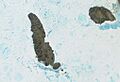
Lougheed Island and King Christian Island seen from space.

See also
 In Spanish: Isla Lougheed para niños
