Luzerne Township, Pennsylvania facts for kids
Quick facts for kids
Luzerne Township
|
|
|---|---|
|
Township
|
|

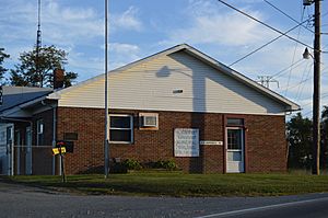
Township municipal building
|
|

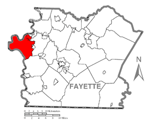
Location of Luzerne Township in Fayette County
|
|

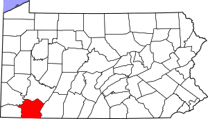
Location of Fayette County in Pennsylvania
|
|
| Country | United States |
| State | Pennsylvania |
| County | Fayette |
| Area | |
| • Total | 30.74 sq mi (79.61 km2) |
| • Land | 29.53 sq mi (76.49 km2) |
| • Water | 1.21 sq mi (3.12 km2) |
| Population
(2020)
|
|
| • Total | 5,685 |
| • Estimate
(2022)
|
5,365 |
| • Density | 199.13/sq mi (76.89/km2) |
| Time zone | UTC-4 (EST) |
| • Summer (DST) | UTC-5 (EDT) |
| Area code(s) | 724 |
Luzerne Township is a community located in Fayette County, Pennsylvania, in the United States. It is a type of local government area called a township. In 2020, about 5,585 people lived here. This was a bit less than the 5,965 people counted in 2010.
Several smaller communities are part of Luzerne Township. These include:
- East Millsboro
- La Belle
- Hiller
- Isabella
- Luzerne
- Dutch Hill
- Maxwell
- Allison
- Alicia
- East Fredericktown
- Penncraft
Some of these places, like La Belle and East Fredericktown, share the same postal code because they are served by the La Belle post office. The SCI Fayette, which is a state prison, is also located near East Fredericktown.
Contents
A Look Back in Time
Luzerne Township has some interesting historical places. Two of these, the Penn-Craft Historic District and the Brown-Moore Blacksmith Shop, are special enough to be listed on the National Register of Historic Places. This means they are important parts of history that are protected.
Where is Luzerne Township?
Luzerne Township is on the western side of Fayette County. It shares a border on its west side with the Monongahela River. This river also forms the border with Greene and Washington counties. The westernmost point of Fayette County is actually in Luzerne Township, along the Monongahela River.
Dunlap Creek forms the eastern border of the township. This creek flows north and eventually joins the Monongahela River near Brownsville. Brownsville is located just northeast of Luzerne Township.
Size of the Township
According to the United States Census Bureau, Luzerne Township covers a total area of about 79.6 square kilometers (or 30.7 square miles). Most of this area, about 76.5 square kilometers (29.5 square miles), is land. The rest, about 3.1 square kilometers (1.2 square miles), is water.
Travel and Roads
The Mon–Fayette Expressway runs through the northern part of Luzerne Township. You can get onto this expressway from Exit 26, which is located south of Hiller.
Who Lives in Luzerne Township?
| Historical population | |||
|---|---|---|---|
| Census | Pop. | %± | |
| 2010 | 5,965 | — | |
| 2020 | 5,585 | −6.4% | |
| 2022 (est.) | 5,365 | −10.1% | |
| U.S. Decennial Census | |||
In 2010, there were 5,956 people living in Luzerne Township. These people lived in about 1,726 households, and 1,163 of these were families.
In 2000, there were 4,683 people. There were 1,897 households, and 1,341 of these were families. About 26.2% of households had children under 18 living with them. Many households, 53.8%, were married couples living together.
See also
 In Spanish: Municipio de Luzerne para niños
 | Laphonza Butler |
 | Daisy Bates |
 | Elizabeth Piper Ensley |

