Lyons River facts for kids
Quick facts for kids Lyons |
|
|---|---|

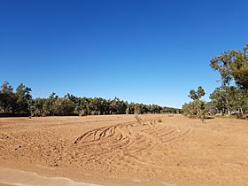
The Lyons River at Ullawarra Road crossing
|
|
| Other name(s) | Malgaru: Mithering |
| Country | Australia |
| State | Western Australia |
| Region | Gascoyne |
| Physical characteristics | |
| Main source | Teano Range below Staten Hill 535 m (1,755 ft) 24°26′42″S 117°35′55″E / 24.44500°S 117.59861°E |
| River mouth | confluence with the Gascoyne River Jimba Jimba 137 m (449 ft) 25°2′31″S 115°4′37″E / 25.04194°S 115.07694°E |
| Length | 561 km (349 mi) |
| Basin features | |
| River system | Gascoyne River catchment |
| Tributaries |
|
| National park | Kennedy Range National Park |
The Lyons River is an important river in the Gascoyne region of Western Australia. It flows through a dry, beautiful part of the country. The river is a key part of the Gascoyne River system, which is one of the largest in Western Australia.
Contents
River's Journey: Where It Starts and Flows
The Lyons River begins in the Teano Range, a mountain area. This starting point is called its headwaters. It starts just west of a place called Staten Hill. From there, the river flows mostly towards the south-west.
Joining Other Waterways
As the Lyons River travels, it collects water from many smaller streams. These smaller streams are called tributaries. The Lyons River has 36 tributaries that join it. Some of the main ones include the Edmund River and the Frederick River. Other important ones are Onslow Creek, Gifford Creek, Koorabooka Creek, and Ulura Creek.
Reaching the Gascoyne River
The Lyons River's journey ends when it meets the Gascoyne River. This meeting point is called a confluence. It happens near the town of Gascoyne Junction. This area is also close to the southern part of the Kennedy Range National Park. Over its 561-kilometre (349-mile) journey, the river drops about 398 metres (1,306 feet) in height.
Special Water Pools
Even though the area can be dry, the Lyons River has some special spots. There are several permanent pools of water along its path. These pools always have water, even when other parts of the river might dry up. Some of these cool pools include Cattle Pool, Windarrie Pool, and Bubbawonnara Pool. They are important for local wildlife.
History and Naming
The Lyons River has a long history, especially for the people who have lived there for thousands of years.
Indigenous Name: Mithering
The local Aboriginal people, the Malgaru, have their own name for the river. They call it Mithering. This name has been used for a very long time and is part of their culture and stories about the land.
European Naming
The first European person to see the river was an explorer named Francis Thomas Gregory. He came across it in 1858. Gregory decided to name the river after a famous naval hero, Admiral Sir Edmund Lyons. This is how the river got its current name, the Lyons River.
See also
 | Delilah Pierce |
 | Gordon Parks |
 | Augusta Savage |
 | Charles Ethan Porter |

