
M26 motorway facts for kids
Quick facts for kids
|
||||
|---|---|---|---|---|
| Lua error in Module:Infobox_road/map at line 15: attempt to index field 'wikibase' (a nil value). | ||||

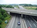
The M26 as it joins the M25. The A21 is crossing above on the bridge.
|
||||
| Route information | ||||
| Length | 9.9 mi (15.9 km) | |||
| Existed | 1980–present | |||
| Major junctions | ||||
| West end | Chevening | |||
M25 motorway Junction 5 M20 motorway Junction 3 |
||||
| East end | Addington | |||
| Location | ||||
| Primary destinations: |
Sevenoaks | |||
| Road network | ||||
|
||||

The M26 is a short but important motorway located in Kent, England. It acts as a connector between two much larger motorways: the M25 and the M20. This road helps traffic moving clockwise on the M25 to easily switch to the M20, especially near the town of Sevenoaks. It is about 16 kilometers (10 miles) long.
Contents
M26 Motorway: A Key Link in Kent
The M26 motorway plays a vital role in connecting major roads in the southeast of England. It helps drivers travel smoothly between different parts of the country. Even though it's short, it's a very busy road.
What is the M26 Motorway For?
The main job of the M26 is to link the M25 and M20 motorways. Imagine it like a shortcut or a bridge between two big highways. This connection is especially useful for traffic heading towards the Channel Tunnel or the Dover ferry port from the M25. It helps reduce traffic jams on other local roads.
Where is the M26 Located?
The M26 is entirely within the county of Kent, which is in the southeast of England. It starts near Chevening, where it meets the M25 motorway at Junction 5. It then travels eastwards, ending near Addington, where it joins the M20 motorway at Junction 3.
When Was the M26 Built?
The M26 motorway was opened in 1980. It was built to improve the road network around London and Kent. Its creation helped to complete a major part of the motorway system in the area. This made it easier for people and goods to travel across the region.
Key Connections of the M26
The M26 has two main connections:
- M25 Motorway: At its western end, the M26 connects to Junction 5 of the M25. The M25 is a very famous motorway that circles around London.
- M20 Motorway: At its eastern end, the M26 joins Junction 3 of the M20. The M20 is a major route that goes from London towards the Channel Tunnel and Dover.
The M26 also has a connection to the A20 near Wrotham. This allows traffic to join or leave the motorway at this point.
|- |colspan=5 align=center bgcolor="#f2f2f2"|1.000 mi = 1.609 km; 1.000 km = 0.621 mi
Images for kids
-
M26 looking east at junction 5. The A21 from Sevenoaks is crossing on the bridge in the foreground.
-
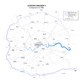
Map of Ringway 4 showing M26 as part of a single route with the M25

