Macomb, Oklahoma facts for kids
Quick facts for kids
Macomb, Oklahoma
|
|
|---|---|
| Nickname(s):
"Queen City of South Pottawatomie County"
|
|

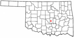
Location of Macomb, Oklahoma
|
|
| Country | United States |
| State | Oklahoma |
| County | Pottawatomie |
| Area | |
| • Total | 0.09 sq mi (0.23 km2) |
| • Land | 0.09 sq mi (0.23 km2) |
| • Water | 0.00 sq mi (0.00 km2) |
| Elevation | 991 ft (302 m) |
| Population
(2020)
|
|
| • Total | 22 |
| • Density | 247.19/sq mi (95.09/km2) |
| Time zone | UTC-6 (Central (CST)) |
| • Summer (DST) | UTC-5 (CDT) |
| ZIP code |
74852
|
| Area code(s) | 405/572 |
| FIPS code | 40-45500 |
| GNIS feature ID | 2412932 |
Macomb is a small town located in Pottawatomie County, Oklahoma, in the United States. It is known for its quiet community. In 2020, only 22 people lived here. This makes Macomb one of the smaller towns in Oklahoma. The town was once called the "Queen City of South Pottawatomie County."
Contents
History of Macomb, Oklahoma
The story of Macomb began with a community called Burnett. This community was located on land owned by a person named Burnett. When the Atchison, Topeka and Santa Fe Railway built a new railway line, people from Burnett decided to move. They moved closer to the railway, and this new spot became the town of Macomb.
A post office opened here on May 29, 1903. It was first spelled "McComb." The town and post office were named after a Santa Fe railway engineer named Macomb. On July 16, 1915, the spelling was changed to "Macomb" to match his name correctly.
Population Changes Over Time
By the end of 1904, the local newspaper, McComb Herald, said the town had 350 people. It even gave Macomb the nickname "Queen City of South Pottawatomie County." However, the official census in 1910 counted only 166 residents.
The population grew to 281 by 1920. But then, tough times hit the area. A long period without rain caused cotton crops to fail. Many people depended on farming, so they had to move away. By 1930, only 197 people lived in Macomb. The population continued to drop, reaching 123 in 1950 and 61 by the year 2000. In 2010, it was 32, and in 2020, it was 22.
Geography and Location
Macomb is located about 10 miles (16 km) southwest of Tecumseh. You can find it along State Highway 59B.
Area of the Town
According to the United States Census Bureau, the town covers a total area of 0.1 square miles (0.23 square kilometers). All of this area is land, meaning there are no large bodies of water within the town limits.
Population Data
| Historical population | |||
|---|---|---|---|
| Census | Pop. | %± | |
| 1910 | 166 | — | |
| 1920 | 281 | 69.3% | |
| 1930 | 197 | −29.9% | |
| 1940 | 201 | 2.0% | |
| 1950 | 123 | −38.8% | |
| 1960 | 76 | −38.2% | |
| 1970 | 41 | −46.1% | |
| 1980 | 58 | 41.5% | |
| 1990 | 64 | 10.3% | |
| 2000 | 61 | −4.7% | |
| 2010 | 32 | −47.5% | |
| 2020 | 22 | −31.2% | |
| U.S. Decennial Census | |||
In the year 2000, there were 61 people living in Macomb. These people lived in 26 households, and 20 of these were families. The town had about 610 people per square mile.
The average household in Macomb had about 3 people. The average family had slightly more than 3 people. In 2000, about 31% of the population was under 18 years old. About 11.5% of the residents were 65 years or older. The average age of people in Macomb was 31 years old.
Education in Macomb
Students living in Macomb attend schools that are part of the Macomb Public Schools district.
See also
 In Spanish: Macomb (Oklahoma) para niños
 | Emma Amos |
 | Edward Mitchell Bannister |
 | Larry D. Alexander |
 | Ernie Barnes |


