Maggoty Gap facts for kids
Quick facts for kids Maggoty Gap |
|
|---|---|
| Elevation | 1,125 ft (343 m) |
| Traversed by | State Road 677 – Willow Branch Road |
| Location | Roanoke county, Virginia, United States |
| Range | Blue Ridge Mountains |
| Coordinates | 37°09′22″N 79°58′19″W / 37.156°N 79.972°W |
Maggoty Gap is a special kind of low point in the Blue Ridge Mountains in Virginia. These low spots are called wind gaps because they are often formed by wind or water over a very long time. They make it easier to travel through mountains.
The exact spot called Maggoty Gap has changed over the years as roads were built and moved. Today, it is mapped in Roanoke County.
Contents
Exploring Maggoty Gap's Location
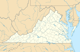
Maggoty Gap is found about 5 miles (8 km) south of the city of Roanoke, Virginia. It is also about 12 miles (19 km) north-northwest of Rocky Mount, Virginia. This spot is about 1,125 feet (343 meters) above sea level.
Even though the map shows Maggoty Gap at a certain spot, the main road, State Road 677, actually goes through it under a railroad bridge. This road leads to the true mountain ridge at a place called "Murray Gap." Murray Gap is where two different water areas, called watersheds, meet. One watershed is for Maggodee Creek, and the other is for Back Creek. This route connects the towns of Starkey, Virginia and Boone's Mill, Virginia. Another way to cross the mountains nearby is using State Road 613, which goes through "Simmonds Gap."
Maggoty Gap's Amazing History
Maggoty Gap was once a super important natural path for a famous road called the Great Wagon Road. People in the area also knew it as The Carolina Road. This road helped wagons and farm animals travel through the Blue Ridge Mountains near Maggodee Creek.
From the late 1700s through much of the 1800s, huge amounts of traffic used this road. It was one of the busiest roads in all of America between 1760 and 1776! People used it until a railroad was built over the mountains in 1892.
Early Travelers and Challenges
In 1746, a man named Morgan Bryan, who was 78 years old, was the first to cut a path for a wagon to cross the gap. He traveled from Starkey, Virginia to Boone's Mill, Virginia. He even had to take his wagon apart and carry it piece by piece up the last hill! It took him and his sons about three months to travel only 80 miles (129 km) to their destination in North Carolina.
Later, in 1753, a group of 15 Moravians tried to use Bryan's road. They were going to a place called Wachovia Tract, which is now Winston-Salem. But they took a wrong turn and missed Maggoty Gap. Instead, they had a very hard time going over a nearby spot called Windy Gap. Eventually, they rejoined Bryan's road at Boone's Mill.
Improving the Road
In 1838, an engineer named Claudius Crozet surveyed the road to make it better. He planned for it to become a turnpike, which was a type of improved dirt road. This new road, called the Pittsylvania, Franklin, and Botetourt Turnpike, was designed to have gentle slopes and be at least 18 feet (5.5 meters) wide.
Crozet's notes showed Maggoty Creek winding around. He also showed the road going up to the "top of the Blue Ridge" at what is now Simmonds Gap, which he called "Maggoty Gap." The turnpike was built soon after, following the route over Simmonds Gap. This route later became State Road 613. However, the turnpike got damaged during the Civil War and was no longer used after 1865.
Maggoty Gap lost its importance for travel when a new, paved highway, US-220, was finished around 1930. This new road went directly from Roanoke through Murray Gap to Rocky Mount, Virginia.
 | Audre Lorde |
 | John Berry Meachum |
 | Ferdinand Lee Barnett |


