Magnolia, Minnesota facts for kids
Quick facts for kids
Magnolia
|
|
|---|---|

Buildings in Magnolia
|
|

Location of Magnolia, Minnesota
|
|
| Country | United States |
| State | Minnesota |
| County | Rock |
| Government | |
| • Type | Mayor - Council |
| Area | |
| • Total | 0.80 sq mi (2.07 km2) |
| • Land | 0.80 sq mi (2.07 km2) |
| • Water | 0.00 sq mi (0.00 km2) |
| Elevation | 1,529 ft (466 m) |
| Population
(2020)
|
|
| • Total | 196 |
| • Density | 245.61/sq mi (94.83/km2) |
| Time zone | UTC-6 (Central (CST)) |
| • Summer (DST) | UTC-5 (CDT) |
| ZIP code |
56158
|
| Area code(s) | 507 |
| FIPS code | 27-39338 |
| GNIS feature ID | 0647376 |
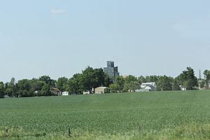
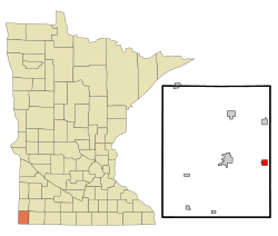
Magnolia is a small and friendly town located in Rock County, Minnesota, in the United States. It's a quiet place where people know their neighbors. According to the 2020 census, about 196 people live in Magnolia. The town covers an area of about 2.07 square kilometers (0.80 square miles), and all of it is land.
Contents
History of Magnolia
Magnolia got its name from Magnolia Township, which is the larger area it's part of. The town has been around for a while, with its first post office opening in 1886.
The town was officially planned out, or platted, in 1891. This means its streets and building lots were mapped out. A few years later, in 1894, Magnolia became an official incorporated town. This means it gained its own local government and could make its own rules.
People of Magnolia
The number of people living in Magnolia has changed over the years. Here's a quick look at how the population has grown and shrunk:
| Historical population | |||
|---|---|---|---|
| Census | Pop. | %± | |
| 1900 | 176 | — | |
| 1910 | 189 | 7.4% | |
| 1920 | 219 | 15.9% | |
| 1930 | 240 | 9.6% | |
| 1940 | 273 | 13.8% | |
| 1950 | 260 | −4.8% | |
| 1960 | 280 | 7.7% | |
| 1970 | 233 | −16.8% | |
| 1980 | 234 | 0.4% | |
| 1990 | 155 | −33.8% | |
| 2000 | 221 | 42.6% | |
| 2010 | 222 | 0.5% | |
| 2020 | 196 | −11.7% | |
| U.S. Decennial Census | |||
Magnolia's Population in 2010
In 2010, there were 222 people living in Magnolia. These people lived in 77 different homes, and 56 of those were families. The town had about 285 people per square mile, which is called the population density.
Most of the people in Magnolia were White (81.5%). There were also smaller groups of African American, Native American, and Asian residents. About 2.3% of the population identified as Hispanic or Latino.
Households and Families
Out of the 77 homes in Magnolia, about 30% had children under 18 living there. More than half of the homes (57.1%) were married couples living together. Some homes had a single parent, either a mom (11.7%) or a dad (3.9%). About 27% of homes were individuals living alone or with roommates who weren't family.
The average number of people in a home was about 2.49. For families, the average size was a bit larger, around 2.93 people.
Age of Residents
The average age of people in Magnolia in 2010 was 33 years old.
- About 30% of the residents were under 18 years old.
- Around 10.5% were young adults, aged 18 to 24.
- About 22% were between 25 and 44 years old.
- Roughly 26% were aged 45 to 64.
- About 11% of the population was 65 years old or older.
When it came to gender, 58.6% of the residents were male, and 41.4% were female.
See also
 In Spanish: Magnolia (Minnesota) para niños
 | Emma Amos |
 | Edward Mitchell Bannister |
 | Larry D. Alexander |
 | Ernie Barnes |

