Maiquetía facts for kids
Quick facts for kids
Maiquetía
|
|
|---|---|
 |
|
| Country | |
| State | Vargas |
| Municipality | Vargas Municipality |
| Founded | 20 January 1670 |
| Elevation | 19 m (62 ft) |
| Population
(2007)
|
|
| • Total | 87,909 |
| • Demonym | Maiquetiense |
| Time zone | UTC-04:00 (VST) |
| Postal code |
1160, 1161
|
| Area code(s) | 0212 |
| Climate | BSh |
| Website | Municipal website |
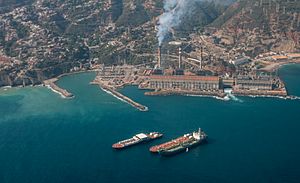
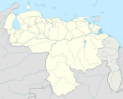
Maiquetía is a city in the Central Region of Venezuela. It is part of the Vargas state. The city is about 19 meters (62 feet) above sea level. It sits on a small piece of land between the Caribbean Sea and the mountains. Caracas, the capital of Venezuela, is about 37 kilometers (23 miles) to the southeast.
Maiquetía is a busy place for business and shopping. Its old town has many narrow streets. These streets are full of stores and a market where people can buy things. The main road in this area is called Avenida Carlos Soublette.
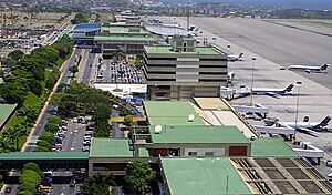
The Simón Bolívar International Airport is very important for Venezuela. It serves Caracas and is the country's main airport. Even though the airport is now in Vargas state, it is still often called Maiquetía Airport. This can sometimes confuse people who live there and visitors. Conviasa, Venezuela's national airline, has its main office in Maiquetía.
Maiquetía is very close to La Guaira. The two cities are connected by Avenida Soublette. Because Maiquetía is near Caracas and the sea, it is a good spot for hotels.
In 1999, Maiquetía was hit by very heavy rains and mudslides. These events caused a lot of damage to the city.
Climate in Maiquetía
Maiquetía has a tropical savannah climate. This means it has hot and humid days all year round. The nights are usually warm.
| Climate data for Maiquetía, Venezuela (Simón Bolívar International Airport) (1991-2020 normals, extremes 1961-2020) | |||||||||||||
|---|---|---|---|---|---|---|---|---|---|---|---|---|---|
| Month | Jan | Feb | Mar | Apr | May | Jun | Jul | Aug | Sep | Oct | Nov | Dec | Year |
| Record high °C (°F) | 33.3 (91.9) |
34.1 (93.4) |
34.4 (93.9) |
41.7 (107.1) |
36.4 (97.5) |
35.6 (96.1) |
35.3 (95.5) |
36.6 (97.9) |
36.9 (98.4) |
35.1 (95.2) |
38.4 (101.1) |
39.7 (103.5) |
41.7 (107.1) |
| Mean daily maximum °C (°F) | 30.4 (86.7) |
30.4 (86.7) |
30.5 (86.9) |
32.0 (89.6) |
32.4 (90.3) |
32.1 (89.8) |
31.9 (89.4) |
32.4 (90.3) |
32.7 (90.9) |
32.2 (90.0) |
31.9 (89.4) |
30.9 (87.6) |
31.6 (88.9) |
| Daily mean °C (°F) | 25.5 (77.9) |
25.5 (77.9) |
26.1 (79.0) |
27.3 (81.1) |
28.0 (82.4) |
27.7 (81.9) |
27.4 (81.3) |
27.9 (82.2) |
28.2 (82.8) |
27.9 (82.2) |
27.4 (81.3) |
26.2 (79.2) |
27.1 (80.8) |
| Mean daily minimum °C (°F) | 22.5 (72.5) |
22.4 (72.3) |
23.0 (73.4) |
24.3 (75.7) |
25.2 (77.4) |
25.1 (77.2) |
24.8 (76.6) |
25.3 (77.5) |
25.7 (78.3) |
25.5 (77.9) |
24.9 (76.8) |
23.5 (74.3) |
24.4 (75.9) |
| Record low °C (°F) | 15.4 (59.7) |
17.9 (64.2) |
18.7 (65.7) |
18.8 (65.8) |
20.6 (69.1) |
19.6 (67.3) |
19.3 (66.7) |
19.5 (67.1) |
19.1 (66.4) |
21.0 (69.8) |
20.8 (69.4) |
19.5 (67.1) |
15.4 (59.7) |
| Average precipitation mm (inches) | 56.7 (2.23) |
50.2 (1.98) |
18.9 (0.74) |
35.2 (1.39) |
44.6 (1.76) |
62.2 (2.45) |
79.2 (3.12) |
95.8 (3.77) |
90.0 (3.54) |
101.5 (4.00) |
107.2 (4.22) |
108.6 (4.28) |
850.1 (33.47) |
| Average precipitation days (≥ 1.0 mm) | 4.0 | 2.7 | 1.6 | 3.5 | 4.6 | 6.6 | 8.2 | 9.0 | 7.7 | 8.1 | 7.0 | 6.6 | 69.6 |
| Average relative humidity (%) | 82 | 81 | 81 | 83 | 84 | 83 | 83 | 82 | 81 | 82 | 82 | 83 | 82 |
| Mean monthly sunshine hours | 232.5 | 218.4 | 241.8 | 183.0 | 201.5 | 207.0 | 241.8 | 244.9 | 228.0 | 207.7 | 195.0 | 210.8 | 2,612.4 |
| Mean daily sunshine hours | 7.5 | 7.8 | 7.8 | 6.1 | 6.5 | 6.9 | 7.8 | 7.9 | 7.6 | 6.7 | 6.5 | 6.8 | 7.2 |
| Source: NOAA (humidity and sun 1961–1990) | |||||||||||||
Sports in Maiquetía
Maiquetía is home to a basketball team called Bucaneros de La Guaira. This team plays its home games at a sports center known as the Polideportivo José María Vargas.
See also
 In Spanish: Maiquetía para niños


