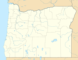
Malheur Reservoir facts for kids
Quick facts for kids Malheur Reservoir |
|
|---|---|
| Location | Malheur, Oregon, United States |
| Coordinates | 44°21′54″N 117°41′54″W / 44.3649749°N 117.6984041°W |
| Type | Lake |
| River sources | Willow Creek |
| Surface area | 1,282 acres (519 ha) |
| Average depth | 38 ft (12 m) |
| Surface elevation | 3,365 ft (1,026 m) |
Malheur Reservoir is a special lake in Malheur County, Oregon, in the United States. It was built to help farmers water their crops. This lake gets its water from Willow Creek.
The reservoir was created in the 1930s by the Orchard Irrigation District. It covers about 1,282-acre (5.19 km2) of land. This large lake can hold around 49,000 acre-feet (60,000,000 m3) of water. This water is very important for watering about 2,300 acres (930 ha) of farmland nearby.
Contents
What is Malheur Reservoir?
Malheur Reservoir is an irrigation lake. This means it was built to store water for farming. The water helps crops grow in dry areas. The lake is in a semi-arid area, which means it doesn't get much rain.
The land around the lake is mostly rangeland. This is open land where animals can graze. Because of the type of land, the lake naturally gets many nutrients. This makes it eutrophic, meaning it has a lot of plant life, like algae.
Public Access and Activities
Most of the land around Malheur Reservoir is privately owned. However, the lake itself and some parts of its shore are open for everyone to use. This means you can visit and enjoy the lake.
Fishing at the Lake
Since the 1960s, rainbow trout have been put into the reservoir. This makes it a popular spot for fishing. How good the fishing is can change. Sometimes, if there isn't much rain, the lake can even dry up.
But when there is plenty of rain, the lake is full. During these wet times, you can catch very large trout. Some of these fish can be longer than 20 inches (51 cm)!
How to Get There
You can reach Malheur Reservoir by driving on a dirt road. One way to get there is from U.S. Route 26. This road is about 15 miles (24 km) southwest of the lake, near a town called Ironside.
Another way is from a different spot on Route 26. This one is about 15 miles (24 km) southeast, near Brogan.
Facilities at the Lake
The lake has a special place for boats. There is a boat ramp on the north side of the lake. This makes it easy to launch your boat. You can also go camping in a few spots near the boat ramp.
The Malheur County Parks Department helps take care of the lake. They maintain the boat ramp, a gravel parking area, and a restroom for visitors.
 | Bessie Coleman |
 | Spann Watson |
 | Jill E. Brown |
 | Sherman W. White |


