
Manipur facts for kids
.svg)
Manipur is a beautiful state located in the northeastern part of Republic of India. It covers an area of about 22,347 square kilometers (8,628 square miles). Manipur is known for its green hills, valleys, and rich culture.
The state shares its borders with other Indian states: Nagaland to the north, Mizoram to the south, and Assam to the west. To its east, Manipur shares a border with the country of Myanmar.
A Glimpse into Manipur's Past
Manipur has a very long and interesting history, with many kings ruling from the main throne of Kangla. The stories of these kings are written down in a special book called "Cheitharol Kumbaba".
The Cheitharol Kumbaba Chronicle
The Cheitharol Kumbaba is like a diary kept by the royal court of Manipur's kings. It tells the history of the Kingdom of Manipur from when its first ruling family started in 33 CE. This ancient book continues all the way until 1949, when the kingdom joined India and the monarchy ended. It finishes with the last king of Manipur, Bodhchandra.
The Cheitharol Kumbaba is probably the oldest historical record from this region. It is written on more than 1,000 pages of special Meetei paper, using an old script called Meetei Mayek. This chronicle helps us understand the long and proud history of Manipur.
Images for kids
-
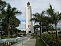
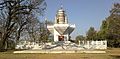
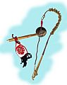
The Kangla Sha, the state emblem
-
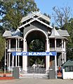
Kangla Gate, the west entrance to the Kangla Fort
-

Loktak Lake, the largest fresh water lake in the state.
-
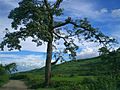
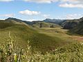
A tree amid Manipur hills.
-
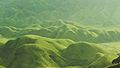
Landscape view for dawn at Senapati, Manipur
-
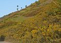
Flowers carpeting the foothills
-
The Dzüko Valley which exists between the boundaries of Manipur and Nagaland has a temperate climate.
-
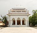
Ningthoukhong Gopinath Temple
-
St. Joseph's Cathedral at Imphal
-
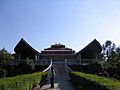
A reconstructed ancient temple dedicated to Meitei God Pakhangba of Sanamahism inside the Kangla Fort, Imphal
-

Bamboo is common in Manipur, and an important contributor to its economy as well as cuisine. Above is soibum yendem eromba, a bamboo shoot dish of Manipur.
-
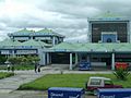
Imphal airport is the second largest airport in India's northeast.
-
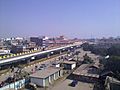
A view of Imphal City
-
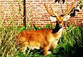
Sangai, the state animal, at Keibul Lamjao National Park. In the wild, it has a habit of waiting and looking back at viewers.
-
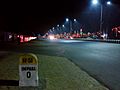
National Highway 150 in Imphal
-
The Shrine – the main theatre
-

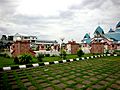
Khuman Lampak Main Stadium in Imphal.
-
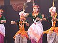
The Lai Haraoba, a dance festival showcases the folk dances of Manipur.
-
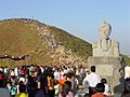
Cheiraoba is a celebration of the new year during the spring season. People feast (top), then climb up a hill together later in the day to signify overcoming hurdles and reaching new heights in the new year.
-
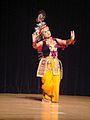
Manipuri dance, one of eight the classical dances of India
-

Thang Ta, the martial art form of Manipur
-
Pena is an ancient Manipur musical instrument, particularly popular among the Meitei, the Pangal and the Meitei Christians
-
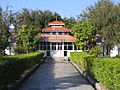
The Chorus Repertory Theatre, Imphal, founded by Ratan Thiyam


.jpg)


.jpeg)


See also
 In Spanish: Manipur para niños
