
Mizoram facts for kids
.svg)

Mizoram is a state in the country of India. It is located in the eastern part of India, near Bangladesh. The state covers an area of about 8,139 square miles (21,079 square kilometers). To give you an idea, it's a bit smaller than the country of Israel. Mizoram is part of the Northeast India region.
The name "Mizoram" means "land of the Mizo people." It is one of the "Seven Sister States" in Northeast India. These states are grouped together because they are in the same region. Mizoram shares its borders with the Indian states of Tripura, Assam, and Manipur. It also shares borders with the neighboring countries of Bangladesh and Myanmar. Mizoram became the 23rd state of India on February 20, 1987. The capital city of Mizoram is Aizawl.
Symbols of Mizoram
Every state has special symbols that represent it. These often include a bird, an animal, a tree, and a flower. Here are the official symbols for Mizoram:
-

The state bird of Mizoram
-
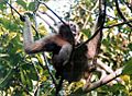
The state animal of Mizoram
-
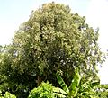
The state tree of Mizoram


Images for kids
-
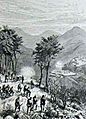
A sketch from 1889 showing a battle between British troops and a Lusei clan in Mizoram.
-
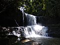
Tuirihiau Falls, a beautiful waterfall.
-
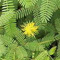
Neptunia oleracea, a type of plant.
-
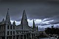
Solomon's Temple, Aizawl, a famous building in Aizawl.
-
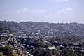
Aizawl, the capital city of Mizoram, built on a ridge.
-

A paddy field in Zawlpui, Serchhip. Paddy fields are where rice is grown.
-
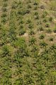
Oil palm trees growing in Mamit.
-
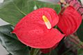
Mizoram grows a lot of Anthurium flowers (shown here). Most of the people who grow these flowers and earn money from them are women in Mizoram.
-
A school campus in Mizoram.
-
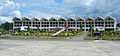
The building of Lengpui Airport.
-

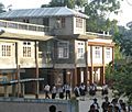
Aizawl Theological College.
-
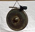
Darkhuang, Zamluang, or jamluang – a traditional musical instrument from Mizoram. Other instruments include the khuang (drum) and dar (cymbals).
-
A traditional dance from Mizoram.
-
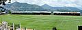
Lammual Stadium.
-
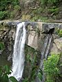
Kawpi Waterfall.


See also
 In Spanish: Mizoram para niños
