Mantachie, Mississippi facts for kids
Quick facts for kids
Mantachie, Mississippi
|
|
|---|---|

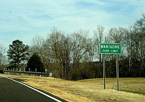
Corporate limits on SR 371
|
|

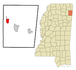
Location of Mantachie, Mississippi
|
|
| Country | United States |
| State | Mississippi |
| County | Itawamba |
| Area | |
| • Total | 4.32 sq mi (11.18 km2) |
| • Land | 4.30 sq mi (11.15 km2) |
| • Water | 0.01 sq mi (0.03 km2) |
| Elevation | 318 ft (97 m) |
| Population
(2020)
|
|
| • Total | 1,121 |
| • Density | 260.46/sq mi (100.57/km2) |
| Time zone | UTC-6 (Central (CST)) |
| • Summer (DST) | UTC-5 (CDT) |
| ZIP code |
38855
|
| Area code(s) | 662 |
| FIPS code | 28-44920 |
| GNIS feature ID | 2406090 |
Mantachie is a small town in Itawamba County, Mississippi, United States. In 2020, about 1,121 people lived there. It is located about 14 miles (23 km) northeast of Tupelo. You can find it where Mississippi Highways 363 and 371 meet. It is also about 5 miles (8 km) north of Interstate 22.
Contents
History of Mantachie
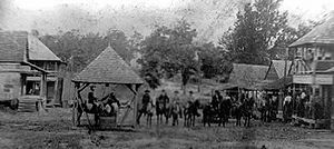
The town of Mantachie started as a simple store at a crossroads. This store was owned by a person named Woods Pearce. Not far from Mantachie, on an old road called Jacinto Road, was the largest village of the Chickasaw people in that part of the state.
Mantachie got its name from one of the Chickasaw chiefs, whose name was Man-ta-chee. Most of the Chickasaw people moved away from this village after a special agreement called the Treaty of Pontotoc Creek was signed in 1832.
Geography of Mantachie
Mantachie is located in the western part of Itawamba County. A stream called Mantachie Creek flows south past the western side of the town. This creek eventually flows into the Tombigbee River.
The town covers a total area of about 4.32 square miles (11.18 square kilometers). Only a very small part of this area, about 0.01 square miles (0.03 square kilometers), is water.
Population and People
| Historical population | |||
|---|---|---|---|
| Census | Pop. | %± | |
| 1910 | 161 | — | |
| 1920 | 195 | 21.1% | |
| 1930 | 188 | −3.6% | |
| 1940 | 238 | 26.6% | |
| 1950 | 178 | −25.2% | |
| 1960 | 246 | 38.2% | |
| 1970 | 534 | 117.1% | |
| 1980 | 732 | 37.1% | |
| 1990 | 651 | −11.1% | |
| 2000 | 1,107 | 70.0% | |
| 2010 | 1,144 | 3.3% | |
| 2020 | 1,121 | −2.0% | |
| U.S. Decennial Census | |||
Mantachie in 2020
In 2020, the town of Mantachie had 1,121 people living there. There were 652 households and 345 families. Most of the people living in Mantachie were White (about 95%). A smaller number were Black or African American (about 1.7%), and other groups made up the rest.
Mantachie in 2010
Back in 2010, there were 1,144 people living in Mantachie. There were 511 households and 319 families. The population density was about 290 people per square mile (112 people per square kilometer).
Most of the people were White (96.6%), with a smaller number of African Americans (2.2%). About 24.5% of the people were under 18 years old. The average age of people in Mantachie was 40.8 years.
Education in Mantachie
The schools in Mantachie are part of the Itawamba County School District.
- Mantachie Elementary School teaches students from kindergarten through 6th grade.
- Mantachie Junior High teaches 7th and 8th graders.
- Mantachie High School is for students in 9th through 12th grades.
The Mississippi Department of Education has given the Mantachie Schools a "B" rating.
School Sports and Teams
The sports teams at Mantachie Schools are called the Mustangs. Their logo looks similar to the mascot of the SMU Mustangs. The school colors are royal blue and gold.
The Mustangs have many different sports teams, including:
- Football
- Cross country
- Slow pitch and fast pitch softball
- Basketball
- Baseball
- Track
- Bowling
- Archery (their archery team won state championships from 2014 to 2017!)
Notable People from Mantachie
Some well-known people have come from Mantachie:
- Randy Boyd: He is a member of the Mississippi House of Representatives, which is where laws are made for the state of Mississippi.
- Jerry Wilburn: He was also a member of the Mississippi House of Representatives for many years, from 1964 to 1980.
See also
 In Spanish: Mantachie para niños
 | Bessie Coleman |
 | Spann Watson |
 | Jill E. Brown |
 | Sherman W. White |


