Manzanillo District facts for kids
Quick facts for kids
Manzanillo
|
|
|---|---|
|
District
|
|
| Country | |
| Province | Puntarenas |
| Canton | Puntarenas |
| Area | |
| • Total | 60.31 km2 (23.29 sq mi) |
| Elevation | 12 m (39 ft) |
| Population
(2011)
|
|
| • Total | 2,811 |
| • Density | 46.609/km2 (120.717/sq mi) |
| Time zone | UTC−06:00 |
| Postal code |
60106
|
Manzanillo is a small but important district located in the Puntarenas canton. It is part of the Puntarenas province in the beautiful country of Costa Rica. This area is known for its natural beauty and local communities.
Contents
Exploring Manzanillo's Location
Manzanillo covers an area of about 60.31 square kilometers (23.3 square miles). It sits at an elevation of 12 meters (about 39 feet) above sea level. This means it's quite close to the coast, which often influences its climate and natural surroundings.
Who Lives in Manzanillo?
| Historical population | |||
|---|---|---|---|
| Census | Pop. | %± | |
| 1927 | 661 | — | |
| 1950 | 1,195 | 80.8% | |
| 1963 | 1,662 | 39.1% | |
| 1973 | 2,163 | 30.1% | |
| 1984 | 2,868 | 32.6% | |
| 2000 | 3,192 | 11.3% | |
| 2011 | 2,811 | −11.9% | |
|
Instituto Nacional de Estadística y Censos |
|||
According to the 2011 census, Manzanillo had a population of 2,811 people. This shows it's a relatively small community. Over the years, the population has changed, growing and shrinking at different times.
Getting Around Manzanillo
Road Connections
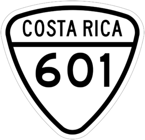
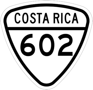
Traveling to and from Manzanillo is mainly done by road. The district is connected by specific road routes that help people move around. These routes are important for daily life and for visitors exploring the area.
- National Route 601
- National Route 602
See also
 In Spanish: Manzanillo de Puntarenas para niños


