Manzini facts for kids
Quick facts for kids
Manzini
|
|
|---|---|
|
City
|
|
 |
|
| Country | |
| Region | Manzini Region |
| Population
(2008)
|
|
| • Total | 78,000 |
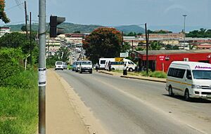
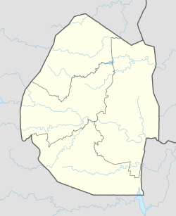
Manzini is a big city in Eswatini. It used to be called Bremersdorp. Manzini is the main city of the Manzini Region in Eswatini.
It is the second largest city in the country. Only the capital city, Mbabane, is bigger. About 110,000 people lived here in 2008. Manzini is known as "The Hub" of Eswatini. This is because it is a very important center for business and transport. The city is located on the MR3 road. Eswatini's main industrial area, Matsapha, is very close to Manzini.
Contents
History of Manzini
Manzini started as a trading post in 1885. A trading post is a place where people can buy and sell goods. In 1898, it became a township. A township is a small town. Arthur Bremer sold his hotel to the British. The British were in charge of Eswatini at that time. They made Bremersdorp their main administrative center. The name Bremersdorp came from Arthur Bremer. Dorp means "village" in Afrikaans.
In 1960, the town's name changed back to its original Swazi name, Manzini. This was to honor Chief Manzini Mbokane. He was a trusted leader and advisor to King Mbandzeni.
From 1890, the town was a British and Boer colonial headquarters. But it was destroyed in 1902 during the Second Boer War. After this, the main government offices moved to Mbabane. Even so, Bremersdorp stayed important for business, farming, and transport. This is why it got the nickname "The Hub."
Since the 1920s, the Swaziland International Trade Fair has been held here. It started as the Agricultural and Mechanical Show. This event is the biggest and most popular annual event in Eswatini.
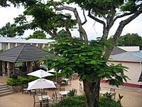
In 1915, a new hotel opened by the Mzimene River. It was called the Riverside Hotel. It stayed open until 1997, changing its name a few times. The buildings were taken down in 2008. A new shopping mall opened on that spot in 2011.
Matsapha International Airport opened in the 1970s. It was Eswatini's only commercial airport. It was about 10 kilometers west of Manzini. Matsapha Airport closed in 2014. Now, the new international airport is King Mswati III International Airport. It is about 57 kilometers east of Manzini. Manzini is the closest big city to this new airport.
Manzini officially became a city in 1994. Its local government changed from the Manzini Town Council to the Manzini City Council.
Manzini is also home to a Nazarene High School. This school is well-known for its successful choir.
Geography of Manzini
The city of Manzini has different types of neighborhoods. These areas spread out from the main business part of the city.
To the west, on the highway to Mbabane, is KaKhoza Township. This is a poorer area that looks like an informal settlement. An informal settlement is a place where homes are built without official planning.
North of the city center is Helemesi Estates. This area has middle-class homes built in the 1990s. The name Helemesi comes from the SiSwati way of saying "Williams." This area is surrounded by Fairview Township. Fairview was built in 1964. It was the first neighborhood in Eswatini where people of all backgrounds could live together. Before the 1960s, a old law stopped Swazi people from owning businesses in Bremersdorp.
Fairview Township became very popular. So, more homes were built north of a hill. On top of this hill are St. Paul's Methodist Church and School, and a water tower. The new area was called Fairview North. The original area became Fairview South.
Fancy neighborhoods were built east of the city center. Coates Valley was one of the first, built in the 1960s. North of Coates Valley is Extension 6, with mostly middle-class homes. Next to it is Madonsa Township, which has very nice, planned homes. These large homes were built from the 1990s until all the land was used up.
South of the city center is Ngwane Park Township. This is a large area with lower and middle-class homes. It was developed from a private farm starting in the 1970s. However, most areas around Manzini are rural. These are called Swazi Nation Land and are managed by local chiefs.
Manzini also has some very poor areas. These include informal settlements along the river, east of Coates Valley, and west between KaKhoza Township and the industrial town of Matsapha.
Transworld Radio Swaziland
There is a Christian radio station in Manzini called Voice of the Church. It started in 1995 with one transmitter.
Climate
Manzini has a humid subtropical climate. This means it has hot, rainy summers and mild, dry winters.
| Climate data for Manzini | |||||||||||||
|---|---|---|---|---|---|---|---|---|---|---|---|---|---|
| Month | Jan | Feb | Mar | Apr | May | Jun | Jul | Aug | Sep | Oct | Nov | Dec | Year |
| Mean daily maximum °C (°F) | 28.5 (83.3) |
28.1 (82.6) |
27.3 (81.1) |
25.8 (78.4) |
24.4 (75.9) |
22.4 (72.3) |
22.6 (72.7) |
23.9 (75.0) |
25.6 (78.1) |
25.7 (78.3) |
26.5 (79.7) |
28.2 (82.8) |
25.7 (78.4) |
| Mean daily minimum °C (°F) | 18.6 (65.5) |
18.6 (65.5) |
17.7 (63.9) |
15.1 (59.2) |
12.0 (53.6) |
8.9 (48.0) |
9.1 (48.4) |
10.7 (51.3) |
13.3 (55.9) |
14.9 (58.8) |
16.3 (61.3) |
17.9 (64.2) |
14.4 (58.0) |
| Average rainfall mm (inches) | 138.6 (5.46) |
141.6 (5.57) |
103.2 (4.06) |
64.5 (2.54) |
17.9 (0.70) |
8.3 (0.33) |
12.1 (0.48) |
23.6 (0.93) |
55.9 (2.20) |
108.3 (4.26) |
131.7 (5.19) |
117.4 (4.62) |
923.1 (36.34) |
| Average rainy days | 11.5 | 8.3 | 9 | 5.8 | 2.6 | 1.4 | 1.7 | 3.5 | 5.5 | 9.3 | 13 | 10.9 | 82.5 |
| Source: World Meteorological Organization | |||||||||||||
Sister Cities
Manzini has "sister city" relationships with other towns. This means they share cultural ties and learn from each other. Manzini is twinned with:
Notable People
- Anna Jochemsen, a paralympian skier, was born here in 1985.
See also
 In Spanish: Manzini para niños


