Mapocho River facts for kids
Quick facts for kids River Mapocho |
|
|---|---|

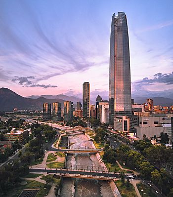
The Mapocho crossing Providencia district (looking east)
|
|
| Country | Chile |
| Physical characteristics | |
| Main source | 1,200 to 252 m (3,937 to 827 ft) 33°22′25″S 70°23′49″W / 33.3735°S 70.397°W |
| River mouth | Maipo River 33°26′37″S 70°49′26″W / 33.44367°S 70.82392°W |
| Length | 110 km (68 mi) |
| Basin features | |
| Basin size | 4,230 km2 (1,630 sq mi) |
The River Mapocho (pronounced Mah-POH-choh) is an important river in Chile, a country in South America. Its name comes from the Mapudungun language, meaning "water that goes deep into the land." This river starts high up in the Andes mountains and flows west, right through the middle of Santiago, which is the capital city of Chile. It basically divides Santiago into two parts!
Contents
River's Journey: From Mountains to City
The Mapocho River begins where two smaller rivers, the San Francisco River and the Molina River, meet in the Andes mountains. A stream called Yerba Loca Creek feeds the San Francisco River. This creek flows from a special protected area with the same name. The Molina River gets its water from the Iver Glacier, which is found on Cerro El Plomo mountain.
Entering Santiago's Urban Area
A few kilometers west of its source, the Mapocho River gets more water from the Arrayán Creek. After this, it flows into the busy city area of Santiago. The western edges of the Andes mountains here make the river change direction. It starts flowing towards the south.
Near Cerro San Cristóbal hill and close to the tall Costanera Center building, the river collects water from the Canal San Carlos. From this point, the river generally flows southwest towards the Plaza Baquedano area. This plaza is a central spot in the city. Long ago, the Mapocho used to split into two branches here. The southern branch was later turned into a walking path and is now a big street called Avenida Libertador General Bernardo O'Higgins.
Flowing Through City Landmarks
After Plaza Baquedano, the river turns northwest. Along its southern bank in this part, you can see some of Santiago's most famous places. These include the beautiful Parque Forestal (Forest Park), the National Museum of Fine Arts, the busy Central Market, and the old Estación Mapocho train station. Further northwest, two highway bridges cross the river. These bridges are part of the Autopista Central highway, connecting the north and south sides of the river.
Around the same longitude as the top of Cerro Renca hill, the Mapocho changes its direction again. It stops flowing northwest and starts heading southwest. Finally, from the southern part of Comodoro Arturo Merino Benítez International Airport, the river turns south. It then flows into the Maipo River, which is where its journey ends.
Mapocho's Role in Santiago's History
Until the 1800s, the Mapocho River marked the northern edge of Santiago. Because of this, it became an important arrival point for people and goods. Trains coming from northern Chile would arrive at the Estación Mapocho (Mapocho Station), which later also became a bus station. The Vega Central, a big market for food, and the Central Market were also built near the river. These markets helped provide food for Santiago.
River Walls and Traditions

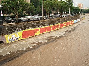
Since the 1970s, the walls of the river channel in Santiago have been used for political messages. Thousands of "Santiaguinos" (people from Santiago) see these messages every day. Also, each year, students from the University of Chile have a fun boat race called a Hazing Regatta down the river. This race celebrates the start of the new school year.
Cleaning Up the River
The Mapocho River has faced challenges with pollution. This pollution comes from household waste, farm runoff, and industrial sewage. Also, waste from several copper mines in the Andes mountains, east of Santiago, used to be dumped directly into the river without being cleaned.
In March 2009, only about 68% of Santiago's wastewater was treated. By the end of that year, this improved to 81%. Laws are in place to make sure industries and local governments clean all their wastewater. There are now many large plants being built to treat and recycle wastewater. There are also ongoing plans to clean up the river even more and make it possible for boats to travel on it.
River Floods
In April 2016, after very heavy rain, the Mapocho River swelled up. It flooded properties in Santiago and caused the drinking water supply for millions of people to become contaminated.
See also
 In Spanish: Río Mapocho para niños
 | Georgia Louise Harris Brown |
 | Julian Abele |
 | Norma Merrick Sklarek |
 | William Sidney Pittman |

