Maravillas Creek facts for kids
Quick facts for kids Maravillas Creek |
|
|---|---|
| Country | United States |
| States | Texas |
| Counties | Brewster |
| Physical characteristics | |
| Main source | Del Norte Mountains between Alpine and Marathon 30°13′56″N 103°28′34″W / 30.23222°N 103.47611°W |
| River mouth | Rio Grande Black Gap WMA 29°33′45″N 102°46′44″W / 29.56250°N 102.77889°W |
| Length | 90 miles (140 km) |
| Basin features | |
| River system | Rio Grande Basin |
| Bridges | US 385 |
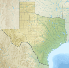
Maravillas Creek is a cool river located in the state of Texas, in the United States. It's like a smaller stream that flows into a much bigger river, the famous Rio Grande. Think of it as a helper river, bringing its water to the mighty Rio Grande.
Contents
What is Maravillas Creek?
Maravillas Creek is a natural waterway that stretches for about 90 miles (which is about 145 kilometers). Its name comes from the Spanish language word for wonders or marvels, which sounds pretty amazing!
Where Does Maravillas Creek Start?
This creek begins its journey in the Del Norte Mountains in Texas. This area is found between two towns called Alpine and Marathon. From there, the water starts to flow, making its way across the land.
Maravillas Creek's Journey
As Maravillas Creek flows, it passes through Brewster County. This county is known for its wide-open spaces and natural beauty. The creek helps to bring water to this dry region.
One important road that crosses over Maravillas Creek is US 385. This bridge allows cars and people to travel easily over the creek.
Joining the Rio Grande
Finally, after its long journey, Maravillas Creek reaches its end point. It flows into the Rio Grande river. This happens in an area called the Black Gap Wildlife Management Area. The Rio Grande is a very important river that forms part of the border between the United States and Mexico. Maravillas Creek is one of many smaller rivers that feed into it.
 | Lonnie Johnson |
 | Granville Woods |
 | Lewis Howard Latimer |
 | James West |


