March Route of Rochambeau's Army: Manship Road-Barstow Road facts for kids
|
March Route of Rochambeau's Army: Manship Road-Barstow Road
|
|

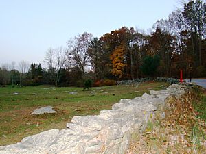
Manship Road and stone wall, in 2016
|
|
| Location | Manship Rd., Barstow Rd. from jct. with Manship Rd. to Westminster Rd., Canterbury, Connecticut |
|---|---|
| Area | 2 acres (0.81 ha) |
| MPS | Rochambeau's Army in Connecticut, 1780-1782 MPS |
| NRHP reference No. | 02001678 |
Quick facts for kids Significant dates |
|
| Dates of significance | 1781, 1782 |
| Added to NRHP | January 8, 2003 |
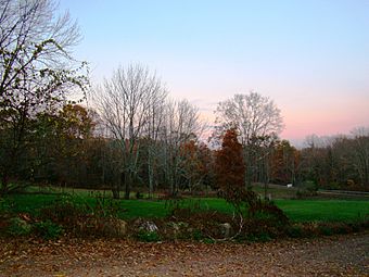
The March Route of Rochambeau's Army: Manship Road-Barstow Road is a special historic place in Canterbury, Connecticut. It was added to the National Register of Historic Places in 2003. This site helps us remember the important journey of French troops led by General Rochambeau during the American Revolution. His army marched through this area in 1781 and again in 1782.
Contents
A Special Part of History
This historic site is important because it's a well-preserved part of the route that General Rochambeau's army used. In this area, the army's path generally followed what is now Connecticut Route 14. However, this specific section of Manship Road and Barstow Road is a bypassed loop.
Why This Section is Unique
This part of the road was cut off from the main route in the 1930s. This means it doesn't have much traffic and hasn't been changed or modernized. Because of this, it still looks much like it did when Rochambeau's soldiers marched through.
The preserved section is about 1,400 feet long. It's on the north side of the main road. It includes parts of Manship Road and Barstow Road. The area starts where the loop meets Manship Road and goes all the way to Westminster Road.
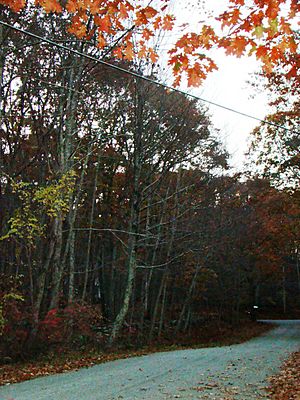
The road itself is paved and about 20 feet wide. It has old stone walls lining its sides. The protected area is about 50 to 55 feet wide, stretching out to these walls.
What You Can See
When you visit, you'll notice the narrow roadway and the stone walls. There is also one old house along this section. This house was built around the 1840s. Its age actually adds to the historic feel of the place.
Rochambeau's Difficult Journey
General Rochambeau's troops marched through this area in June 1781. They found the roads in this general area to be the most challenging part of their entire journey. Even though the road is now paved, its look and feel still remind us of the soldiers' difficult passage.
Other Historic Route Sections
There are other preserved parts of Rochambeau's route nearby. These include:
- March Route of Rochambeau's Army: Old Canterbury Road: This section is about 2 miles (3 kilometers) to the east. You can find it along Route 14, then straight onto 14A (Canterbury Road).
- March Route of Rochambeau's Army: Palmer Road: This is about a 2,000-foot (600-meter) stretch. It's about 3 miles (5 kilometers) to the west along Route 14.
Many other places connected to Rochambeau's route were also looked at for listing on the National Register in 2001.
 | Dorothy Vaughan |
 | Charles Henry Turner |
 | Hildrus Poindexter |
 | Henry Cecil McBay |


