March Route of Rochambeau's Army: Bailey Road facts for kids
Quick facts for kids |
|
|
March Route of Rochambeau's Army: Bailey Road
|
|
 |
|
| Location | Bailey Rd., Bolton, Connecticut |
|---|---|
| Area | 2 acres (0.81 ha) |
| MPS | Rochambeau's Army in Connecticut, 1780-1782 MPS |
| NRHP reference No. | 02001677 |
| Added to NRHP | January 8, 2003 |
The March Route of Rochambeau's Army: Bailey Road is a special part of an old, abandoned road in Bolton, Connecticut. It's like a time capsule! This road was added to the National Register of Historic Places in 2003. This means it's recognized as an important historical site. It's one of the best-preserved sections in Connecticut that was used by French soldiers. These troops were led by General Rochambeau during the American Revolutionary War in 1781.
Contents
Following Rochambeau's Historic Path
This historic section of Bailey Road is found off United States Route 6 in western Andover. The part of the road that people still use ends a short distance west of the town line. After that, it continues as an old country path, about 50 feet (15 m) wide.
What Does This Old Road Look Like Today?
This now-abandoned stretch of road once went all the way to Brandy Street in Bolton. It generally runs from east to west, but it winds and turns to follow the natural hills and valleys. It even goes up a steep ridge! Both sides of the road used to have stone walls. The wall on the south side is still in better shape than the one on the north.
You can also find two small stone slab bridges along this road. These are like tiny tunnels made of stone slabs, built to let water flow underneath. What makes this part of the Rochambeau Route special is that no new buildings or roads have been built on it since it was abandoned. It looks much like it did hundreds of years ago!
Why Was This Road So Important?
French soldiers who wrote about their journey were not very happy with the roads in Connecticut. They described the route between their fourth and fifth camps (which were in Windham and Bolton) as "frightful." They said it had "mountains and steep ridges." One writer even said they traveled "with the greatest difficulty imaginable."
This road was first built around 1710. However, by the 1790s, people started using better, more suitable routes. By the time of World War II, this specific part of the road was completely abandoned.
Discovering a Piece of History
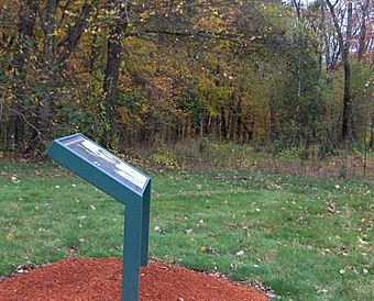
Researchers preparing for the 200th anniversary of Rochambeau's march helped identify this old road section. They found it partly because there were still old homes from that time period near both ends of the road. Today, the eastern end of this historic path has a special sign that helps people understand its importance.
 | Isaac Myers |
 | D. Hamilton Jackson |
 | A. Philip Randolph |


