Maricopa Colony, Arizona facts for kids
Quick facts for kids
Maricopa Colony, Arizona
|
|
|---|---|

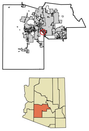
Location in Maricopa County, Arizona
|
|
| Country | United States |
| State | Arizona |
| County | Maricopa |
| Area | |
| • Total | 5.49 sq mi (14.21 km2) |
| • Land | 5.49 sq mi (14.21 km2) |
| • Water | 0.00 sq mi (0.00 km2) |
| Population
(2020)
|
|
| • Total | 854 |
| • Density | 155.70/sq mi (60.12/km2) |
| Time zone | UTC-7 (MST (no DST)) |
| ZIP code |
85339
|
| Area code(s) | 520 |
| FIPS code | 04-44450 |
Maricopa Colony is a special kind of community in Maricopa County, Arizona, United States. It's called a census-designated place (CDP). This means it's an area that looks like a town but isn't officially run by its own local government. It's part of the Gila River Indian Community, which is a federally recognized Native American community.
In 2020, about 854 people lived in Maricopa Colony. This was more than the 709 people who lived there in 2010. You can find Maricopa Colony on the southern side of the Phoenix metropolitan area, near Baseline Road and 83rd Avenue.
Who Lives Here?
| Historical population | |||
|---|---|---|---|
| Census | Pop. | %± | |
| 2010 | 709 | — | |
| 2020 | 854 | 20.5% | |
| U.S. Decennial Census | |||
In 2010, there were 709 people living in Maricopa Colony. Most of the people (92%) were Native American. About 1% were White, and 4% were from other backgrounds. Around 3% of the people were from two or more different backgrounds. Also, 14% of the population identified as Hispanic or Latino.
Getting Around
There's a bus service called Gila River Transit. It helps people travel between Maricopa Colony and Komatke.
See also
 In Spanish: Maricopa Colony para niños
 | Sharif Bey |
 | Hale Woodruff |
 | Richmond Barthé |
 | Purvis Young |


