Komatke, Arizona facts for kids
Quick facts for kids
Komatke, Arizona
O'odham: Komaḍk
|
|
|---|---|

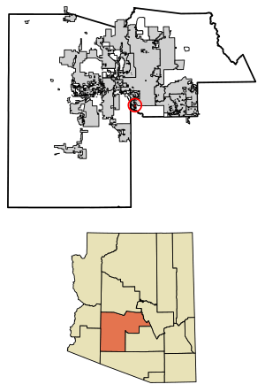
Location in Maricopa County, Arizona
|
|
| Country | United States |
| State | Arizona |
| County | Maricopa |
| Area | |
| • Total | 2.43 sq mi (6.30 km2) |
| • Land | 2.43 sq mi (6.30 km2) |
| • Water | 0.00 sq mi (0.00 km2) |
| Elevation | 1,060 ft (320 m) |
| Population
(2020)
|
|
| • Total | 1,013 |
| • Density | 416.36/sq mi (160.74/km2) |
| Time zone | UTC-7 (Mountain (MST)) |
| ZIP code |
85339 (Laveen)
|
| FIPS code | 04-38655 |
Komatke (which is Komaḍk in the O'odham language) is a small community in Maricopa County, Arizona, United States. It's called a census-designated place (CDP) because it's a special area set up by the government for counting people.
In 2020, about 1,013 people lived in Komatke. This was more than the 821 people counted in 2010. Komatke is part of the Gila River Indian Community, which is a Native American reservation. The name Komatke comes from the Sierra Estrella mountains nearby.
Contents
Where is Komatke Located?
Komatke is found in Arizona, a state in the southwestern United States. It is located at about 33.3 degrees North and 112.1 degrees West. This means it's south of a place called Laveen, Arizona.
Komatke is about 15 miles (24 kilometers) southwest of Downtown Phoenix. The total land area of Komatke is about 2.4 square miles (6.3 square kilometers). All of this area is land, with no large bodies of water.
A special place in Komatke is the Saint John the Baptist Parish Laveen, also known as the Saint Johns Mission. This mission and its school were started by a group called the Franciscans in 1894. Komatke is about 1,030 feet (314 meters) above sea level.
Who Lives in Komatke?
Based on information from the year 2000, there were 1,174 people living in Komatke. Most of the people living here are Native American (about 93.6%). There were also people who identified as White (1.6%), Black or African American (0.1%), Asian (less than 0.1%), and Pacific Islander (less than 0.1%). About 2.3% were from other races, and 2.4% were from two or more races.
Also, about 15.8% of the people in Komatke were of Hispanic background.
Learning in Komatke
Komatke has a school called Gila Crossing Community School. This school teaches students from kindergarten up to 8th grade. It is connected with the Bureau of Indian Education, which helps support schools for Native American communities.
Getting Around Komatke
People in Komatke can use public transportation to travel. Valley Metro Bus route 51 connects Komatke to bigger cities like Phoenix, Arizona and Glendale, Arizona. There is also Gila River Transit, which helps people travel between Komatke and Maricopa Colony, Arizona.
See also
 In Spanish: Komatke para niños
 | Dorothy Vaughan |
 | Charles Henry Turner |
 | Hildrus Poindexter |
 | Henry Cecil McBay |


