
Marienville, Pennsylvania facts for kids
Quick facts for kids
Marienville, Pennsylvania
|
|
|---|---|

Marienville, Pennsylvania
|
|

Marienville, Pennsylvania
Location in Pennsylvania

Marienville, Pennsylvania
Location in the United States
|
|
| Country | United States |
| State | Pennsylvania |
| County | Forest |
| Township | Jenks |
| Area | |
| • Total | 6.06 sq mi (15.69 km2) |
| • Land | 6.06 sq mi (15.69 km2) |
| • Water | 0.00 sq mi (0.00 km2) |
| Elevation | 1,735 ft (529 m) |
| Population
(2020)
|
|
| • Total | 3,362 |
| • Density | 554.88/sq mi (214.23/km2) |
| Time zone | UTC-5 (Eastern (EST)) |
| • Summer (DST) | UTC-4 (EDT) |
| ZIP code |
16239
|
| FIPS code | 42-47416 |
| GNIS feature ID | 1213633 |
Marienville is a small community in Forest County, Pennsylvania, in the United States. It's known as a "census-designated place" (CDP), which means it's a special area the government counts for population. Marienville is located in Jenks Township.
The community sits at an elevation of about 1,735 feet (529 meters) above sea level. You can find it at these coordinates: 41.4702014 degrees North and -79.1247623 degrees West. In the past, people sometimes called it "Marion" or "Marionville."
Marienville is a popular spot for outdoor fun, especially for those who enjoy riding ATVs on trails. It is also home to a state correctional facility called SCI Forest.
Contents
Exploring Marienville's Location
Marienville is in the southeastern part of Forest County. It's right in the middle of Jenks Township.
Main Roads and Travel
Pennsylvania Route 66 is the main road that goes through Marienville. If you head northeast on Route 66, you'll travel about 24 miles (39 km) to Kane, where it connects with U.S. Route 6. If you go southwest for about 27 miles (43 km), you'll reach Interstate 80 near Clarion. Another road, Pennsylvania Route 899, goes south from Marienville for about 10 miles (16 km) to Clarington.
Community Size
According to the U.S. Census Bureau, the Marienville CDP covers a total area of about 6.06 square miles (15.7 square kilometers). All of this area is land, with no significant bodies of water.
-
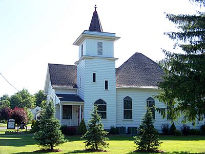
Marienville Presbyterian Church

Population of Marienville
The number of people living in Marienville has changed over time. The U.S. Census Bureau counts the population every ten years.
Population Changes Over Time
Here's how the population has been recorded:
| Historical population | |||
|---|---|---|---|
| Census | Pop. | %± | |
| 2010 | 3,137 | — | |
| 2020 | 3,362 | 7.2% | |
| U.S. Decennial Census | |||
In 2010, the population of Marienville was 3,137 people. By 2020, the population had grown to 3,362 people.
See also
 In Spanish: Marienville para niños
