Marmaton, Kansas facts for kids
Quick facts for kids
Marmaton, Kansas
|
|
|---|---|

|
|
| Country | United States |
| State | Kansas |
| County | Bourbon |
| Township | Marmaton |
| Incorporated | 1858 |
| Elevation | 853 ft (260 m) |
| Time zone | UTC-6 (CST) |
| • Summer (DST) | UTC-5 (CDT) |
| Area code | 620 |
| FIPS code | 20-44875 |
| GNIS ID | 474764 |
Marmaton is a small, quiet place in Bourbon County, Kansas, United States. It's what we call an unincorporated community. This means it's a group of homes and businesses that isn't officially a town or city with its own local government. Even though it's not a city, people live and work there.
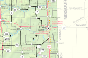
You can find Marmaton about three miles east of Redfield. It's also two miles south of U.S. Route 54, right where 155th Street and Limestone Road meet. If you live in Marmaton, your mail usually comes from Fort Scott, Kansas.
History of Marmaton
Marmaton became an official community in 1858. When a place is incorporated, it means it gets a formal legal status, often allowing it to have its own local rules or government.
How Marmaton Got Its Name
The community of Marmaton was named after the Marmaton River, which flows through the area. The name "Marmaton" comes from an old French word, Marmiton. This word was used by early fur traders and means "scullion" or a "kitchen helper." It's interesting how places get their names from history!
 | Lonnie Johnson |
 | Granville Woods |
 | Lewis Howard Latimer |
 | James West |

