Marshepaug River facts for kids
Quick facts for kids Marshepaug River |
|
|---|---|

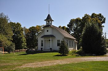
Milton Historic District on the Marshepaug River
|
|
| Other name(s) | (Also called Ackerman Brook, Great Pond River, Marshapogge River, Mashepaug River, and other names) |
| Country | United States |
| States | Connecticut |
| Towns | Goshen, Litchfield |
| Physical characteristics | |
| Main source | Woodbridge Lake Goshen, Massachusetts 1,138 ft (347 m) (41°47′53″N 73°15′13″W / 41.798102°N 73.253510°W) |
| River mouth | East Branch of the Shepaug River Litchfield, Connecticut 978 ft (298 m) (41°46′01″N 73°16′39″W / 41.7670404°N 73.2776167°W) |
| Length | 3 mi (4.8 km) |
| Width |
|
| Basin features | |
| River system | Housatonic |
| Basin size | 7,291.86 acres (2,950.91 ha) |
| Gradient | 52.66 fpm |
The Marshepaug River is a small but important river. It flows through the towns of Goshen and Litchfield. These towns are located in northwest Connecticut in the United States. The river is about 3 miles (4.8 km) long.
The Marshepaug River starts near Woodbridge Lake. It then flows southwest through the Milton Center Historic District. Finally, it joins the East Branch of the Shepaug River. This river helps drain a large area. It covers more than 7,000 acres (2,800 hectares) of land. The river also has a steep slope, dropping over 52 feet for every mile it flows. This steepness is called its gradient.
The River's Past: How it Helped People
During the 1800s, the Marshepaug River was very important. Its flowing water provided power for many businesses. People used this waterpower to run sawmills. Sawmills cut logs into lumber. The river also powered gristmills, which ground grain into flour. There were even bloomery forges. These places used heat and waterpower to make iron. The river's energy helped these industries grow.
 | Madam C. J. Walker |
 | Janet Emerson Bashen |
 | Annie Turnbo Malone |
 | Maggie L. Walker |

