Martin, South Dakota facts for kids
Quick facts for kids
Martin
Pažóla otȟúŋwah (Lakota)
|
|
|---|---|

Downtown Martin: Main Street, looking northeast from 4th Avenue
|
|

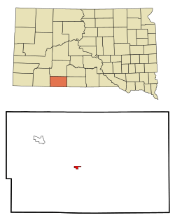
Location in Bennett County and the state of South Dakota
|
|
| Country | United States |
| State | South Dakota |
| County | Bennett |
| Founded | 1912 |
| Area | |
| • Total | 0.56 sq mi (1.45 km2) |
| • Land | 0.56 sq mi (1.45 km2) |
| • Water | 0.00 sq mi (0.00 km2) |
| Elevation | 3,324 ft (1,013 m) |
| Population
(2020)
|
|
| • Total | 938 |
| • Density | 1,672.01/sq mi (645.65/km2) |
| Time zone | UTC−7 (Mountain (MST)) |
| • Summer (DST) | UTC−6 (MDT) |
| ZIP code |
57551
|
| Area code(s) | 605 |
| FIPS code | 46-41100 |
| GNIS feature ID | 1267471 |
| Website | http://www.martinsd.net/ |
Martin is a city located in South Dakota, a state in the United States. It is the main town, or county seat, of Bennett County, South Dakota. In the Lakota language, the city's name is pažóla otȟúŋwahe, which means "Knoll City". As of the 2020 census, about 938 people lived there.
Contents
History of Martin
Martin was officially started in 1911. The city was named after Eben Martin. He was a U.S. Representative for South Dakota. This means he was a politician who helped make laws for the country.
Geography and Location
According to the United States Census Bureau, the city of Martin covers a total area of about 1.45 square kilometers (or 0.56 square miles). All of this area is land, meaning there are no large lakes or rivers within the city limits. The city uses the ZIP code 57551 for mail.
Getting Around Martin
You can reach Martin by car using a few main roads. U.S. Route 18 passes through the city, going from east to west. South Dakota Highway 73 also runs into the town from the north. For air travel, there is a local airport called Martin Municipal Airport.
People Who Live Here
| Historical population | |||
|---|---|---|---|
| Census | Pop. | %± | |
| 1930 | 720 | — | |
| 1940 | 1,013 | 40.7% | |
| 1950 | 989 | −2.4% | |
| 1960 | 1,184 | 19.7% | |
| 1970 | 1,248 | 5.4% | |
| 1980 | 1,018 | −18.4% | |
| 1990 | 1,151 | 13.1% | |
| 2000 | 1,106 | −3.9% | |
| 2010 | 1,071 | −3.2% | |
| 2020 | 938 | −12.4% | |
| U.S. Decennial Census | |||
Population in 2010
In 2010, there were 1,071 people living in Martin. The city had 401 households. About 48.3% of the people living in Martin were Native American. Around 41.6% were White. Other groups made up smaller parts of the population. About 30.4% of the residents were under 18 years old. The average age of people in the city was 31.7 years.
Education
The Bennett County School District is in charge of schools for all of Bennett County, including Martin.
Notable People from Martin
- Vine Deloria Jr was an important author, thinker, and activist. He worked to protect the rights of Native Americans. He was born in Martin.
- Jay Novacek is a famous American football player. He played as a tight end and is in the College Football Hall of Fame. He was also born in Martin, South Dakota.
See also
 In Spanish: Martin (Dakota del Sur) para niños
 | John T. Biggers |
 | Thomas Blackshear |
 | Mark Bradford |
 | Beverly Buchanan |


