
Mata de Cañas facts for kids
Quick facts for kids
Mata de Cañas
|
|
|---|---|
|
Barrio
|
|

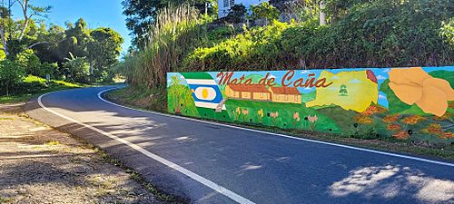
Mural on Puerto Rico Highway 568 in Mata de Cañas
|
|

Location of Mata de Cañas within the municipality of Orocovis shown in red
|
|

Mata de Cañas
Location in Caribbean
|
|
| Commonwealth | |
| Municipality | |
| Area | |
| • Total | 1.61 sq mi (4.2 km2) |
| • Land | 1.61 sq mi (4.2 km2) |
| • Water | 0 sq mi (0 km2) |
| Elevation | 2,083 ft (635 m) |
| Population
(2010)
|
|
| • Total | 538 |
| • Density | 334.2/sq mi (129.0/km2) |
| Source: 2010 Census | |
| Time zone | UTC−4 (AST) |
Mata de Cañas is a small community, also known as a barrio, located in the town of Orocovis, Puerto Rico in Puerto Rico. In 2010, about 538 people lived there.
Contents
Exploring Mata de Cañas
What are Barrios and Sectors?
In Puerto Rico, a barrio is like a neighborhood or a district. These barrios are then divided into even smaller areas called sectores (which means sectors in English).
Think of it like this: a town has different neighborhoods, and each neighborhood has smaller blocks or areas within it.
Local Areas in Mata de Cañas
The Mata de Cañas barrio includes several specific sectors. These are:
- Sector El Jobo
- Sector El Perico
- Sector Sopapo
- Sector Berto Díaz
A Look at History
How Puerto Rico Became Part of the U.S.
Puerto Rico used to belong to Spain. After the Spanish–American War in 1898, Spain gave Puerto Rico to the United States. This happened under an agreement called the Treaty of Paris of 1898.
Puerto Rico then became an unincorporated territory of the United States. This means it is part of the U.S. but does not have all the same rights as a state.
Population Over Time
In 1899, the United States government counted the people living in Puerto Rico. At that time, the combined population of Mata de Cañas and the nearby Sabana barrios was 1,089 people.
The population of Mata de Cañas has changed over the years:
| Historical population | |||
|---|---|---|---|
| Census | Pop. | %± | |
| 1980 | 584 | — | |
| 1990 | 516 | −11.6% | |
| 2000 | 487 | −5.6% | |
| 2010 | 538 | 10.5% | |
| U.S. Decennial Census 1899 (shown as 1900) 1910-1930 1930-1950 1980-2000 2010 |
|||
Gallery
-
A stretch of Puerto Rico Highway 568 in Mata de Cañas
.jpg)
See also
 In Spanish: Mata de Cañas (Orocovis) para niños
- List of communities in Puerto Rico
