Maumee Road Lands facts for kids
The Maumee Road Lands were special pieces of land given by the United States Congress to the state of Ohio in 1823. These lands were located along the path where a new road was planned in the northwest part of Ohio. This road was important for connecting different settlements and helping people travel.
Contents
Why the Maumee Road Was Needed
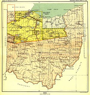
For a long time, much of Ohio was home to Native American nations. After the Treaty of Greenville in 1795, more land became available for white settlers. Later, the Treaty of Fort Industry in 1805 moved the boundary further west.
Challenges of Building a Road
The area between the Maumee River and the 1805 boundary was still Native American land. This meant the United States could not legally build a road there. Also, this region included the Great Black Swamp, a very wet and difficult area to cross. Building a road through it would need a lot of planning and money.
Treaties and Agreements
In 1808, the Treaty of Brownstown was signed. In this agreement, Native American nations gave the U.S. a strip of land two miles (about 3 kilometers) wide. This land stretched from Perrysburg, Ohio on the Maumee River to Bellevue, Ohio. The goal was to build a wide road, about 120 feet (37 meters) across, to connect different U.S. lands.
Early Plans for the Road
In 1811, Congress set aside $6,000 to explore and map out a sixty-foot-wide road. Later, in 1815, plans were made to survey the land one mile (1.6 km) on each side of the road. These land sections were meant to be sold to help pay for the road. In 1816, there was talk of moving the road's path to go through Fremont, Ohio. However, not much happened with these plans right away.
New Land and Surveys
By 1817, all the land between the Maumee River and the Western Reserve was given up by Native Americans through the Treaty of Fort Meigs. This land was then surveyed into townships and sections by 1821, making it ready for new development.
Ohio Receives Land for the Road
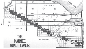
In 1823, Congress finally allowed the state of Ohio to build the road. They also gave Ohio a special land grant. This grant included the 120-foot-wide road path itself, plus one mile (1.6 km) of land on each side. These lands became known as the “Maumee Road Lands.”
Funding the Road's Construction
In 1825, Ohio set aside money to build the road. The state also planned to sell the land it had been granted to help pay for the construction. The road section was about 46 miles (74 km) long. The land given to Ohio was huge, about 60,000 acres (243 square kilometers), located in Wood County, Ohio and Sandusky County, Ohio.
Today, much of United States Route 20 follows the path of this historic Maumee Road.
 | William M. Jackson |
 | Juan E. Gilbert |
 | Neil deGrasse Tyson |


