Maungaturoto facts for kids
Quick facts for kids
Maungaturoto
Maungatūroto
|
|
|---|---|
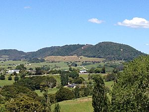
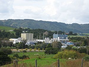
View from the hills of Maungaturoto
|
|
| Country | New Zealand |
| Region | Northland Region |
| District | Kaipara District |
| Ward | Otamatea Ward |
| Electorates |
|
| Area | |
| • Total | 3.17 km2 (1.22 sq mi) |
| Population | |
| • Total | 1,010 |
| • Density | 318.6/km2 (825/sq mi) |
Maungaturoto is a small town in the Northland Region of New Zealand. It's located close to the Otamatea River, which is an arm of the large Kaipara Harbour. The town is about 25 kilometers north of Wellsford and 45 kilometers south of Whangārei.
The New Zealand Ministry for Culture and Heritage explains that the name Maungatūroto means "mountain standing up in lagoons" in the Māori language.
Contents
Who Lives in Maungaturoto?
Maungatūroto is a rural settlement. In the 2023 New Zealand census, the town had a population of 921 people. This was a small increase of 6 people since the 2018 census.
People and Ages
There were 429 males, 489 females, and 3 people of other genders living in 330 homes. The average age of people in Maungaturoto was 39.6 years.
- About 21.8% of the people were under 15 years old.
- Around 16.3% were aged 15 to 29.
- About 40.7% were aged 30 to 64.
- And 20.8% were 65 years or older.
Backgrounds and Languages
People in Maungaturoto come from different backgrounds:
- 82.7% identified as European (Pākehā).
- 29.0% identified as Māori.
- 4.2% identified as Pasifika.
- 3.3% identified as Asian.
Most people (97.7%) spoke English. About 6.5% spoke the Māori language.
Beliefs and Work
Many people in Maungaturoto have different beliefs:
- 39.7% identified as Christian.
- 42.7% said they had no religion.
- 5.5% followed Māori religious beliefs.
For those aged 15 and older, about 42.9% worked full-time, and 14.2% worked part-time. The average income was $34,300.
Schools in Maungaturoto
Maungaturoto has several schools for students of different ages. All these schools welcome both boys and girls.
Otamatea High School
Otamatea High School is a secondary school for students in years 7 to 13. It has about 691 students. The school first opened in 1939 as a District High School. In 2000, it won the Goodman Fielder Composite School of the Year Award!
Maungaturoto School
Maungaturoto School is a primary school for younger students, from years 1 to 6. It has about 202 students. This school has been around for a long time, first opening its doors in 1874.
Otamatea Christian School
Otamatea Christian School is a state-integrated school that teaches students from years 1 to 13. It has about 31 students.
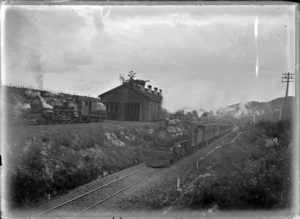
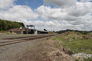
Maungaturoto Railway Station
About 2 kilometers southwest of the town, Maungaturoto used to have a busy railway station. It was part of the North Auckland Line.
The station opened on 13 August 1915. Passenger trains stopped running on 31 July 1967, and the station officially closed on 12 June 1987.
- In 1923, a special refreshment room opened where travelers could get food and drinks.
- A hostel was even built in 1940 for the women who worked there, but it closed in 1956.
- The station also had a goods shed for storing items, a loading area, and yards for cattle. It even had a special track called a passing loop where trains could wait for others to pass.
 | Isaac Myers |
 | D. Hamilton Jackson |
 | A. Philip Randolph |


