Mayreville facts for kids
Quick facts for kids
Mayreville
|
||
|---|---|---|
 |
||
|
||
| Country | France | |
| Region | Occitanie | |
| Department | Aude | |
| Arrondissement | Carcassonne | |
| Canton | La Piège au Razès | |
| Intercommunality | Hers et Ganguise | |
| Area
1
|
8.17 km2 (3.15 sq mi) | |
| Population
(Jan. 2019)
|
81 | |
| • Density | 9.91/km2 (25.68/sq mi) | |
| Time zone | UTC+01:00 (CET) | |
| • Summer (DST) | UTC+02:00 (CEST) | |
| INSEE/Postal code |
11226 /11420
|
|
| Elevation | 262–361 m (860–1,184 ft) (avg. 310 m or 1,020 ft) |
|
| 1 French Land Register data, which excludes lakes, ponds, glaciers > 1 km2 (0.386 sq mi or 247 acres) and river estuaries. | ||
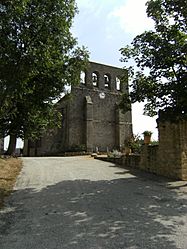
Mayreville is a small commune, which is a type of local government area or village, located in the south of France. It is part of the Occitanie region and the Aude department. As of January 2019, about 81 people live in Mayreville, making it a very quiet and peaceful place.
Contents
About Mayreville
Mayreville is a tiny village in the Aude department. It is known for its calm environment. The word "commune" means it is a small administrative area with its own local government.
Where is Mayreville?
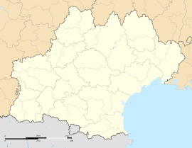
Mayreville is located in the southern part of France. It is found within the Occitanie region, which is one of the larger administrative areas in France. The village is also part of the Aude department, which is a smaller division within the Occitanie region.
How Many People Live Here?
Mayreville is a very small community. In January 2019, the population was recorded as 81 people. This makes it one of the less populated communes in France.
Local Government
Like all communes in France, Mayreville has a local government. This government helps manage the daily life of the village.
The Mayor of Mayreville
The head of the local government in a commune is called the mayor. The mayor is responsible for many things, like keeping the village tidy, managing local services, and representing the people who live there. Thierry de Kerimel de Kerveno served as the mayor of Mayreville from 2008 to 2014.
Geography of Mayreville
Mayreville is situated in an area with varying heights. Understanding its geography helps us know more about the village.
Elevation and Area
The village of Mayreville is located at an average height of 310 meters (about 1,017 feet) above sea level. The lowest point in the commune is 262 meters (about 860 feet), and the highest point is 361 meters (about 1,184 feet). The total area of Mayreville is 8.17 square kilometers (about 3.15 square miles).
See also
 In Spanish: Mayreville para niños


