McIntire, Iowa facts for kids
Quick facts for kids
McIntire, Iowa
|
|
|---|---|

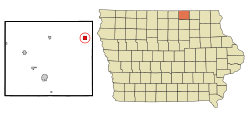
Location of McIntire, Iowa
|
|
| Country | United States |
| State | Iowa |
| County | Mitchell |
| Area | |
| • Total | 1.01 sq mi (2.61 km2) |
| • Land | 1.01 sq mi (2.61 km2) |
| • Water | 0.00 sq mi (0.00 km2) |
| Elevation | 1,273 ft (388 m) |
| Population
(2020)
|
|
| • Total | 113 |
| • Density | 111.99/sq mi (43.25/km2) |
| Time zone | UTC-6 (Central (CST)) |
| • Summer (DST) | UTC-5 (CDT) |
| ZIP code |
50455
|
| Area code(s) | 641 |
| FIPS code | 19-48045 |
| GNIS feature ID | 0458917 |
McIntire is a small city located in Mitchell County, Iowa, in the United States. In 2020, about 113 people lived there. It's a quiet place with a rich history.
Contents
The Story of McIntire
How McIntire Began
McIntire was officially planned out in 1891. It got its name from its founders, John and Sarah McIntire. They were important people in starting the town.
Changes Over Time
In 1921, McIntire got electricity, which was a big step forward. Trains used to come through daily on the Chicago Great Western Line. This continued until 1967, when the train line was no longer used. For a long time, Main Street was the only paved road in town, until 2015.
Where is McIntire Located?
McIntire is found at specific coordinates: 43.436587 degrees North and -92.595703 degrees West. This helps people find it on a map.
Land Area
According to the United States Census Bureau, McIntire covers about 1.01 square miles (2.61 square kilometers) of land. There is no water area within the city limits.
Who Lives in McIntire?
This section looks at the number of people living in McIntire and how that has changed.
| Historical populations | ||
|---|---|---|
| Year | Pop. | ±% |
| 1900 | 427 | — |
| 1910 | 487 | +14.1% |
| 1920 | 514 | +5.5% |
| 1930 | 268 | −47.9% |
| 1940 | 300 | +11.9% |
| 1950 | 300 | +0.0% |
| 1960 | 270 | −10.0% |
| 1970 | 234 | −13.3% |
| 1980 | 197 | −15.8% |
| 1990 | 147 | −25.4% |
| 2000 | 173 | +17.7% |
| 2010 | 122 | −29.5% |
| 2020 | 113 | −7.4% |
| Source: and Iowa Data Center Source: |
||
Population in 2020
The census in 2020 showed that 113 people lived in McIntire. There were 50 households, which means 50 different homes where people lived. The city had about 112 people per square mile.
- Most residents (93.8%) were White.
- About 5.3% of people identified with two or more races.
- A small number (2.7%) were Hispanic or Latino.
Many households (26%) had children under 18 living with them. The average age in McIntire was 42.5 years old. About 28.3% of the people were under 20 years old.
Population in 2010
In the census of 2010, McIntire had 122 people. There were 55 households. The population density was about 121 people per square mile.
- All residents (100%) were White.
- About 1.6% of the population was Hispanic or Latino.
About 16.4% of households had children under 18. The average age of people in McIntire was 49.5 years. Many residents (34.4%) were 65 years old or older.
See also
 In Spanish: McIntire (Iowa) para niños
 | Shirley Ann Jackson |
 | Garett Morgan |
 | J. Ernest Wilkins Jr. |
 | Elijah McCoy |

