Mitchell County, Iowa facts for kids
Quick facts for kids
Mitchell County
|
|
|---|---|

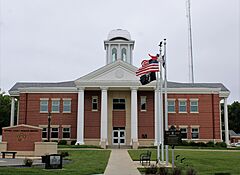
Mitchell County Courthouse in Osage
|
|

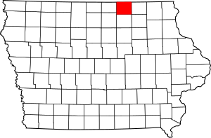
Location within the U.S. state of Iowa
|
|
 Iowa's location within the U.S. |
|
| Country | |
| State | |
| Founded | 1851 |
| Named for | John Mitchel |
| Seat | Osage |
| Largest city | Osage |
| Area | |
| • Total | 470 sq mi (1,200 km2) |
| • Land | 469 sq mi (1,210 km2) |
| • Water | 0.4 sq mi (1 km2) 0.09% |
| Population
(2020)
|
|
| • Total | 10,565 |
| • Density | 22.48/sq mi (8.68/km2) |
| Time zone | UTC−6 (Central) |
| • Summer (DST) | UTC−5 (CDT) |
| Congressional district | 1st |
Mitchell County is a place in the state of Iowa, USA. It's called a county, which is like a smaller region within a state. In 2020, about 10,565 people lived here. The main town, or county seat, where the county government is located, is Osage.
Contents
History of Mitchell County
Mitchell County was created in 1851. It's not completely clear who the county was named after. Some say it was named for John Mitchel, an early land surveyor. Others believe it was named after an Irish patriot.
The county used to have a special building called the Mitchell County Courthouse. It was finished in 1858. This building was important enough to be listed on the National Register of Historic Places. Sadly, the original courthouse building is no longer standing.
Geography of Mitchell County
Mitchell County covers a total area of about 470 square miles. Most of this area, about 469 square miles, is land. A very small part, about 0.4 square miles, is water. This means the county is mostly land.
Main Roads in Mitchell County
These are the most important roads that go through Mitchell County:
Neighboring Counties
Mitchell County shares borders with these other counties:
- Mower County, Minnesota to the north
- Howard County to the east
- Floyd County to the south
- Cerro Gordo County to the southwest
- Worth County to the west
Population of Mitchell County
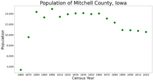
The number of people living in Mitchell County has changed over the years. Here's a look at the population from different U.S. Census counts:
| Historical population | |||
|---|---|---|---|
| Census | Pop. | %± | |
| 1860 | 3,409 | — | |
| 1870 | 9,582 | 181.1% | |
| 1880 | 14,363 | 49.9% | |
| 1890 | 13,299 | −7.4% | |
| 1900 | 14,916 | 12.2% | |
| 1910 | 13,435 | −9.9% | |
| 1920 | 13,921 | 3.6% | |
| 1930 | 14,065 | 1.0% | |
| 1940 | 14,121 | 0.4% | |
| 1950 | 13,945 | −1.2% | |
| 1960 | 14,043 | 0.7% | |
| 1970 | 13,108 | −6.7% | |
| 1980 | 12,329 | −5.9% | |
| 1990 | 10,928 | −11.4% | |
| 2000 | 10,874 | −0.5% | |
| 2010 | 10,776 | −0.9% | |
| 2020 | 10,565 | −2.0% | |
| 2023 (est.) | 10,518 | −2.4% | |
| U.S. Decennial Census 1790-1960 1900-1990 1990-2000 2010-2018 |
|||
2020 Census Information
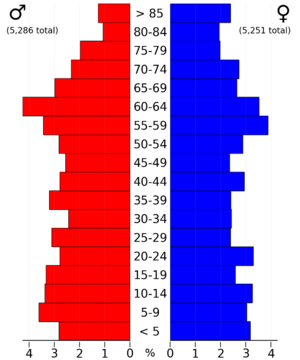
In 2020, the census counted 10,565 people living in Mitchell County. This means there were about 22 people living in each square mile. Most people (97.47%) said they belonged to one race. About 93.84% were non-Hispanic White. Other groups included Black people (0.40%), Hispanic people (1.83%), Native Americans (0.11%), and Asian people (0.44%). Some people (3.35%) were of another race or more than one race.
There were 4,847 places where people could live, like houses or apartments. Out of these, 4,382 were being lived in.
2010 Census Information
The 2010 census recorded 10,776 people in the county. This was a bit more than in 2020. There were 4,850 housing units, and 4,395 of them were occupied.
Economy in Mitchell County
In January 2017, there was a plan to build a large farm for 5,000 hogs in Lincoln Township. However, the leaders of Mitchell County decided not to approve the plan.
Towns and Communities
Mitchell County has several towns and smaller communities.
Cities in Mitchell County
Census-Designated Places (CDPs)
These are areas that are like towns but are not officially organized as cities:
Townships in Mitchell County
A township is a small area of land, usually with a local government. Mitchell County has these townships:
- Burr Oak
- Cedar
- Douglas
- East Lincoln
- Jenkins
- Liberty
- Mitchell
- Newburg
- Osage
- Otranto
- Rock
- St. Ansgar
- Stacyville
- Union
- Wayne
- West Lincoln
Community Population Ranking (2020 Census)
This table shows how many people live in each city or community in Mitchell County, based on the 2020 census. The county seat is marked with a dagger (†).
| Rank | City/Town/etc. | Type | Population (2020 Census) |
|---|---|---|---|
| 1 | † Osage | City | 3,627 |
| 2 | St. Ansgar | City | 1,160 |
| 3 | Riceville (partially in Howard County) | City | 806 |
| 4 | Stacyville | City | 458 |
| 5 | Mitchell | City | 124 |
| 6 | McIntire | City | 113 |
| 7 | Carpenter | City | 87 |
| 8 | New Haven | CDP | 77 |
| 9 | Orchard | City | 68 |
| 10 | Little Cedar | CDP | 64 |
| 11 | Toeterville | CDP | 53 |
| 12 | Mona | CDP | 35 |
| 13 | Otranto | CDP | 27 |
| 14 | Meyer | CDP | 14 |
See also
 In Spanish: Condado de Mitchell (Iowa) para niños
 | Charles R. Drew |
 | Benjamin Banneker |
 | Jane C. Wright |
 | Roger Arliner Young |


