Meyer, Iowa facts for kids
Quick facts for kids
Meyer, Iowa
|
|
|---|---|
| Country | United States |
| State | Iowa |
| County | Mitchell |
| Township | Stacyville |
| Area | |
| • Total | 0.71 sq mi (1.83 km2) |
| • Land | 0.71 sq mi (1.83 km2) |
| • Water | 0.00 sq mi (0.00 km2) |
| Population
(2020)
|
|
| • Total | 14 |
| • Density | 19.77/sq mi (7.64/km2) |
| Time zone | Central (CST) |
| ZIP code |
50455 (McIntire)
|
| FIPS code | 19-51510 |
Meyer is a small place in Iowa, United States. It's known as an unincorporated community, which means it doesn't have its own local government like a city or town. It's also a census-designated place, which is an area the government defines for counting people.
Meyer is located in Stacyville Township, within Mitchell County. In 2020, only 14 people lived there. This was a decrease from 31 people in 2010.
Contents
Where is Meyer, Iowa?
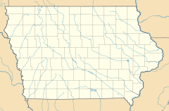
Meyer is in the northeastern part of Mitchell County. It's about 5 miles (8 kilometers) northeast of Stacyville. Another town, McIntire, is about 6 miles (9.7 kilometers) northwest of Meyer. The post office that serves Meyer is actually in McIntire.
The county seat, Osage, is about 17 miles (27 kilometers) southwest of Meyer. The border with the state of Minnesota is only about 3 miles (4.8 kilometers) north of Meyer.
Land and Water Around Meyer
According to the U.S. Census Bureau, the Meyer area covers about 0.71 square miles (1.83 square kilometers). All of this area is land; there are no large bodies of water within Meyer itself. The land around Meyer is part of the area where water flows into the Little Cedar River. This means any rain that falls in Meyer will eventually make its way to this river.
How Many People Live in Meyer?
The number of people living in Meyer has changed over the years.
| Historical population | |||
|---|---|---|---|
| Census | Pop. | %± | |
| 2010 | 31 | — | |
| 2020 | 14 | −54.8% | |
| U.S. Decennial Census | |||
In 2010, there were 31 people living in Meyer. By 2020, the population had decreased to 14 people. This shows that Meyer is a very small and quiet community.
A Look Back: Meyer's Past
Meyer has been around for a while. In 1925, the population of Meyer was 99 people. This was much larger than it is today, showing that the community has become smaller over time.
See also
 In Spanish: Meyer (Iowa) para niños
 | Emma Amos |
 | Edward Mitchell Bannister |
 | Larry D. Alexander |
 | Ernie Barnes |


