Stacyville, Iowa facts for kids
Quick facts for kids
Stacyville, Iowa
|
|
|---|---|

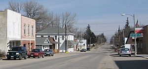
Downtown Stacyville, Iowa.
|
|

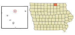
Location of Stacyville, Iowa
|
|
| Country | United States |
| State | Iowa |
| County | Mitchell |
| Area | |
| • Total | 0.54 sq mi (1.39 km2) |
| • Land | 0.52 sq mi (1.33 km2) |
| • Water | 0.02 sq mi (0.06 km2) |
| Elevation | 1,198 ft (365 m) |
| Population
(2020)
|
|
| • Total | 458 |
| • Density | 889.32/sq mi (343.17/km2) |
| Time zone | UTC-6 (Central (CST)) |
| • Summer (DST) | UTC-5 (CDT) |
| ZIP code |
50476
|
| Area code(s) | 641 |
| FIPS code | 19-74820 |
| GNIS feature ID | 0461945 |
Stacyville is a small city located in Mitchell County, Iowa, in the United States. In 2020, the city had a population of 458 people.
Contents
History of Stacyville
Stacyville was first planned out in 1856. It was named after its founder, a person called Homer I. Stacy.
Geography of Stacyville
Stacyville is found at specific coordinates: 43.436910 degrees North and -92.783011 degrees West. These numbers help pinpoint its exact location on a map.
The city covers a total area of about 1.37 square kilometers (0.53 square miles). Most of this area is land, about 1.32 square kilometers (0.51 square miles). A small part, about 0.05 square kilometers (0.02 square miles), is water.
Population and People
| Historical populations | ||
|---|---|---|
| Year | Pop. | ±% |
| 1880 | 326 | — |
| 1900 | 490 | +50.3% |
| 1910 | 407 | −16.9% |
| 1920 | 513 | +26.0% |
| 1930 | 529 | +3.1% |
| 1940 | 533 | +0.8% |
| 1950 | 544 | +2.1% |
| 1960 | 588 | +8.1% |
| 1970 | 598 | +1.7% |
| 1980 | 538 | −10.0% |
| 1990 | 481 | −10.6% |
| 2000 | 469 | −2.5% |
| 2010 | 494 | +5.3% |
| 2020 | 458 | −7.3% |
| Source: and Iowa Data Center Source: |
||
2020 Population Details
In 2020, the census showed 458 people living in Stacyville. There were 215 households and 130 families. The city had about 888 people per square mile.
Most residents, about 98%, were White. A small number of people were from other racial backgrounds. About 1.3% of the population identified as Hispanic or Latino.
The average age in Stacyville was 48 years old. About 21% of the people were under 20 years old. Over 31% of residents were 65 years or older. The population was almost evenly split between males (49.1%) and females (50.9%).
2010 Population Details
According to the census in 2010, Stacyville had 494 residents. There were 223 households and 123 families. The population density was about 968 people per square mile.
Most people (97.4%) were White. A small percentage were African American, Native American, or Asian. About 1.2% of the population was Hispanic or Latino.
The median age in 2010 was 51 years. About 18% of residents were under 18. Over 33% were 65 years or older. The city had slightly more females (50.8%) than males (49.2%).
Education in Stacyville
Stacyville is part of the St. Ansgar Community School District. This district manages the public schools for the area.
Visitation School was a local school that taught students from kindergarten through 12th grade. The main school building opened in 1923. The high school section closed in 1968, making it a school for younger students (K-8).
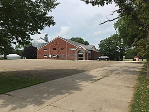
The entire Visitation School closed in 2003. The old main building became the Stacyville Memories Museum. The school's gymnasium was used by the Stacyville Community Center and a daycare. In 2012, the main building was planned to be taken down. The museum moved to the Stacyville Library, but the gym remained.
See also
 In Spanish: Stacyville (Iowa) para niños
 | Ernest Everett Just |
 | Mary Jackson |
 | Emmett Chappelle |
 | Marie Maynard Daly |


