
Mower County, Minnesota facts for kids
Quick facts for kids
Mower County
|
|
|---|---|

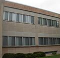
Mower County Courthouse in Austin
|
|

Location within the U.S. state of Minnesota
|
|
 Minnesota's location within the U.S. |
|
| Country | |
| State | |
| Founded | February 20, 1855 (created) March 1, 1856 (organized) |
| Named for | John Edward Mower |
| Seat | Austin |
| Largest city | Austin |
| Area | |
| • Total | 711.5 sq mi (1,843 km2) |
| • Land | 711.3 sq mi (1,842 km2) |
| • Water | 0.2 sq mi (0.5 km2) 0.03% |
| Population
(2020)
|
|
| • Total | 40,029 |
| • Estimate
(2023)
|
40,058 |
| • Density | 56.3/sq mi (21.7/km2) |
| Time zone | UTC−6 (Central) |
| • Summer (DST) | UTC−5 (CDT) |
| Congressional district | 1st |
Mower County is a county in the state of Minnesota. A county is like a smaller region within a state. As of the 2020 census, about 40,029 people lived here. The main city and county seat is Austin. You can find Lake Louise State Park in the southeastern part of Mower County, near Le Roy.
Contents
History of Mower County
The land that is now Mower County has a long history. In 1836, the United States government created the Wisconsin Territory. This territory included the area that would later become Minnesota. In 1848, the eastern part of this territory became the state of Wisconsin.
Minnesota Territory is Formed
On March 3, 1849, the Minnesota Territory was created. The new government for this territory then set up nine counties in October of that year. Later, in 1853, parts of two original counties, Dakota and Wabashaw, were used to create Rice County.
How Mower County Began
In 1852, families started to settle in the southern part of Rice County. This led to a fast-growing settlement. On February 20, 1855, the government of the Minnesota Territory officially created Mower County. It was formed from the southernmost part of Rice County. The new county was named after John Edward Mower. He was a member of the territorial government.
Organizing the County
On March 1, 1856, the governor of the territory, Willis A. Gorman, signed a law that officially organized Mower County. He chose three people to be commissioners. These commissioners first met in Frankford Township. In January 1857, they chose Austin Township as the permanent county seat. By July 1857, the exact spot was set within Austin village. This village had been planned out in the spring of 1856.
Geography and Nature
Mower County is located right on Minnesota's border with Iowa. The land here has gentle rolling hills. There are also many small streams and valleys. Most of the land is used for farming.
Rivers and Streams
The Cedar River flows south through the western part of the county. It then continues into Iowa. The Upper Iowa River also starts in Mower County. Its smaller branches join together near Le Roy. They then flow east out of the county into Iowa. Other streams like Deer Creek, Bear Creek, and Carey Creek also flow through the county.
Lakes and Ponds
Mower County is one of only four counties in Minnesota that does not have any natural lakes. However, it does have four small ponds and lakes that were created by dams:
- East Side Lake: Located in the northeast part of Austin.
- Lake Louise: Found in Lake Louise State Park near Le Roy.
- Mill Pond: In downtown Austin, close to the Hormel plant.
- Ramsey Mill Pond: In Ramsey Golf Course, near the small community of Ramsey.
The Cedar River enters Mower County from Dodge County to the north. It flows through four townships in the western part of the county. These are Udolpho, Lansing, Austin, and Lyle.
Transportation
Mower County has several ways to get around.
- Southern Minnesota Area Rural Transit provides public transportation.
Major Roads
 I-90
I-90 I-90 Bus.
 US 63
US 63 US 218
 Minnesota State Highway 16
 Minnesota State Highway 56
 Minnesota State Highway 105
 Minnesota State Highway 251
Airports
- Austin Municipal Airport (AUM) is located east of Austin.
Neighboring Counties
Mower County shares borders with several other counties:
- Dodge County - to the north
- Olmsted County - to the northeast
- Fillmore County - to the east
- Howard County, Iowa - to the southeast
- Mitchell County, Iowa - to the south
- Worth County, Iowa - to the southwest
- Freeborn County - to the west
- Steele County - to the northwest
Protected Natural Areas
Mower County is home to several areas set aside for nature and wildlife:
- Lake Louise State Park
- Larson State Wildlife Management Area
- Red Cedar State Wildlife Management Area
- Rose State Wildlife Management Area
Population and People
| Historical population | |||
|---|---|---|---|
| Census | Pop. | %± | |
| 1860 | 3,217 | — | |
| 1870 | 10,447 | 224.7% | |
| 1880 | 16,799 | 60.8% | |
| 1890 | 18,019 | 7.3% | |
| 1900 | 22,335 | 24.0% | |
| 1910 | 22,640 | 1.4% | |
| 1920 | 25,993 | 14.8% | |
| 1930 | 28,065 | 8.0% | |
| 1940 | 36,113 | 28.7% | |
| 1950 | 42,277 | 17.1% | |
| 1960 | 48,498 | 14.7% | |
| 1970 | 44,919 | −7.4% | |
| 1980 | 40,390 | −10.1% | |
| 1990 | 37,385 | −7.4% | |
| 2000 | 38,603 | 3.3% | |
| 2010 | 39,163 | 1.5% | |
| 2020 | 40,029 | 2.2% | |
| 2023 (est.) | 40,058 | 2.3% | |
| U.S. Decennial Census 1790-1960 1900-1990 1990-2000 2010-2020 |
|||
The number of people living in Mower County has changed over time. It reached its highest point in 1960. Since then, the population has gone down a bit. This is partly because some younger people have moved to bigger cities for job opportunities.
Population in 2020
The 2020 Census showed the different groups of people living in Mower County:
| Race | Number of People | Percentage |
|---|---|---|
| White | 29,804 | 74.45% |
| Black or African American | 1,613 | 4.03% |
| Native American | 57 | 0.14% |
| Asian | 2,052 | 5.13% |
| Pacific Islander | 225 | 0.64% |
| Other/Mixed Race | 1,167 | 2.92% |
| Hispanic or Latino | 5,081 | 12.7% |
Cities and Towns
Mower County has several cities and smaller communities:
Cities
- Adams
- Austin (This is the county seat, meaning it's where the county government is located)
- Brownsdale
- Dexter
- Elkton
- Grand Meadow
- Le Roy
- Lyle
- Mapleview
- Racine
- Rose Creek
- Sargeant
- Taopi
- Waltham
Census-Designated Place
- Lansing (This is a community that the U.S. Census Bureau defines for statistical purposes)
Unincorporated Communities
These are smaller settlements that are not officially organized as cities or towns:
Townships
Mower County is divided into 20 townships. Each township is about 36 square miles in size. Mower County is five townships wide from west to east and four townships from north to south.
- Adams
- Austin
- Bennington
- Clayton
- Dexter
- Frankford
- Grand Meadow
- Lansing
- Le Roy
- Lodi
- Lyle
- Marshall
- Nevada
- Pleasant Valley
- Racine
- Red Rock
- Sargeant
- Udolpho
- Waltham
- Windom
Images for kids
-
Mower County Courthouse in Austin
See also
 In Spanish: Condado de Mower para niños
